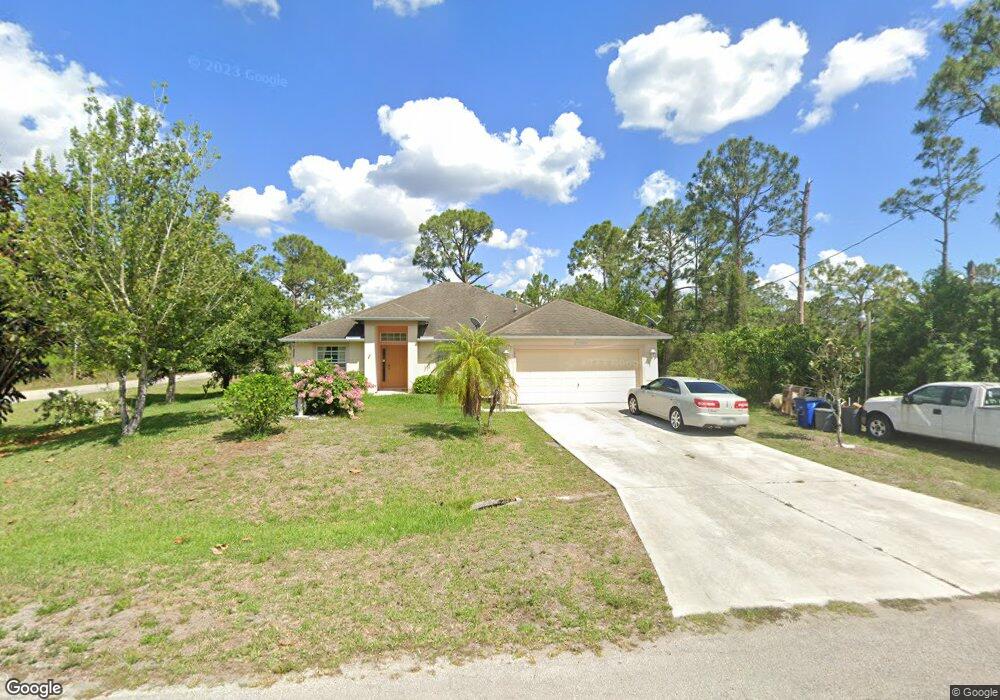
1251 Blanding Ave Fort Myers, FL 33913
West Fort Myers NeighborhoodEstimated Value: $299,000 - $375,000
4
Beds
2
Baths
1,811
Sq Ft
$183/Sq Ft
Est. Value
About This Home
This home is located at 1251 Blanding Ave, Fort Myers, FL 33913 and is currently estimated at $330,814, approximately $182 per square foot. 1251 Blanding Ave is a home located in Lee County with nearby schools including Lehigh Elementary School, Gateway Elementary School, and The Alva School.
Ownership History
Date
Name
Owned For
Owner Type
Purchase Details
Closed on
Aug 24, 2010
Sold by
Olson Thomas and Olson Mary Gaye
Bought by
Barrera Raul G and Barrera Oralia T
Current Estimated Value
Purchase Details
Closed on
Oct 18, 2004
Sold by
Eagle Construction & Development Corp
Bought by
Olson Thomas and Olson Mary Gaye
Purchase Details
Closed on
Aug 31, 2004
Sold by
Arp John E and Arp Carolyn S
Bought by
Davis Richard
Purchase Details
Closed on
Jul 1, 2004
Sold by
Davis Richard
Bought by
Eagle Construction & Development Corp
Create a Home Valuation Report for This Property
The Home Valuation Report is an in-depth analysis detailing your home's value as well as a comparison with similar homes in the area
Home Values in the Area
Average Home Value in this Area
Purchase History
| Date | Buyer | Sale Price | Title Company |
|---|---|---|---|
| Barrera Raul G | $54,000 | Cape Coral Title Insurance A | |
| Olson Thomas | $14,000 | First American Title Ins Co | |
| Davis Richard | $8,000 | First American Title Ins Co | |
| Eagle Construction & Development Corp | -- | -- |
Source: Public Records
Tax History Compared to Growth
Tax History
| Year | Tax Paid | Tax Assessment Tax Assessment Total Assessment is a certain percentage of the fair market value that is determined by local assessors to be the total taxable value of land and additions on the property. | Land | Improvement |
|---|---|---|---|---|
| 2025 | $1,274 | $77,207 | -- | -- |
| 2024 | $1,115 | $75,031 | -- | -- |
| 2023 | $1,211 | $72,846 | $0 | $0 |
| 2022 | $1,115 | $70,724 | $0 | $0 |
| 2021 | $1,043 | $167,657 | $6,000 | $161,657 |
| 2020 | $1,035 | $67,716 | $0 | $0 |
| 2019 | $1,059 | $66,194 | $0 | $0 |
| 2018 | $1,035 | $64,960 | $0 | $0 |
| 2017 | $1,005 | $63,624 | $0 | $0 |
| 2016 | $978 | $112,281 | $3,630 | $108,651 |
| 2015 | $957 | $94,400 | $3,530 | $90,870 |
| 2014 | $832 | $86,208 | $2,350 | $83,858 |
| 2013 | -- | $71,491 | $2,500 | $68,991 |
Source: Public Records
Map
Nearby Homes
- 1242 Belgrave St
- 1253 Barnet Ave
- 1241 Songbird St
- 1264 Belfast Ave
- 1252 Belfast Ave Unit 16
- 1254 Burlwood Ave
- 1249 Bowles Ave
- 1261 Burbeck St
- 1232 Burbeck St
- 1240 Burbeck St
- 1242 Burbeck St
- 1206 Burbeck St
- 1266 Burbeck St
- 1246 Burbeck St
- 1262 Bowles Ave
- 1259 Burbeck St
- 1249 Bermar St
- 1247 Brunell Ave
- 1242 Bermar St
- 1263 Songbird St
- 1250 Barnet Ave
- 1255 Blanding Ave Unit 15
- 1249 Belfast Ave
- 1245 Songbird St
- 1251 Barnet Ave
- 1256 Barnet Ave
- 1252 Barnet Ave
- 1257 Barnet Ave
- 1262 Barnet Ave
- 1259 Blanding Ave
- 1257 Blanding Ave
- 1264 Blanding Ave
- 1263 Blanding Ave
- 1260 Blanding Ave
- 1258 Blanding Ave
- 1256 Blanding Ave
- 1223 Songbird St
- 1221 Songbird St Unit 18
- 1239 Songbird St
- 1260 Songbird St