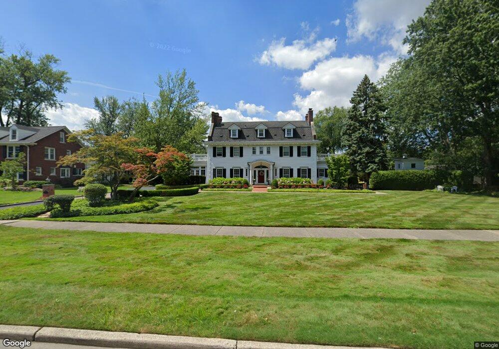
1251 Devonshire Rd Grosse Pointe Park, MI 48230
Estimated Value: $732,500 - $974,000
Studio
5
Baths
3,833
Sq Ft
$234/Sq Ft
Est. Value
About This Home
This home is located at 1251 Devonshire Rd, Grosse Pointe Park, MI 48230 and is currently estimated at $896,375, approximately $233 per square foot. 1251 Devonshire Rd is a home located in Wayne County with nearby schools including George Defer Elementary School, Pierce Middle School, and Grosse Pointe South High School.
Ownership History
Date
Name
Owned For
Owner Type
Purchase Details
Closed on
Feb 22, 2003
Sold by
Barrett Daniel M and Dettloff Janet A
Bought by
Barrett Daniel M
Current Estimated Value
Home Financials for this Owner
Home Financials are based on the most recent Mortgage that was taken out on this home.
Original Mortgage
$650,000
Outstanding Balance
$279,393
Interest Rate
6%
Mortgage Type
Purchase Money Mortgage
Estimated Equity
$616,982
Purchase Details
Closed on
Jun 5, 1998
Sold by
Corradino Lorraine W and Corradino D
Bought by
Barrett Daniel M
Create a Home Valuation Report for This Property
The Home Valuation Report is an in-depth analysis detailing your home's value as well as a comparison with similar homes in the area
Home Values in the Area
Average Home Value in this Area
Purchase History
| Date | Buyer | Sale Price | Title Company |
|---|---|---|---|
| Barrett Daniel M | -- | Fidelity National Title Ins | |
| Barrett Daniel M | $540,000 | -- |
Source: Public Records
Mortgage History
| Date | Status | Borrower | Loan Amount |
|---|---|---|---|
| Open | Barrett Daniel M | $650,000 |
Source: Public Records
Tax History
| Year | Tax Paid | Tax Assessment Tax Assessment Total Assessment is a certain percentage of the fair market value that is determined by local assessors to be the total taxable value of land and additions on the property. | Land | Improvement |
|---|---|---|---|---|
| 2025 | $7,934 | $431,100 | $0 | $0 |
| 2024 | $7,637 | $418,000 | $0 | $0 |
| 2023 | $7,293 | $390,400 | $0 | $0 |
| 2022 | $6,929 | $374,900 | $0 | $0 |
| 2021 | $13,662 | $392,300 | $0 | $0 |
| 2019 | $14,059 | $348,500 | $0 | $0 |
| 2018 | $6,606 | $297,500 | $0 | $0 |
| 2017 | $14,410 | $146,300 | $0 | $0 |
| 2016 | $13,616 | $272,200 | $0 | $0 |
| 2015 | $24,723 | $260,400 | $0 | $0 |
| 2013 | $23,950 | $245,900 | $0 | $0 |
| 2012 | $6,691 | $252,700 | $125,900 | $126,800 |
Source: Public Records
Map
Nearby Homes
- 1206 Balfour St
- 1338 Somerset Ave
- 3430 Bedford St
- 1254 Beaconsfield Ave
- 3460 Bedford St
- 1328 Lakepointe St
- 1417 Beaconsfield Ave
- 3675 Bedford St
- 3520 Audubon Rd
- 3709 Haverhill St
- 3650 Somerset Ave
- 1239 Maryland St
- 3690 Three Mile Dr
- 1048 Lakepointe St Unit A
- 1083 Lakepointe St
- 3903 Berkshire St
- 1332 Wayburn St
- 3920 Devonshire Rd
- 1336 Wayburn St
- 15239 Mack Ave
- 1246 Buckingham Rd
- 1254 Buckingham Rd
- 1241 Devonshire Rd
- 1238 Buckingham Rd
- 1265 Devonshire Rd
- 1264 Buckingham Rd
- 1231 Devonshire Rd
- 1230 Buckingham Rd
- 1223 Devonshire Rd
- 1222 Buckingham Rd
- 1303 Devonshire Rd
- 1304 Buckingham Rd
- 1246 Devonshire Rd
- 1258 Devonshire Rd
- 1242 Devonshire Rd
- 1215 Devonshire Rd
- 1214 Buckingham Rd
- 1266 Devonshire Rd
- 1255 Buckingham Rd
- 1311 Devonshire Rd
Your Personal Tour Guide
Ask me questions while you tour the home.