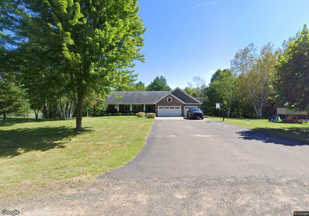
1251 State Road 48 Cumberland, WI 54829
Estimated Value: $352,000 - $611,000
--
Bed
--
Bath
--
Sq Ft
6.16
Acres
About This Home
This home is located at 1251 State Road 48, Cumberland, WI 54829 and is currently estimated at $478,144. 1251 State Road 48 is a home with nearby schools including Cumberland Elementary School, Cumberland Middle School, and Cumberland High School.
Ownership History
Date
Name
Owned For
Owner Type
Purchase Details
Closed on
Aug 10, 2021
Sold by
Cifaldi Robert A
Bought by
Johnson Ian S
Current Estimated Value
Home Financials for this Owner
Home Financials are based on the most recent Mortgage that was taken out on this home.
Interest Rate
2.77%
Purchase Details
Closed on
Jun 7, 2021
Sold by
Cifaldi Robert
Bought by
Rydberg Gary
Home Financials for this Owner
Home Financials are based on the most recent Mortgage that was taken out on this home.
Interest Rate
2.96%
Create a Home Valuation Report for This Property
The Home Valuation Report is an in-depth analysis detailing your home's value as well as a comparison with similar homes in the area
Home Values in the Area
Average Home Value in this Area
Purchase History
| Date | Buyer | Sale Price | Title Company |
|---|---|---|---|
| Johnson Ian S | $350,000 | -- | |
| Johnson Ian S | $10 | Makenna Rademacher | |
| Johnson Ian S | $350,000 | -- | |
| Rydberg Gary | $10,000 | -- | |
| Rydberg Gary | $10,000 | -- |
Source: Public Records
Mortgage History
| Date | Status | Borrower | Loan Amount |
|---|---|---|---|
| Previous Owner | Johnson Ian S | -- | |
| Previous Owner | Rydberg Gary | -- |
Source: Public Records
Tax History Compared to Growth
Tax History
| Year | Tax Paid | Tax Assessment Tax Assessment Total Assessment is a certain percentage of the fair market value that is determined by local assessors to be the total taxable value of land and additions on the property. | Land | Improvement |
|---|---|---|---|---|
| 2024 | $6,804 | $291,900 | $27,400 | $264,500 |
| 2023 | $6,113 | $291,900 | $27,400 | $264,500 |
| 2022 | $5,967 | $289,300 | $24,800 | $264,500 |
| 2021 | $6,111 | $297,600 | $33,100 | $264,500 |
| 2020 | $6,147 | $297,600 | $33,100 | $264,500 |
| 2019 | $4,418 | $200,300 | $14,200 | $186,100 |
| 2018 | $4,439 | $200,300 | $14,200 | $186,100 |
| 2017 | $4,246 | $200,300 | $14,200 | $186,100 |
| 2016 | $4,323 | $200,300 | $14,200 | $186,100 |
| 2015 | $4,105 | $200,300 | $14,200 | $186,100 |
| 2014 | $4,350 | $200,300 | $14,200 | $186,100 |
| 2013 | $4,111 | $200,300 | $14,200 | $186,100 |
Source: Public Records
Map
Nearby Homes
- 2287 Carlone St Unit Lot 9
- 2293 Caroline St Unit Lot 6
- 2285 Carlone St Unit Lot 10
- 584 21 1 2 Ave
- 915 Nedvidek St
- 949 Nedvidek St
- 358 24th Ave
- 2526 7 1 4 St
- XXX 25 1 4 Ave
- 2529 3 1 4 5th St
- 2510 7 1 2 St
- 2578 6th St
- 568 26th Ave
- 178 25 24th Ave
- 0 10th St Unit 1596476
- 2136 9 3 4 St
- 1753 7th St
- 19 22nd Ave
- 231 27 1/4 26 7/8 Ave
- 2667 2 1 4 St
- 1261 State Road 48
- 1265 State Road 48
- 2252 Us Highway 63
- 2252 Us Highway 63
- 0 Hwy 48
- 000000 State Road 48
- 000 St Hwy 48
- 0 Us Hwy 48 Unit 4580114
- 0 Us Hwy 48 Unit 4729727
- 0 Us Hwy 48
- 0 State Road 48
- 0 Hwy 48 Unit 818952
- 0 Hwy 48 Unit 612834
- 0 Hwy 48 Unit 869231
- 0 Hwy 48 Unit 852541
- 0 Hwy 48 Unit 832709
- 0 Hwy 48 Unit 626601
- 0 Hwy 48 Unit 809109
- 0 Hwy 48 Unit 871038
- 0 Hwy 48 Unit 887563