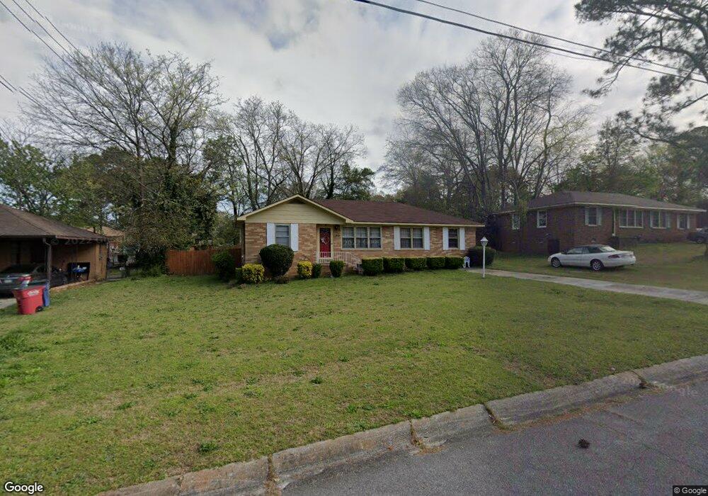
1251 Westmount Rd Macon, GA 31204
Estimated Value: $86,000 - $102,476
3
Beds
1
Bath
1,326
Sq Ft
$73/Sq Ft
Est. Value
About This Home
This home is located at 1251 Westmount Rd, Macon, GA 31204 and is currently estimated at $96,869, approximately $73 per square foot. 1251 Westmount Rd is a home located in Bibb County with nearby schools including John Robert Lewis Elementary School, Weaver Middle School, and Westside High School.
Ownership History
Date
Name
Owned For
Owner Type
Purchase Details
Closed on
Jul 17, 2025
Sold by
Lockett Sharon Y
Bought by
Davis Sharon V
Current Estimated Value
Purchase Details
Closed on
Feb 4, 2021
Sold by
Stewart Sharon V
Bought by
Lockett Sharon Y
Purchase Details
Closed on
Sep 18, 2019
Sold by
Davis Maurice V and Jefferson Oliver
Bought by
Stewart Sharon Y
Purchase Details
Closed on
Aug 13, 2019
Sold by
Stewart Sharon Y
Bought by
Stewart Sharon V and Davis Maurice V
Purchase Details
Closed on
Apr 27, 1984
Sold by
Marvin Alfred Davis 896 and Marvin 421
Bought by
Davis Jacquline G
Create a Home Valuation Report for This Property
The Home Valuation Report is an in-depth analysis detailing your home's value as well as a comparison with similar homes in the area
Home Values in the Area
Average Home Value in this Area
Purchase History
| Date | Buyer | Sale Price | Title Company |
|---|---|---|---|
| Davis Sharon V | -- | None Listed On Document | |
| Davis Sharon V | -- | None Listed On Document | |
| Lockett Sharon Y | -- | None Available | |
| Stewart Sharon Y | -- | None Available | |
| Stewart Sharon V | -- | None Available | |
| Davis Jacquline G | -- | -- |
Source: Public Records
Tax History Compared to Growth
Tax History
| Year | Tax Paid | Tax Assessment Tax Assessment Total Assessment is a certain percentage of the fair market value that is determined by local assessors to be the total taxable value of land and additions on the property. | Land | Improvement |
|---|---|---|---|---|
| 2025 | $882 | $35,884 | $2,802 | $33,082 |
| 2024 | $840 | $33,083 | $3,009 | $30,074 |
| 2023 | $816 | $32,149 | $2,075 | $30,074 |
| 2022 | $739 | $22,440 | $3,587 | $18,853 |
| 2021 | $853 | $22,440 | $3,587 | $18,853 |
| 2020 | $1,057 | $27,232 | $3,587 | $23,645 |
| 2019 | $523 | $27,232 | $3,587 | $23,645 |
| 2018 | $979 | $27,232 | $3,587 | $23,645 |
| 2017 | $489 | $27,232 | $3,587 | $23,645 |
| 2016 | $442 | $27,232 | $3,587 | $23,645 |
| 2015 | $617 | $26,921 | $3,587 | $23,334 |
| 2014 | $1,174 | $26,921 | $3,587 | $23,334 |
Source: Public Records
Map
Nearby Homes
- 1042 Washington St
- 3846 Log Cabin Dr
- 1202 James St
- 3220 Hollingsworth Rd
- 3908 Log Cabin Dr
- 3584 Log Cabin Dr
- 4450 Bluebird Terrace
- 3565 Log Cabin Dr
- 3533 Greenbriar Rd
- 4281 Robinson Ct
- 3941 Log Cabin Dr
- 3515 Greenbriar Rd
- 3782 Robinson Rd
- 3515 Log Cabin Dr
- 1184 Edna Place
- 3491 Bond St W
- 3745 Partridge Dr
- 1241 Westmount Rd
- 1261 Westmount Rd
- 3778 Log Cabin Dr
- 3782 Log Cabin Dr
- 1233 Westmount Rd
- 1252 Westmount Rd
- 1252 W Mount Rd
- 1248 Westmount Rd
- 1051 Pike St
- 3764 Log Cabin Dr
- 1057 Pike St
- 1240 Westmount Rd
- 1061 Pike St
- 1216 Pike St
- 1225 Westmount Rd
- 1105 Hartridge Dr
- 1077 Pike St
- 3787 Log Cabin Dr
- 3758 Log Cabin Dr
- 1020 Washington St