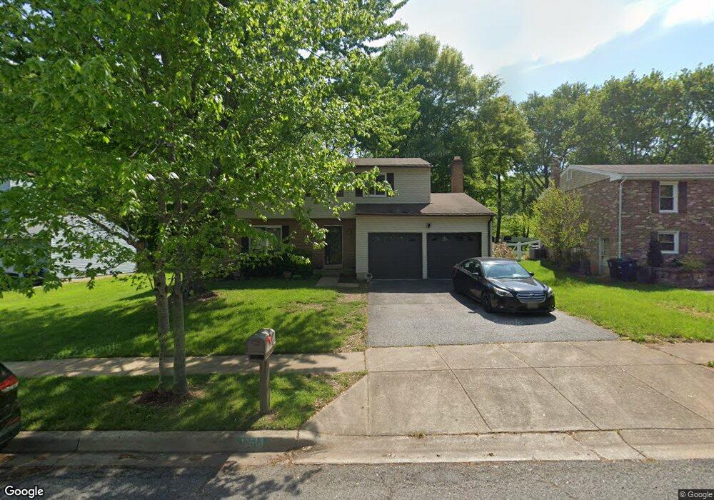
12514 Lampton Ln Fort Washington, MD 20744
Estimated Value: $434,456 - $499,000
--
Bed
3
Baths
1,752
Sq Ft
$271/Sq Ft
Est. Value
About This Home
This home is located at 12514 Lampton Ln, Fort Washington, MD 20744 and is currently estimated at $474,364, approximately $270 per square foot. 12514 Lampton Ln is a home located in Prince George's County with nearby schools including Potomac Landing Elementary School, Accokeek Academy, and Friendly High School.
Ownership History
Date
Name
Owned For
Owner Type
Purchase Details
Closed on
Aug 19, 2019
Sold by
Bostic Tobias A and Bostic Katie M
Bought by
Bostic Katie M
Current Estimated Value
Home Financials for this Owner
Home Financials are based on the most recent Mortgage that was taken out on this home.
Original Mortgage
$150,000
Outstanding Balance
$99,207
Interest Rate
3.8%
Mortgage Type
Credit Line Revolving
Estimated Equity
$375,157
Purchase Details
Closed on
Jul 9, 1985
Sold by
Suber James W
Bought by
Bostic Tobias A and Bostic Katie M
Create a Home Valuation Report for This Property
The Home Valuation Report is an in-depth analysis detailing your home's value as well as a comparison with similar homes in the area
Home Values in the Area
Average Home Value in this Area
Purchase History
| Date | Buyer | Sale Price | Title Company |
|---|---|---|---|
| Bostic Katie M | -- | Peak Settlements Llc | |
| Bostic Tobias A | $95,500 | -- |
Source: Public Records
Mortgage History
| Date | Status | Borrower | Loan Amount |
|---|---|---|---|
| Open | Bostic Katie M | $150,000 |
Source: Public Records
Tax History Compared to Growth
Tax History
| Year | Tax Paid | Tax Assessment Tax Assessment Total Assessment is a certain percentage of the fair market value that is determined by local assessors to be the total taxable value of land and additions on the property. | Land | Improvement |
|---|---|---|---|---|
| 2025 | $4,968 | $394,800 | -- | -- |
| 2024 | $4,968 | $379,800 | $127,400 | $252,400 |
| 2023 | $4,848 | $371,633 | $0 | $0 |
| 2022 | $4,682 | $363,467 | $0 | $0 |
| 2021 | $4,523 | $355,300 | $126,200 | $229,100 |
| 2020 | $4,350 | $326,267 | $0 | $0 |
| 2019 | $4,256 | $297,233 | $0 | $0 |
| 2018 | $3,900 | $268,200 | $101,200 | $167,000 |
| 2017 | $3,740 | $252,233 | $0 | $0 |
| 2016 | -- | $236,267 | $0 | $0 |
| 2015 | $4,021 | $220,300 | $0 | $0 |
| 2014 | $4,021 | $220,300 | $0 | $0 |
Source: Public Records
Map
Nearby Homes
- 12309 Livingston Rd
- 12110 Livingston Rd
- 12306 Dendron Place
- 0 Livingston Rd Unit MDPG2166028
- 1410 Rich Hill Dr
- 12115 Old Fort Rd
- 12417 Parkton St
- 12116 Old Fort Rd
- 411 Rexburg Ave
- 12220 Livingston Rd
- 12806 Monroe Ave
- PARCEL 43 Old Fort Rd
- 12700 Parkton St
- 804 Cascade Dr
- 12800 Asbury Dr
- 12204 Clear Creek Dr
- 13024 Old Fort Rd
- 13030 Old Fort Rd
- 500 Bonhill Dr
- 802 Cornish St
- 12516 Lampton Ln
- 12512 Lampton Ln
- 12510 Lampton Ln
- 12600 Lampton Ln
- 12508 Lampton Ln
- 914 E Tantallon Dr
- 12602 Lampton Ln
- 12506 Lampton Ln
- 12601 Lampton Ln
- 912 E Tantallon Dr
- 12604 Lampton Ln
- 907 Newmont St
- 12509 Lampton Ln
- 909 E Tantallon Dr
- 911 E Tantallon Dr
- 12504 Lampton Ln
- 12603 Lampton Ln
- 910 E Tantallon Dr
- 12606 Lampton Ln
- 905 Newmont St