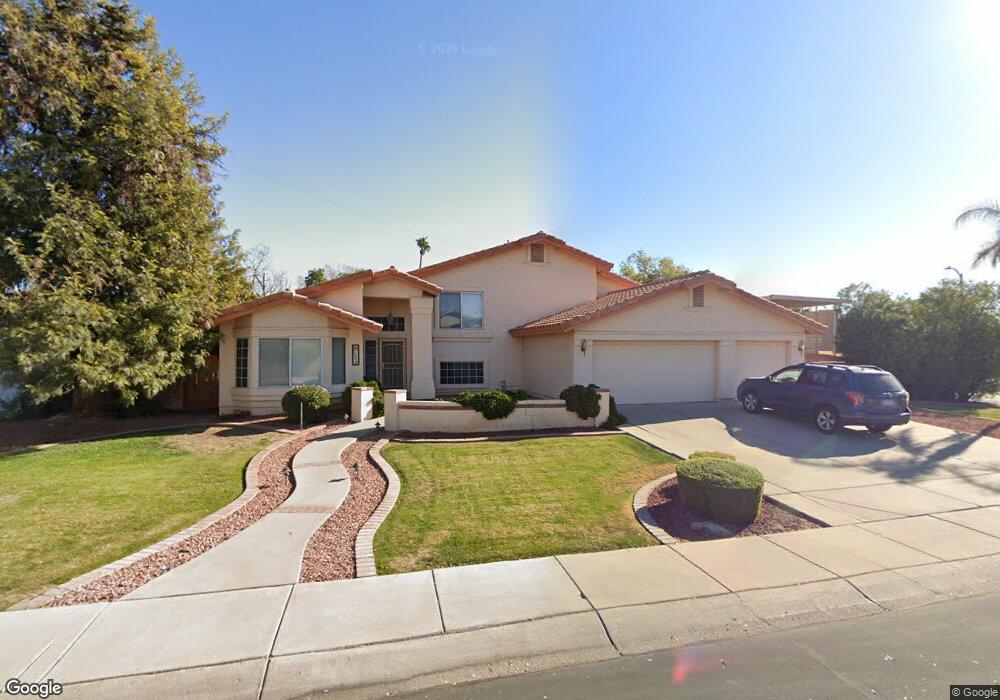
12515 N 70th Dr Peoria, AZ 85381
Estimated Value: $582,681 - $781,000
--
Bed
4
Baths
3,366
Sq Ft
$199/Sq Ft
Est. Value
About This Home
This home is located at 12515 N 70th Dr, Peoria, AZ 85381 and is currently estimated at $671,420, approximately $199 per square foot. 12515 N 70th Dr is a home located in Maricopa County with nearby schools including Oakwood Elementary School, Cactus High School, and Legacy Traditional School - Glendale.
Ownership History
Date
Name
Owned For
Owner Type
Purchase Details
Closed on
Nov 7, 2014
Sold by
Goldberg Mark L and Goldberg Loretta G
Bought by
Mark L Living & Loretta G Goldberg Livin and Goldberg Loretta G
Current Estimated Value
Purchase Details
Closed on
Apr 21, 1997
Sold by
Adams Robert J and Adams Carol A
Bought by
Goldberg Mark L and Goldberg Loretta G
Home Financials for this Owner
Home Financials are based on the most recent Mortgage that was taken out on this home.
Original Mortgage
$157,000
Interest Rate
8.13%
Mortgage Type
New Conventional
Create a Home Valuation Report for This Property
The Home Valuation Report is an in-depth analysis detailing your home's value as well as a comparison with similar homes in the area
Home Values in the Area
Average Home Value in this Area
Purchase History
| Date | Buyer | Sale Price | Title Company |
|---|---|---|---|
| Mark L Living & Loretta G Goldberg Livin | -- | None Available | |
| Goldberg Mark L | $212,000 | Ati Title Agency |
Source: Public Records
Mortgage History
| Date | Status | Borrower | Loan Amount |
|---|---|---|---|
| Closed | Goldberg Mark L | $157,000 |
Source: Public Records
Tax History Compared to Growth
Tax History
| Year | Tax Paid | Tax Assessment Tax Assessment Total Assessment is a certain percentage of the fair market value that is determined by local assessors to be the total taxable value of land and additions on the property. | Land | Improvement |
|---|---|---|---|---|
| 2025 | $2,282 | $30,140 | -- | -- |
| 2024 | $2,311 | $28,704 | -- | -- |
| 2023 | $2,311 | $45,850 | $9,170 | $36,680 |
| 2022 | $2,263 | $36,050 | $7,210 | $28,840 |
| 2021 | $2,422 | $33,070 | $6,610 | $26,460 |
| 2020 | $2,445 | $32,930 | $6,580 | $26,350 |
| 2019 | $2,366 | $30,310 | $6,060 | $24,250 |
| 2018 | $2,288 | $29,100 | $5,820 | $23,280 |
| 2017 | $2,289 | $26,820 | $5,360 | $21,460 |
| 2016 | $2,266 | $25,480 | $5,090 | $20,390 |
| 2015 | $2,114 | $25,810 | $5,160 | $20,650 |
Source: Public Records
Map
Nearby Homes
- 7126 W Columbine Dr
- 7214 W Columbine Dr
- 12709 N 72nd Ave
- 6845 W Charter Oak Rd
- 7220 W Larkspur Dr
- 6849 W Wethersfield Rd
- 7233 W Corrine Dr
- 6749 W Charter Oak Rd
- 6746 W Wethersfield Rd
- 6763 W Wethersfield Rd
- 6739 W Cactus Rd
- 7191 W Surrey Ave
- 6914 W Sunnyside Dr Unit 3
- 7301 W Sweetwater Ave
- 7157 W Cherry Hills Dr
- 6821 W Cherry Hills Dr
- 7113 W Sunnyside Dr
- 6938 W Jenan Dr
- 7266 W Cherry Hills Dr
- 7418 W Corrine Dr
- 12525 N 70th Dr
- 6946 W Columbine Dr
- 7020 W Columbine Dr
- 7003 W Columbine Dr
- 7009 W Columbine Dr
- 6945 W Columbine Dr
- 7027 W Corrine Dr
- 7015 W Columbine Dr
- 7026 W Columbine Dr
- 6939 W Columbine Dr
- 6938 W Columbine Dr
- 7021 W Columbine Dr
- 6944 W Bloomfield Rd
- 7002 W Bloomfield Rd
- 6938 W Bloomfield Rd
- 7017 W Corrine Dr
- 7008 W Bloomfield Rd
- 7035 W Corrine Dr
- 7035 W Corrine Dr
- 7032 W Columbine Dr