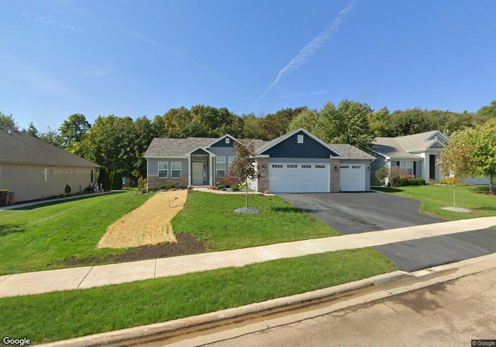
12518 Battery Park Dr Loves Park, IL 61111
Estimated Value: $406,000 - $506,000
3
Beds
2
Baths
2,900
Sq Ft
$150/Sq Ft
Est. Value
About This Home
This home is located at 12518 Battery Park Dr, Loves Park, IL 61111 and is currently estimated at $434,376, approximately $149 per square foot. 12518 Battery Park Dr is a home located in Boone County with nearby schools including Seth Whitman Elementary School, Belvidere Central Middle School, and Belvidere North High School.
Ownership History
Date
Name
Owned For
Owner Type
Purchase Details
Closed on
Mar 31, 2021
Sold by
Harvest Farms Il Llc
Bought by
Acadia Homes Llc
Current Estimated Value
Purchase Details
Closed on
Jun 12, 2019
Sold by
Peace Residential Inc
Bought by
Petry Tr
Purchase Details
Closed on
Jun 23, 2016
Bought by
Peace Residential Inc
Purchase Details
Closed on
Jun 22, 2016
Bought by
Stillman Banccorp Na
Create a Home Valuation Report for This Property
The Home Valuation Report is an in-depth analysis detailing your home's value as well as a comparison with similar homes in the area
Home Values in the Area
Average Home Value in this Area
Purchase History
| Date | Buyer | Sale Price | Title Company |
|---|---|---|---|
| Acadia Homes Llc | $159,600 | Security First Title | |
| Petry Tr | $2,514,300 | Security First Title | |
| Peace Residential Inc | $1,592,000 | -- | |
| Hallmark Homes Llc | -- | -- | |
| Stillman Banccorp Na | -- | -- |
Source: Public Records
Tax History Compared to Growth
Tax History
| Year | Tax Paid | Tax Assessment Tax Assessment Total Assessment is a certain percentage of the fair market value that is determined by local assessors to be the total taxable value of land and additions on the property. | Land | Improvement |
|---|---|---|---|---|
| 2024 | $8,388 | $118,563 | $8,333 | $110,230 |
| 2023 | $8,388 | $103,965 | $8,333 | $95,632 |
| 2022 | $8,570 | $103,058 | $8,333 | $94,725 |
| 2021 | $474 | $5,333 | $5,333 | $0 |
| 2020 | $511 | $5,333 | $5,333 | $0 |
| 2019 | $496 | $5,333 | $5,333 | $0 |
| 2018 | $523 | $5,333 | $5,333 | $0 |
| 2017 | $526 | $5,360 | $5,360 | $0 |
| 2016 | $68 | $679 | $679 | $0 |
| 2015 | $35 | $679 | $679 | $0 |
| 2014 | $25,036 | $679 | $679 | $0 |
Source: Public Records
Map
Nearby Homes
- 1014 Forest Garden Dr
- 12408 Lakeview Dr
- 12407 Lakeview Dr
- 12342 Lakeview Dr
- 1004 Stuyvesant Dr
- 910 Stuyvesant Dr
- 906 Stuyvesant Dr
- 12413 Tweed Dr
- 12592 Tweed Dr
- 173 Callaway Cove
- 12936 Melrose Rd
- 215 Trent Ln
- 12725 Ashfield Rd
- 11251 Wentworth Place
- 11939 Argyle Rd
- 11734 Glen Eagles Ln
- 12830 Beloit Rd
- 11999 Oakridge Rd
- 12514 Battery Park Dr
- 12612 Battery Park Dr
- 12616 Battery Park Dr
- 12510 Battery Park Dr
- 12442 Fire Island Dr
- 12615 Battery Park Dr
- 1010 Forest Garden Dr
- 1009 Forest Garden Dr
- 12438 Fire Island Dr
- 12624 Battery Park Dr
- 12619 Battery Park Dr
- 742 W Hampton Ave
- 12427 Lakeview Dr
- 12431 Lakeview Dr
- 12441 Fire Island Dr
- 1011 Benbrook Dr
- 12714 Battery Park Dr
- 738 W Hampton Ave
- 1018 Forest Garden Dr
- 12439 Fire Island Dr