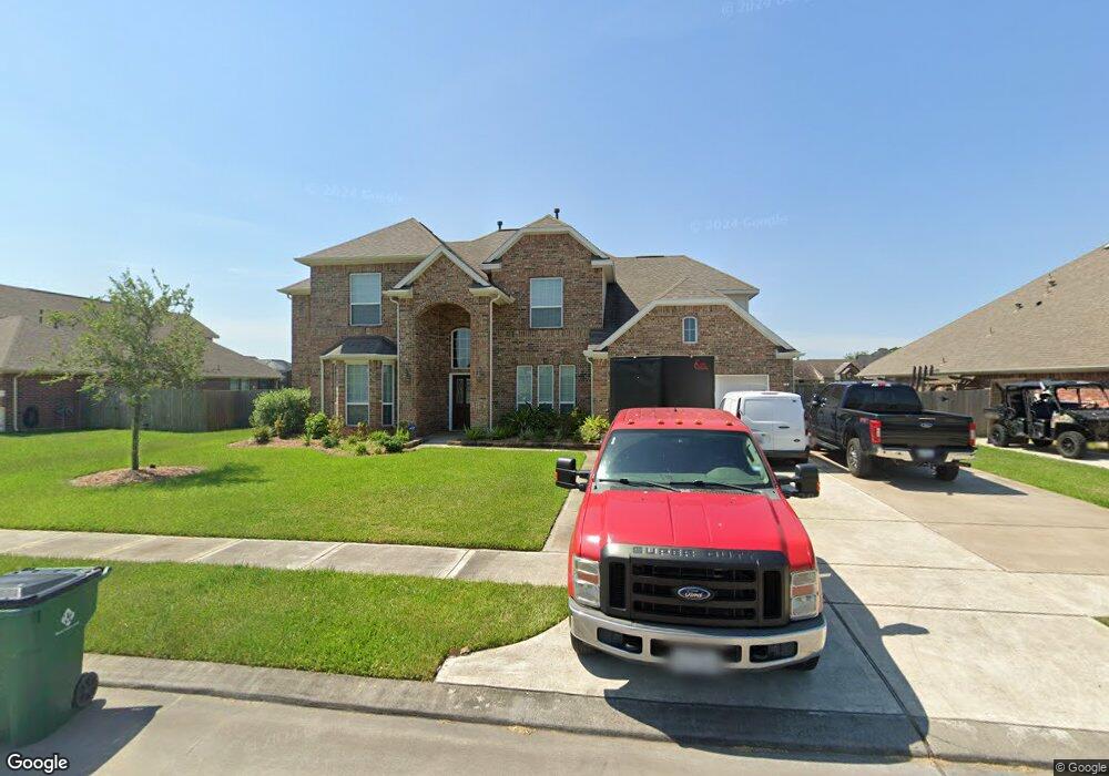
1252 Laurel Loop Angleton, TX 77515
Estimated Value: $482,000 - $563,000
Studio
4
Baths
3,591
Sq Ft
$147/Sq Ft
Est. Value
About This Home
This home is located at 1252 Laurel Loop, Angleton, TX 77515 and is currently estimated at $527,750, approximately $146 per square foot. 1252 Laurel Loop is a home located in Brazoria County with nearby schools including Westside Elementary School, Angleton Junior High School, and Angleton High School.
Ownership History
Date
Name
Owned For
Owner Type
Purchase Details
Closed on
Jan 29, 2016
Sold by
Anglia Homes Lp
Bought by
Duncan Emily and Duncan Gregory M
Current Estimated Value
Home Financials for this Owner
Home Financials are based on the most recent Mortgage that was taken out on this home.
Original Mortgage
$133,805
Outstanding Balance
$105,668
Interest Rate
3.99%
Mortgage Type
New Conventional
Estimated Equity
$422,082
Create a Home Valuation Report for This Property
The Home Valuation Report is an in-depth analysis detailing your home's value as well as a comparison with similar homes in the area
Home Values in the Area
Average Home Value in this Area
Purchase History
| Date | Buyer | Sale Price | Title Company |
|---|---|---|---|
| Duncan Emily | -- | Red Oak Title |
Source: Public Records
Mortgage History
| Date | Status | Borrower | Loan Amount |
|---|---|---|---|
| Open | Duncan Emily | $133,805 |
Source: Public Records
Tax History
| Year | Tax Paid | Tax Assessment Tax Assessment Total Assessment is a certain percentage of the fair market value that is determined by local assessors to be the total taxable value of land and additions on the property. | Land | Improvement |
|---|---|---|---|---|
| 2025 | $8,675 | $519,880 | $85,390 | $434,490 |
| 2024 | $8,675 | $521,300 | $85,390 | $435,910 |
| 2023 | $8,675 | $510,000 | $85,390 | $424,610 |
| 2022 | $9,967 | $405,900 | $51,980 | $383,630 |
| 2021 | $10,127 | $369,000 | $47,250 | $321,750 |
| 2020 | $10,624 | $365,000 | $47,250 | $317,750 |
| 2019 | $10,807 | $359,000 | $47,250 | $311,750 |
| 2018 | $10,806 | $352,710 | $47,250 | $305,460 |
| 2017 | $10,717 | $333,000 | $47,250 | $285,750 |
| 2016 | $7,479 | $232,400 | $35,440 | $196,960 |
| 2015 | $149 | $35,440 | $35,440 | $0 |
| 2014 | $149 | $5,700 | $5,700 | $0 |
Source: Public Records
Map
Nearby Homes
- 0 Creekside Unit 13213123
- 00 Brahman Trail
- 000 Brahman Trail
- 00 Cahill
- 0 Hennessee Ln Unit 94643980
- 607 Longhorn Trail
- 000 Fm 521
- 00 Fm 523 Loop N
- 0 County Road 807 Unit 69526704
- 0 Creekside Unit 96763941
- TBD Sandy Trail
- 555 County Road 31
- 0 Marshall Ave Unit 36963003
- 1012 Enchanted Oaks Dr
- 1105 Oak Park Dr
- 900 Enchanted Oaks Dr
- 0 Anchor Rd Unit 22484698
- 1187 Thomas Dr
- 1140 Thomas Dr
- 619 Longhorn Trail
- 1252 Laurel Loop
- 1256 Laurel Loop
- 1256 Laurel Loop
- 1248 Laurel Loop
- 1275 Laurel Ln
- 1260 Laurel Loop
- 1260 Laurel Loop
- 1244 Laurel Loop
- 1249 Laurel Loop
- 1277 Laurel Loop
- 1264 Laurel Loop
- 1264 Laurel Loop
- 1240 Laurel Loop
- 1245 Laurel Loop
- 1283 Laurel Ln
- 1281 Laurel Loop
- 1200 Shady Oak Dr
- 1112 Shady Oak Dr
- 1236 Laurel Loop
- 1268 Laurel Loop
Your Personal Tour Guide
Ask me questions while you tour the home.