Estimated Value: $771,000 - $864,000
3
Beds
2
Baths
1,841
Sq Ft
$454/Sq Ft
Est. Value
About This Home
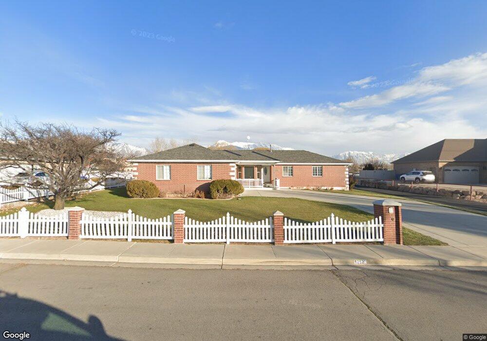
This home is located at 1252 N 1200 W, Lehi, UT 84043 and is currently estimated at $835,339, approximately $453 per square foot. 1252 N 1200 W is a home located in Utah County with nearby schools including Lehi Elementary School, Lehi Junior High School, and Lehi High School.
Ownership History
Date
Name
Owned For
Owner Type
Purchase Details
Closed on
Apr 20, 2018
Sold by
Morehouse Joan C and N J Carson Trust
Bought by
Hc Property Land Lc
Current Estimated Value
Purchase Details
Closed on
Jun 30, 2011
Sold by
Carson Neil C and Carson Ja Laine W
Bought by
Carson Neil C and Carson Ja Laine W
Purchase Details
Closed on
Jun 13, 2000
Sold by
Carson Neil C and Carson Ja Laine
Bought by
Carson Neil C and Carson Ja Laine W
Purchase Details
Closed on
Jun 1, 1998
Sold by
Carson Neil C and Carson Ja Laine W
Bought by
Carson Neil C and Carson Ja Laine W
Home Financials for this Owner
Home Financials are based on the most recent Mortgage that was taken out on this home.
Original Mortgage
$62,000
Interest Rate
7.1%
Mortgage Type
Seller Take Back
Create a Home Valuation Report for This Property
The Home Valuation Report is an in-depth analysis detailing your home's value as well as a comparison with similar homes in the area
Home Values in the Area
Average Home Value in this Area
Purchase History
| Date | Buyer | Sale Price | Title Company |
|---|---|---|---|
| Hc Property Land Lc | -- | First American Title | |
| Carson Neil C | -- | Signature Title Insurance Ag | |
| Carson Neil C | -- | -- | |
| Carson Neil C | -- | -- | |
| Carson Neil C | -- | -- |
Source: Public Records
Mortgage History
| Date | Status | Borrower | Loan Amount |
|---|---|---|---|
| Previous Owner | Carson Neil C | $62,000 |
Source: Public Records
Tax History Compared to Growth
Tax History
| Year | Tax Paid | Tax Assessment Tax Assessment Total Assessment is a certain percentage of the fair market value that is determined by local assessors to be the total taxable value of land and additions on the property. | Land | Improvement |
|---|---|---|---|---|
| 2025 | $3,369 | $429,720 | $431,200 | $301,100 |
| 2024 | $3,369 | $394,265 | $0 | $0 |
| 2023 | $3,005 | $381,840 | $0 | $0 |
| 2022 | $3,201 | $646,000 | $399,200 | $246,800 |
| 2021 | $2,796 | $459,400 | $254,400 | $205,000 |
| 2020 | $2,672 | $431,300 | $236,100 | $195,200 |
| 2019 | $2,477 | $413,300 | $236,100 | $177,200 |
| 2018 | $2,546 | $405,500 | $228,300 | $177,200 |
| 2017 | $2,443 | $234,925 | $0 | $0 |
| 2016 | $2,642 | $235,780 | $0 | $0 |
| 2015 | $2,692 | $228,025 | $0 | $0 |
| 2014 | $2,322 | $195,500 | $0 | $0 |
Source: Public Records
Map
Nearby Homes
- 1094 W 1425 N
- 1132 Titan Dr
- 1301 N 900 W Unit 12
- 1032 Titan Dr
- 1332 W 1500 N
- 1127 N 1500 W
- 1610 N 1125 W
- 902 W 1500 N
- 1627 W Boxwood Dr Unit 110
- 1659 W Boxwood Dr Unit 109
- 1249 W 1800 N
- 1272 W 1800 N
- 1817 W Bad Rock Cir
- 1011 W Mountain Way Unit 316
- 1542 N 1900 W
- 578 N Woods Dr
- 443 W 820 N
- 996 N 200 W
- 1150 N 200 W Unit 6
- 1755 N 250 W