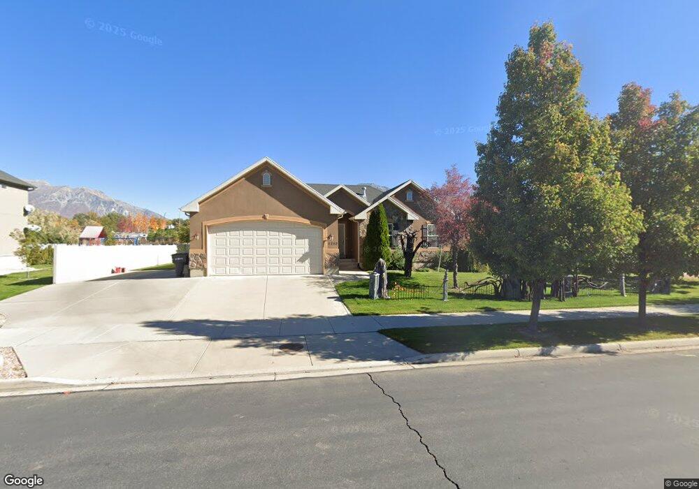
1252 Reese Dr Provo, UT 84601
Lakeview NeighborhoodEstimated Value: $568,000 - $634,657
3
Beds
2
Baths
3,156
Sq Ft
$188/Sq Ft
Est. Value
About This Home
This home is located at 1252 Reese Dr, Provo, UT 84601 and is currently estimated at $592,664, approximately $187 per square foot. 1252 Reese Dr is a home located in Utah County with nearby schools including Lakeview School, Dixon Middle School, and Provo High School.
Ownership History
Date
Name
Owned For
Owner Type
Purchase Details
Closed on
Nov 9, 2017
Sold by
Mott Randy A and Mott Pam T
Bought by
Mott Randy A and Mott Pamela T
Current Estimated Value
Purchase Details
Closed on
May 30, 2008
Sold by
Castillo Antonio Blancas and Arteche Alma Rosa
Bought by
Mott Randy A and Mott Pam T
Home Financials for this Owner
Home Financials are based on the most recent Mortgage that was taken out on this home.
Original Mortgage
$241,488
Outstanding Balance
$154,962
Interest Rate
6.05%
Mortgage Type
FHA
Estimated Equity
$437,702
Purchase Details
Closed on
Feb 27, 2006
Sold by
Kriser Homes & Communities Inc
Bought by
Castillo Antonio Blancas and Arteche Alma Rosa
Home Financials for this Owner
Home Financials are based on the most recent Mortgage that was taken out on this home.
Original Mortgage
$211,152
Interest Rate
6.8%
Mortgage Type
Fannie Mae Freddie Mac
Create a Home Valuation Report for This Property
The Home Valuation Report is an in-depth analysis detailing your home's value as well as a comparison with similar homes in the area
Home Values in the Area
Average Home Value in this Area
Purchase History
| Date | Buyer | Sale Price | Title Company |
|---|---|---|---|
| Mott Randy A | -- | None Available | |
| Mott Randy A | -- | First American Orem | |
| Castillo Antonio Blancas | -- | Mountain West Title Company |
Source: Public Records
Mortgage History
| Date | Status | Borrower | Loan Amount |
|---|---|---|---|
| Open | Mott Randy A | $241,488 | |
| Previous Owner | Castillo Antonio Blancas | $211,152 |
Source: Public Records
Tax History
| Year | Tax Paid | Tax Assessment Tax Assessment Total Assessment is a certain percentage of the fair market value that is determined by local assessors to be the total taxable value of land and additions on the property. | Land | Improvement |
|---|---|---|---|---|
| 2025 | $3,188 | $329,780 | -- | -- |
| 2024 | $3,188 | $313,830 | $0 | $0 |
| 2023 | $3,141 | $304,810 | $0 | $0 |
| 2022 | $3,245 | $317,515 | $0 | $0 |
| 2021 | $2,465 | $420,700 | $170,700 | $250,000 |
| 2020 | $2,362 | $377,800 | $148,400 | $229,400 |
| 2019 | $2,207 | $367,200 | $148,400 | $218,800 |
| 2018 | $1,943 | $327,800 | $137,500 | $190,300 |
| 2017 | $1,699 | $157,520 | $0 | $0 |
| 2016 | $1,606 | $138,765 | $0 | $0 |
| 2015 | $1,543 | $134,805 | $0 | $0 |
| 2014 | $1,445 | $131,615 | $0 | $0 |
Source: Public Records
Map
Nearby Homes
- 1271 N 2470 W
- 1127 Independence Ave
- 1107 Independence Ave
- 2711 W 1390 N
- 1639 N 2250 W Unit 1
- 1234 Uinta Dr
- 1616 N 2100 W
- 1682 N 2250 W
- 986 Independence Ave
- 2152 S 30 W
- 962 Independence Ave
- 927 Independence Ave
- 1159 N 2850 W
- 1903 W 890 N
- 1515 N 1830 W
- 2862 W 1100 N
- 925 N 1760 W
- 2818 W 880 N
- 108 W 2070 S
- 1986 N 2950 W
- 1234 Reese Dr
- 1264 Reese Dr
- 1255 Reese Dr
- 1255 Reese Dr Unit 33
- 2372 W 1200 N
- 1276 Reese Dr
- 1267 Reese Dr
- 1198 Reese Dr Unit 15
- 1198 Reese Dr Unit 15
- 1279 Reese Dr
- 2398 W 1200 N
- 1234 N 2410 W
- 1212 2410 W
- 1186 Reese Dr
- 1288 Reese Dr
- 1191 Reese Dr
- 1246 N 2410 W
- 1287 Reese Dr
- 2379 W 1200 N
- 1174 Reese Dr
Your Personal Tour Guide
Ask me questions while you tour the home.