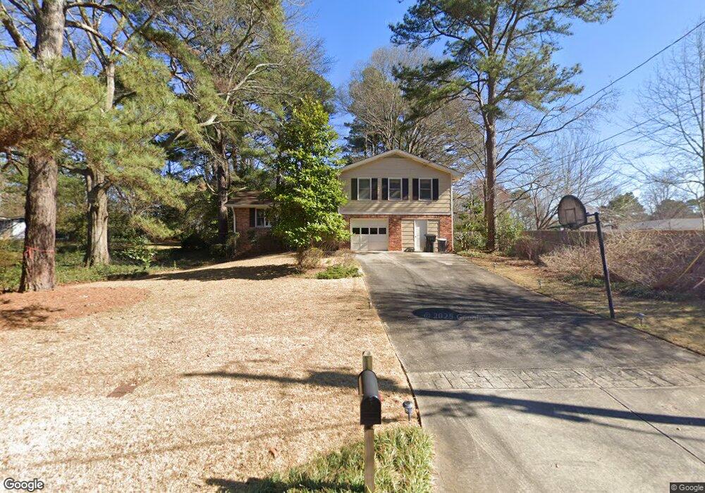
1252 Sheppard Dr SW Unit 2 Lilburn, GA 30047
Estimated Value: $339,000 - $378,000
3
Beds
3
Baths
1,600
Sq Ft
$220/Sq Ft
Est. Value
About This Home
This home is located at 1252 Sheppard Dr SW Unit 2, Lilburn, GA 30047 and is currently estimated at $351,424, approximately $219 per square foot. 1252 Sheppard Dr SW Unit 2 is a home located in Gwinnett County with nearby schools including Mountain Park Elementary School, Trickum Middle School, and Parkview High School.
Ownership History
Date
Name
Owned For
Owner Type
Purchase Details
Closed on
Jun 4, 2002
Sold by
Cook Richard B and Cook Jennifer K
Bought by
Pinto Carol C
Current Estimated Value
Home Financials for this Owner
Home Financials are based on the most recent Mortgage that was taken out on this home.
Original Mortgage
$122,000
Outstanding Balance
$51,767
Interest Rate
6.86%
Mortgage Type
New Conventional
Estimated Equity
$299,657
Purchase Details
Closed on
Aug 25, 1994
Sold by
Price Donald R Cathy
Bought by
Cook Richard B Jennison
Home Financials for this Owner
Home Financials are based on the most recent Mortgage that was taken out on this home.
Original Mortgage
$102,250
Interest Rate
8.37%
Mortgage Type
FHA
Create a Home Valuation Report for This Property
The Home Valuation Report is an in-depth analysis detailing your home's value as well as a comparison with similar homes in the area
Home Values in the Area
Average Home Value in this Area
Purchase History
| Date | Buyer | Sale Price | Title Company |
|---|---|---|---|
| Pinto Carol C | $134,000 | -- | |
| Cook Richard B Jennison | $107,000 | -- |
Source: Public Records
Mortgage History
| Date | Status | Borrower | Loan Amount |
|---|---|---|---|
| Open | Pinto Carol C | $122,000 | |
| Previous Owner | Cook Richard B Jennison | $102,250 |
Source: Public Records
Tax History Compared to Growth
Tax History
| Year | Tax Paid | Tax Assessment Tax Assessment Total Assessment is a certain percentage of the fair market value that is determined by local assessors to be the total taxable value of land and additions on the property. | Land | Improvement |
|---|---|---|---|---|
| 2024 | $963 | $123,280 | $22,200 | $101,080 |
| 2023 | $963 | $116,160 | $26,400 | $89,760 |
| 2022 | $922 | $106,320 | $23,600 | $82,720 |
| 2021 | $910 | $72,240 | $15,600 | $56,640 |
| 2020 | $908 | $72,240 | $15,600 | $56,640 |
| 2019 | $2,302 | $68,840 | $15,600 | $53,240 |
| 2018 | $2,301 | $68,840 | $15,600 | $53,240 |
| 2016 | $2,014 | $54,640 | $12,000 | $42,640 |
| 2015 | $1,737 | $45,400 | $10,000 | $35,400 |
| 2014 | -- | $41,880 | $8,000 | $33,880 |
Source: Public Records
Map
Nearby Homes
- 5145 Apollo Ln SW
- 1334 Jennie Ln SW
- 1404 Megan Danielle Dr SW
- 1054 Morgan Garner Dr SW
- 5125 Ophelia Ct SW
- 1468 Bristolwood Ct SW
- 1465 Pounds Rd SW Unit 1
- 1075 Westchester Dr SW
- 450 Rockfern Ct
- 460 Rockfern Ct Unit 14A
- 5002 Abbey Ln SW
- 5113 Brownlee Rd
- 811 Sweet Pine Brook
- 1394 Rockbridge Rd
- 1348 Ridgewood Dr SW
- 1461 Fox Forest Terrace SW
- 5104 Onawa Ct SW
- 1242 Sheppard Dr SW
- 5185 Apollo Ln SW
- 5182 Collins Ct SW
- 5175 Apollo Ln SW
- 1232 Sheppard Dr SW
- 5172 Collins Ct SW
- 1241 Sheppard Dr SW
- 1241 Sheppard Dr SW Unit Acres
- 5165 Apollo Ln SW
- 1251 Sheppard Dr SW Unit 2
- 5183 Collins Ct SW
- 0 Sheppard Dr SW Unit 7173394
- 0 Sheppard Dr SW Unit 3228824
- 0 Sheppard Dr SW Unit 8557438
- 0 Collins Ct SW Unit 8655186
- 0 Collins Ct SW Unit 8106320
- 1261 Sheppard Dr SW
- 1231 Sheppard Dr SW Unit 2
- 5162 Collins Ct SW
- 1222 Sheppard Dr SW