Estimated Value: $412,000 - $481,000
--
Bed
--
Bath
--
Sq Ft
10.9
Acres
About This Home
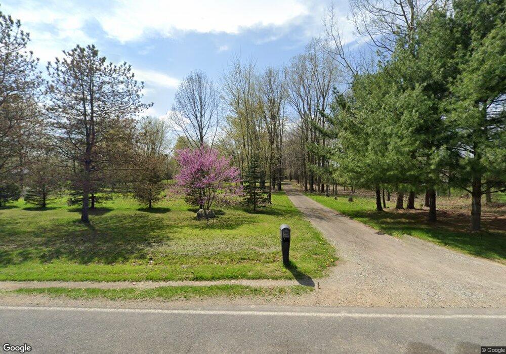
This home is located at 12522 New Lothrop Rd, Byron, MI 48418 and is currently estimated at $451,438. 12522 New Lothrop Rd is a home located in Shiawassee County with nearby schools including Byron Area Elementary School, Byron Area Middle School, and Byron Area High School.
Ownership History
Date
Name
Owned For
Owner Type
Purchase Details
Closed on
Nov 22, 2021
Sold by
Rusek Richard E
Bought by
Robbins Mandi
Current Estimated Value
Home Financials for this Owner
Home Financials are based on the most recent Mortgage that was taken out on this home.
Original Mortgage
$363,750
Interest Rate
3.11%
Mortgage Type
New Conventional
Purchase Details
Closed on
Jun 7, 2004
Sold by
Craine Kristine A
Bought by
Craine Mitchell J
Home Financials for this Owner
Home Financials are based on the most recent Mortgage that was taken out on this home.
Original Mortgage
$182,000
Interest Rate
4.87%
Mortgage Type
New Conventional
Create a Home Valuation Report for This Property
The Home Valuation Report is an in-depth analysis detailing your home's value as well as a comparison with similar homes in the area
Home Values in the Area
Average Home Value in this Area
Purchase History
| Date | Buyer | Sale Price | Title Company |
|---|---|---|---|
| Robbins Mandi | $375,000 | Myers Kelly A | |
| Craine Mitchell J | -- | Centennial Title Co |
Source: Public Records
Mortgage History
| Date | Status | Borrower | Loan Amount |
|---|---|---|---|
| Previous Owner | Robbins Mandi | $363,750 | |
| Previous Owner | Craine Mitchell J | $182,000 |
Source: Public Records
Tax History Compared to Growth
Tax History
| Year | Tax Paid | Tax Assessment Tax Assessment Total Assessment is a certain percentage of the fair market value that is determined by local assessors to be the total taxable value of land and additions on the property. | Land | Improvement |
|---|---|---|---|---|
| 2025 | $4,981 | $214,800 | $0 | $0 |
| 2024 | $4,758 | $196,000 | $0 | $0 |
| 2023 | $2,053 | $187,200 | $0 | $0 |
| 2022 | $4,493 | $169,500 | $0 | $0 |
| 2021 | $2,670 | $155,800 | $0 | $0 |
| 2020 | $2,626 | $140,800 | $0 | $0 |
| 2019 | $2,585 | $128,200 | $0 | $0 |
| 2018 | $2,526 | $118,500 | $0 | $0 |
| 2017 | $2,409 | $104,900 | $0 | $0 |
| 2016 | -- | $104,900 | $0 | $0 |
| 2015 | -- | $98,200 | $0 | $0 |
| 2014 | $12 | $93,700 | $0 | $0 |
Source: Public Records
Map
Nearby Homes
- 00 Lehring and Britton Roads
- Parcel E Turkey Trail
- Parcel F Turkey Trail
- Parcel D Turkey Trail
- 206 Emmett
- Parcel B Turkey Trail
- 111 N Ann St
- 301 N Church St
- vl Lehring Rd
- 12266 Lillie Rd
- 3901 Lovejoy Rd
- 14830 County Line Rd
- 4527 W Lovejoy Rd
- 6035 Beard Rd
- 11240 Silver Lake Rd
- 8812 S Byron Rd
- 9503 Vernon Rd
- 15283 Longfellow Dr
- 15303 Longfellow Dr
- 16141 Duffield Rd
- 12566 New Lothrop Rd
- 12540 New Lothrop Rd
- 12486 New Lothrop Rd
- 12600 New Lothrop Rd
- 12537 New Lothrop Rd Unit Bldg-Unit
- 12537 New Lothrop Rd
- 12537 New Lothrop Rd
- 12722 New Lothrop Rd
- 12363 New Lothrop Rd
- 12409 New Lothrop Rd
- 12409 New Lothrop Rd
- 12668 New Lothrop Rd
- 12653 New Lothrop Rd
- 12653 New Lothrop Rd
- 12551 New Lothrop Rd
- 12301 New Lothrop Rd
- 12199 New Lothrop Rd
- 9854 Bath Rd
- 12934 New Lothrop Rd
- 12962 New Lothrop Rd