Estimated Value: $986,736
--
Bed
--
Bath
29,974
Sq Ft
$33/Sq Ft
Est. Value
About This Home
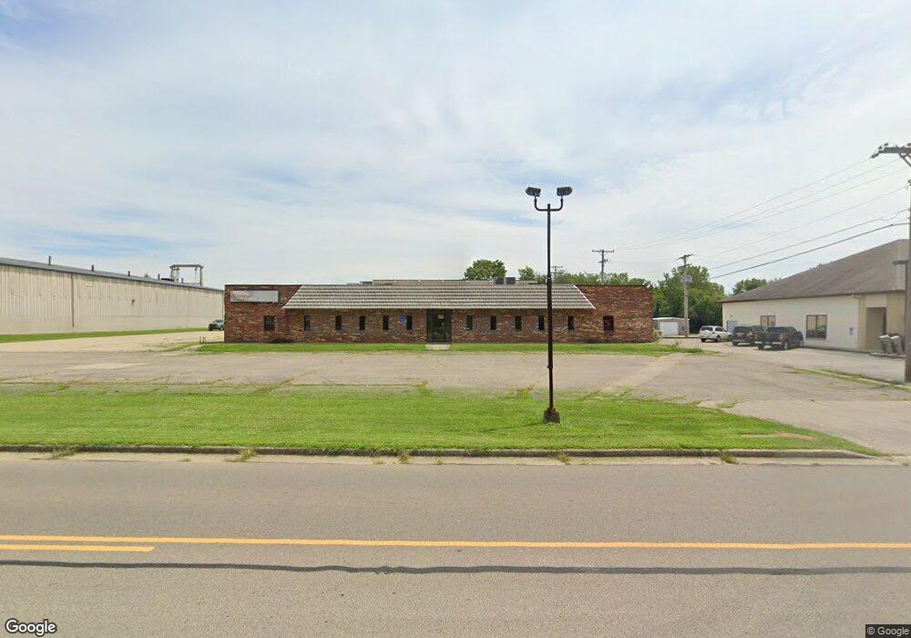
This home is located at 1253 Bellbrook Ave, Xenia, OH 45385 and is currently estimated at $986,736, approximately $32 per square foot. 1253 Bellbrook Ave is a home located in Greene County with nearby schools including Xenia High School, Summit Academy Community School for Alternative Learners - Xenia, and Legacy Christian Academy.
Ownership History
Date
Name
Owned For
Owner Type
Purchase Details
Closed on
Jun 27, 2019
Sold by
Rolin Investments 2 Llc
Bought by
Rolin Investments 6 Llc
Current Estimated Value
Purchase Details
Closed on
Feb 24, 2015
Sold by
Warrior Properties Inc
Bought by
Rolin Investments 2 Llc
Home Financials for this Owner
Home Financials are based on the most recent Mortgage that was taken out on this home.
Original Mortgage
$356,250
Interest Rate
3.64%
Mortgage Type
Future Advance Clause Open End Mortgage
Purchase Details
Closed on
Jun 3, 1994
Sold by
Lafreniere Robert J
Bought by
Warrior Properties Inc
Home Financials for this Owner
Home Financials are based on the most recent Mortgage that was taken out on this home.
Original Mortgage
$360,000
Interest Rate
8.48%
Mortgage Type
Commercial
Create a Home Valuation Report for This Property
The Home Valuation Report is an in-depth analysis detailing your home's value as well as a comparison with similar homes in the area
Home Values in the Area
Average Home Value in this Area
Purchase History
| Date | Buyer | Sale Price | Title Company |
|---|---|---|---|
| Rolin Investments 6 Llc | -- | None Available | |
| Rolin Investments 2 Llc | $475,000 | Hallmark Title | |
| Warrior Properties Inc | $325,000 | -- |
Source: Public Records
Mortgage History
| Date | Status | Borrower | Loan Amount |
|---|---|---|---|
| Previous Owner | Rolin Investments 2 Llc | $356,250 | |
| Previous Owner | Warrior Properties Inc | $360,000 |
Source: Public Records
Tax History Compared to Growth
Tax History
| Year | Tax Paid | Tax Assessment Tax Assessment Total Assessment is a certain percentage of the fair market value that is determined by local assessors to be the total taxable value of land and additions on the property. | Land | Improvement |
|---|---|---|---|---|
| 2024 | $8,958 | $176,820 | $23,620 | $153,200 |
| 2023 | $8,958 | $176,820 | $23,620 | $153,200 |
| 2022 | $9,813 | $164,870 | $23,620 | $141,250 |
| 2021 | $9,965 | $164,870 | $23,620 | $141,250 |
| 2020 | $9,596 | $164,870 | $23,620 | $141,250 |
| 2019 | $10,348 | $170,990 | $23,620 | $147,370 |
| 2018 | $10,437 | $170,990 | $23,620 | $147,370 |
| 2017 | $10,764 | $170,990 | $23,620 | $147,370 |
| 2016 | $10,764 | $174,850 | $23,620 | $151,230 |
| 2015 | $10,799 | $174,850 | $23,620 | $151,230 |
| 2014 | $10,431 | $174,850 | $23,620 | $151,230 |
Source: Public Records
Map
Nearby Homes
- 1272 Bellbrook Ave
- 1208 Bellbrook Ave
- 1618 Navajo Dr
- 1708 Ottawa Dr
- 1881 Commonwealth Dr
- 1653 Seneca Dr
- 1454 Kylemore Dr
- 1342 Kylemore Dr
- 1829 Gayhart Dr
- 1766 Gayhart Dr
- 1568 Cheyenne Dr
- 646 Glady Ave
- 1908 Whitt St
- 1255 Colorado Dr
- 1223 June Dr
- 530 Cincinnati Ave
- 1283 June Dr
- 305-325 Bellbrook Ave
- 1391 June Dr
- 1107 Arkansas Dr
- 1260 Bellbrook Ave
- 1248 Bellbrook Ave
- 1286 Bellbrook Ave
- 1234 Bellbrook Ave
- 1222 Bellbrook Ave
- 1298 Bellbrook Ave
- 1328 Bellbrook Ave
- 1067 Buckskin Trail
- 1055 Buckskin Trail
- 1196 Bellbrook Ave
- 1077 Buckskin Trail
- 1041 Buckskin Trail
- 1091 Buckskin Trail
- 1029 Buckskin Trail
- 1182 Bellbrook Ave
- 1103 Buckskin Trail
- 1015 Buckskin Trail
- 1117 Buckskin Trail
- 1170 Bellbrook Ave
- 991 Deerfield Ct