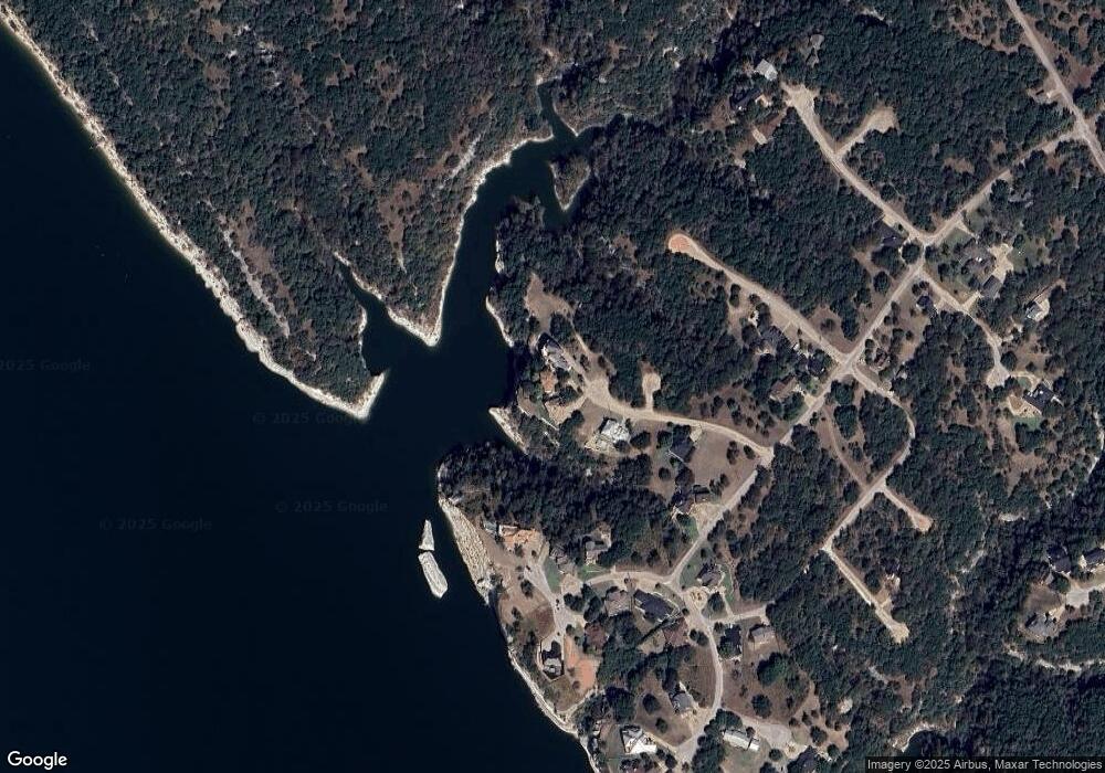
1253 Briar Ct Whitney, TX 76692
Estimated Value: $941,084 - $978,000
4
Beds
4
Baths
4,127
Sq Ft
$233/Sq Ft
Est. Value
About This Home
This home is located at 1253 Briar Ct, Whitney, TX 76692 and is currently estimated at $959,695, approximately $232 per square foot. 1253 Briar Ct is a home located in Hill County with nearby schools including Whitney Elementary School, Whitney Intermediate School, and Whitney Middle School.
Ownership History
Date
Name
Owned For
Owner Type
Purchase Details
Closed on
Mar 26, 2015
Sold by
Jones Billye Small and Jones Billye Small
Bought by
Kidnew Robert B and Kidnew Jo Dee M
Current Estimated Value
Home Financials for this Owner
Home Financials are based on the most recent Mortgage that was taken out on this home.
Original Mortgage
$400,000
Outstanding Balance
$306,924
Interest Rate
3.73%
Mortgage Type
New Conventional
Estimated Equity
$652,771
Create a Home Valuation Report for This Property
The Home Valuation Report is an in-depth analysis detailing your home's value as well as a comparison with similar homes in the area
Home Values in the Area
Average Home Value in this Area
Purchase History
| Date | Buyer | Sale Price | Title Company |
|---|---|---|---|
| Kidnew Robert B | $400,000 | Micro Title Hill County Llc |
Source: Public Records
Mortgage History
| Date | Status | Borrower | Loan Amount |
|---|---|---|---|
| Open | Kidnew Robert B | $400,000 |
Source: Public Records
Tax History Compared to Growth
Tax History
| Year | Tax Paid | Tax Assessment Tax Assessment Total Assessment is a certain percentage of the fair market value that is determined by local assessors to be the total taxable value of land and additions on the property. | Land | Improvement |
|---|---|---|---|---|
| 2025 | $12,688 | $827,430 | $244,660 | $582,770 |
| 2024 | $12,500 | $853,020 | $244,660 | $608,360 |
| 2023 | $11,538 | $831,000 | $244,660 | $586,340 |
| 2022 | $12,601 | $699,630 | $159,970 | $539,660 |
| 2021 | $13,015 | $616,130 | $159,970 | $456,160 |
| 2020 | $12,359 | $653,750 | $159,970 | $493,780 |
| 2019 | $11,768 | $506,150 | $121,340 | $384,810 |
| 2018 | $11,792 | $507,950 | $122,590 | $385,360 |
| 2017 | $12,083 | $515,750 | $122,630 | $393,120 |
| 2016 | $12,195 | $520,510 | $122,630 | $397,880 |
| 2015 | -- | $500,240 | $114,610 | $385,630 |
| 2014 | -- | $496,580 | $109,150 | $387,430 |
Source: Public Records
Map
Nearby Homes
- 1259 Stone Ct
- 1237 Overlook Ct
- 1272 Paint Brush Ct
- 1270 Paint Brush Ct
- 1233 Overlook Ct
- 1264 Overlook Dr
- 1269 Paint Brush Ct
- 1277 Paint Brush Ct
- 1179 Leaning Oak Trail
- 1181 Leaning Oak Trail
- 1212 Overlook Ct
- 1289 Oak Grove Ct
- 1213 Overlook Ct
- 1189 Mesa Ct
- 1306 Overlook Dr
- 3031 Ash Ct
- 3039 Ash Ct
- 1142 Neches Trail
- 1141 Neches Trail
- 3041 Ash Ct
- 1252 Briar Ct
- 1254 Briar Ct
- 1250 Briar Ct
- 1255 Briar Ct
- 1256 Briar Ct
- 1249 Briar Ct
- 1257 Stone Ct
- 1247 Briar Ct
- 1261 Stone Ct
- 1246 Briar Ct
- 1248 Briar Ct
- 1238 Overlook Ct
- 1273 Paint Brush Ct
- 1243 Overlook Dr
- 01239 Overlook Ct
- 1235 Overlook Ct
- 1284 Overlook Ct
- 1234 Overlook Ct
- 1245 Overlook Dr
- 1229 Overlook Ct
