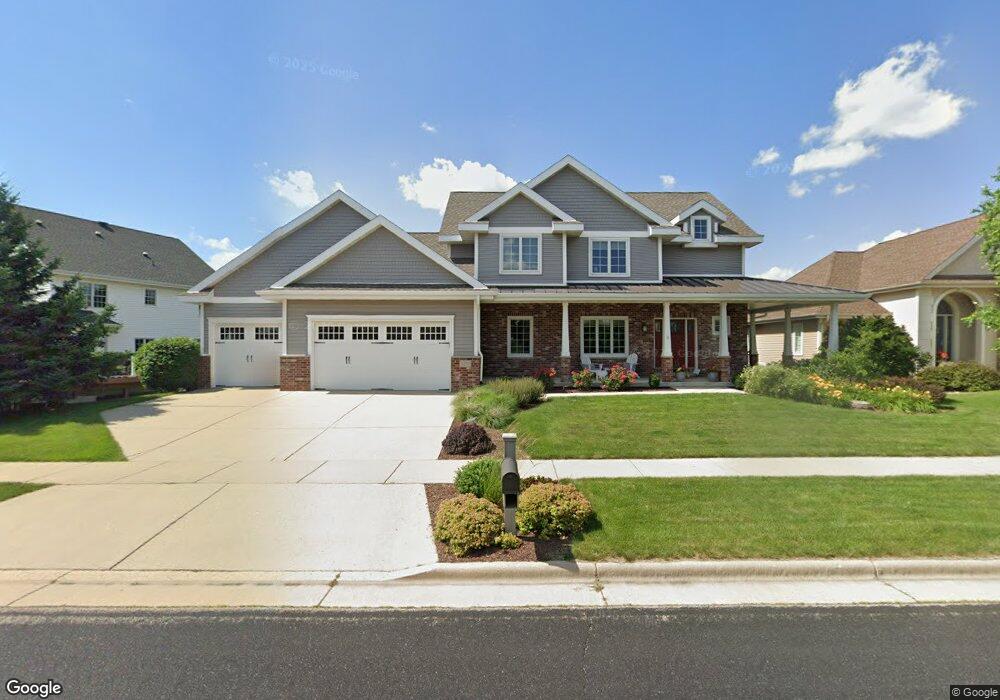
1253 Dartmouth Dr Waunakee, WI 53597
Estimated Value: $715,228 - $816,000
5
Beds
4
Baths
3,191
Sq Ft
$238/Sq Ft
Est. Value
About This Home
This home is located at 1253 Dartmouth Dr, Waunakee, WI 53597 and is currently estimated at $760,807, approximately $238 per square foot. 1253 Dartmouth Dr is a home located in Dane County with nearby schools including Arboretum Elementary School, Waunakee Intermediate School, and Waunakee Community Middle School.
Ownership History
Date
Name
Owned For
Owner Type
Purchase Details
Closed on
Jun 16, 2014
Sold by
Raemisch Jordan and Rose Hilary
Bought by
Shefchik Corey L and Shefchik Ann E
Current Estimated Value
Home Financials for this Owner
Home Financials are based on the most recent Mortgage that was taken out on this home.
Original Mortgage
$336,800
Outstanding Balance
$255,984
Interest Rate
4.18%
Mortgage Type
New Conventional
Estimated Equity
$504,823
Purchase Details
Closed on
Oct 27, 2011
Sold by
King Brian M and King Jennifer J
Bought by
Rose Hilary and Raemisch Jordan
Purchase Details
Closed on
Jul 27, 2006
Sold by
Savannah Village Llc
Bought by
King Brian M and King Jennifer J
Home Financials for this Owner
Home Financials are based on the most recent Mortgage that was taken out on this home.
Original Mortgage
$304,000
Interest Rate
6.82%
Mortgage Type
Construction
Create a Home Valuation Report for This Property
The Home Valuation Report is an in-depth analysis detailing your home's value as well as a comparison with similar homes in the area
Home Values in the Area
Average Home Value in this Area
Purchase History
| Date | Buyer | Sale Price | Title Company |
|---|---|---|---|
| Shefchik Corey L | $421,000 | None Available | |
| Rose Hilary | $404,500 | None Available | |
| King Brian M | $89,900 | None Available |
Source: Public Records
Mortgage History
| Date | Status | Borrower | Loan Amount |
|---|---|---|---|
| Open | Shefchik Corey L | $336,800 | |
| Previous Owner | King Brian M | $304,000 |
Source: Public Records
Tax History Compared to Growth
Tax History
| Year | Tax Paid | Tax Assessment Tax Assessment Total Assessment is a certain percentage of the fair market value that is determined by local assessors to be the total taxable value of land and additions on the property. | Land | Improvement |
|---|---|---|---|---|
| 2024 | $9,750 | $592,600 | $96,000 | $496,600 |
| 2023 | $9,430 | $592,600 | $96,000 | $496,600 |
| 2021 | $9,669 | $491,500 | $90,500 | $401,000 |
| 2020 | $9,350 | $491,500 | $90,500 | $401,000 |
| 2019 | $9,316 | $491,500 | $90,500 | $401,000 |
| 2018 | $9,003 | $420,000 | $88,000 | $332,000 |
| 2017 | $8,932 | $420,000 | $88,000 | $332,000 |
| 2016 | $8,811 | $420,000 | $88,000 | $332,000 |
| 2015 | $8,653 | $420,000 | $88,000 | $332,000 |
| 2014 | -- | $420,000 | $88,000 | $332,000 |
| 2013 | $8,620 | $420,000 | $88,000 | $332,000 |
Source: Public Records
Map
Nearby Homes
- 1306 Hanover Ct
- 1140 Reese Trail
- 1151 Reese Trail
- 1104 Reese Trail
- 1146 Irene Ct
- 1148 Irene Ct
- 1155 Irene Ct Unit 15
- 1153 Irene Ct Unit 14
- 1157 Irene Ct Unit 16
- 1151 Irene Ct Unit 13
- 1033 Quinn Dr
- 1109 Stephenson Ln
- 1110 Stephenson Ln
- 1122 Stephenson Ln
- 1028 Quinn Dr
- 5802 Woodland Dr
- 1016 Quinn Dr
- 5018 Apricot Blossom Ct
- 5006 Apricot Blossom Ct
- Lot 36 Cooper Hawk Dr