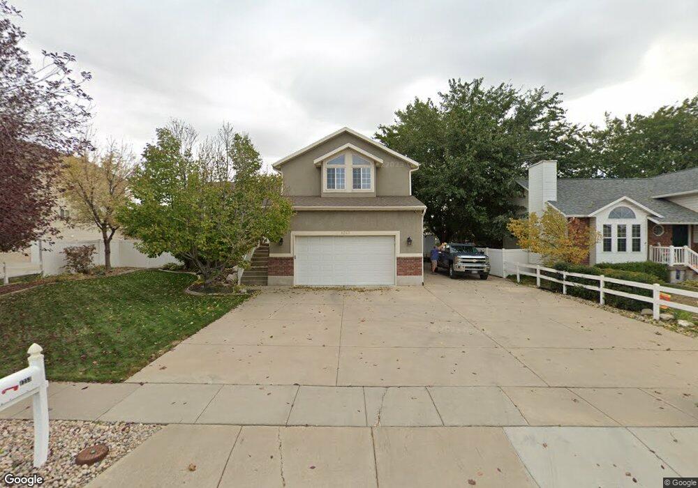
1253 W 1900 S Woods Cross, UT 84087
Estimated Value: $552,000 - $635,799
3
Beds
3
Baths
2,479
Sq Ft
$239/Sq Ft
Est. Value
About This Home
This home is located at 1253 W 1900 S, Woods Cross, UT 84087 and is currently estimated at $593,200, approximately $239 per square foot. 1253 W 1900 S is a home located in Davis County with nearby schools including Woods Cross Elementary School, South Davis Junior High School, and Woods Cross High School.
Ownership History
Date
Name
Owned For
Owner Type
Purchase Details
Closed on
Feb 21, 2017
Sold by
Mabey Jeffrey T and Mabey Jennifer L
Bought by
Mabey Family Trust
Current Estimated Value
Purchase Details
Closed on
Sep 19, 2001
Sold by
Cannon & Cannon Inc
Bought by
Mabey Jeffrey T and Mabey Jennifer L
Purchase Details
Closed on
Feb 27, 2001
Sold by
Cannon Bernie C and Cannon Kathy
Bought by
Cannon & Cannon Inc
Home Financials for this Owner
Home Financials are based on the most recent Mortgage that was taken out on this home.
Original Mortgage
$140,000
Interest Rate
6.98%
Mortgage Type
Construction
Create a Home Valuation Report for This Property
The Home Valuation Report is an in-depth analysis detailing your home's value as well as a comparison with similar homes in the area
Home Values in the Area
Average Home Value in this Area
Purchase History
| Date | Buyer | Sale Price | Title Company |
|---|---|---|---|
| Mabey Family Trust | -- | -- | |
| Mabey Jeffrey T | -- | United Title Services | |
| Cannon & Cannon Inc | -- | Backman Stewart Title Servic |
Source: Public Records
Mortgage History
| Date | Status | Borrower | Loan Amount |
|---|---|---|---|
| Previous Owner | Cannon & Cannon Inc | $140,000 |
Source: Public Records
Tax History Compared to Growth
Tax History
| Year | Tax Paid | Tax Assessment Tax Assessment Total Assessment is a certain percentage of the fair market value that is determined by local assessors to be the total taxable value of land and additions on the property. | Land | Improvement |
|---|---|---|---|---|
| 2025 | $3,468 | $314,050 | $123,677 | $190,373 |
| 2024 | $3,468 | $303,050 | $134,435 | $168,615 |
| 2023 | $3,279 | $530,000 | $180,362 | $349,638 |
| 2022 | $3,411 | $307,450 | $78,250 | $229,200 |
| 2021 | $3,057 | $437,000 | $115,833 | $321,167 |
| 2020 | $2,745 | $387,000 | $110,560 | $276,440 |
| 2019 | $2,711 | $376,000 | $102,013 | $273,987 |
| 2018 | $2,709 | $374,000 | $100,080 | $273,920 |
| 2016 | $2,285 | $169,015 | $45,871 | $123,144 |
| 2015 | $2,207 | $156,475 | $45,871 | $110,604 |
| 2014 | $2,183 | $158,599 | $45,871 | $112,728 |
| 2013 | -- | $138,243 | $36,825 | $101,418 |
Source: Public Records
Map
Nearby Homes
- 1255 W 2050 S
- 1384 W 2175 S
- 1984 S 1500 W
- 2024 S 925 W
- 1998 S 1600 W
- 916 W 2025 S
- 1334 W 1300 S
- 913 W 2025 S
- 1422 W 1300 S
- 1309 W 1200 S
- 1007 W 1300 S
- 1137 S 1050 W
- 1552 S 850 W
- 1282 S 875 W
- 1069 W Linden Ln Unit 31
- Swiss 2 - Urban Plan at The Audrey - theAUDREY
- Swiss 3 - Urban Plan at The Audrey - theAUDREY
- Swiss 1 - Cottage Plan at The Audrey - theAUDREY
- Swiss 4 - Cottage Plan at The Audrey - theAUDREY
- Swiss 2 - Cottage Plan at The Audrey - theAUDREY