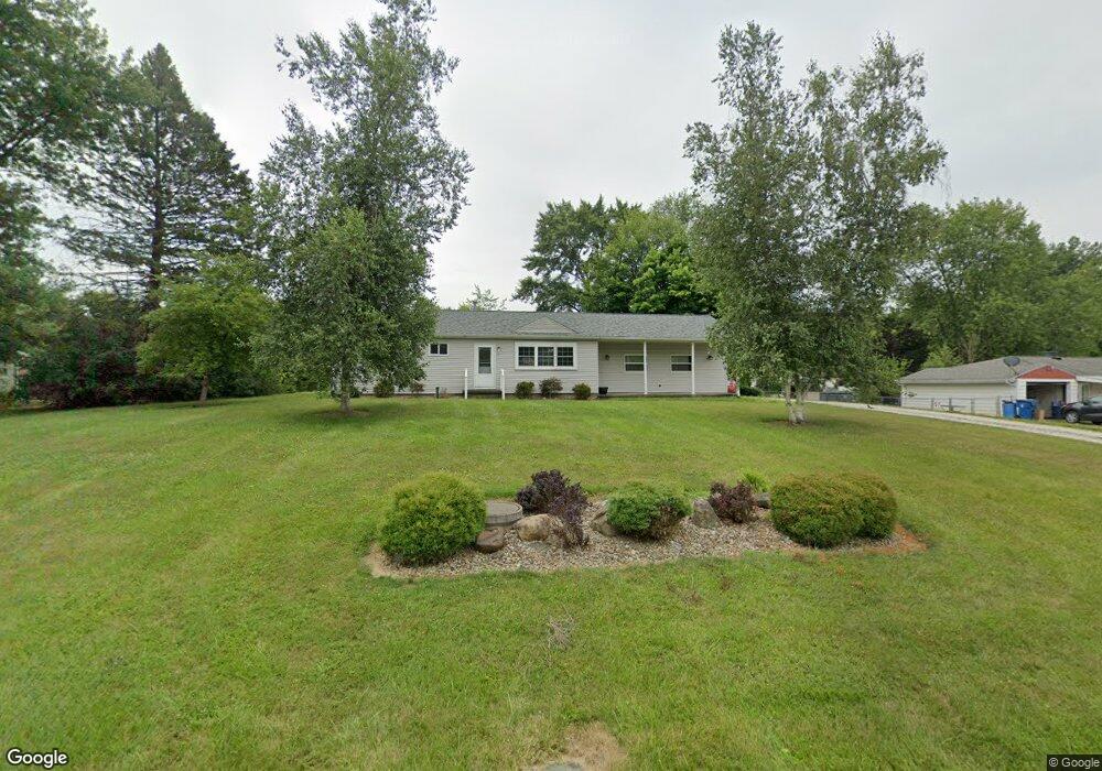
12534 Agnes St NE Alliance, OH 44601
Estimated Value: $176,000 - $205,000
3
Beds
1
Bath
960
Sq Ft
$199/Sq Ft
Est. Value
About This Home
This home is located at 12534 Agnes St NE, Alliance, OH 44601 and is currently estimated at $191,254, approximately $199 per square foot. 12534 Agnes St NE is a home located in Stark County with nearby schools including Marlington High School and Regina Coeli/St Joseph School.
Ownership History
Date
Name
Owned For
Owner Type
Purchase Details
Closed on
Dec 29, 2015
Sold by
Heppe Timothy J
Bought by
Tj Rentals Of Alliance Llc
Current Estimated Value
Purchase Details
Closed on
Aug 21, 2015
Sold by
Liberty South Rentals Inc
Bought by
Heppe Timothy J
Purchase Details
Closed on
Mar 1, 2013
Sold by
Edgar Leo K
Bought by
Liberty & South Rentals Inc
Purchase Details
Closed on
Feb 4, 2013
Sold by
Liberty & South Rentals Inc
Bought by
Edgar Leo K
Purchase Details
Closed on
Oct 5, 2004
Sold by
Edgar Leo K
Bought by
Liberty & South Rentals Inc
Purchase Details
Closed on
Aug 4, 1998
Sold by
Redd William A
Bought by
Edgar Leo K
Home Financials for this Owner
Home Financials are based on the most recent Mortgage that was taken out on this home.
Original Mortgage
$81,600
Interest Rate
7.03%
Mortgage Type
VA
Create a Home Valuation Report for This Property
The Home Valuation Report is an in-depth analysis detailing your home's value as well as a comparison with similar homes in the area
Home Values in the Area
Average Home Value in this Area
Purchase History
| Date | Buyer | Sale Price | Title Company |
|---|---|---|---|
| Tj Rentals Of Alliance Llc | -- | Attorney | |
| Heppe Timothy J | $102,000 | Attorney | |
| Liberty & South Rentals Inc | -- | None Available | |
| Edgar Leo K | -- | None Available | |
| Liberty & South Rentals Inc | -- | -- | |
| Edgar Leo K | $80,000 | -- |
Source: Public Records
Mortgage History
| Date | Status | Borrower | Loan Amount |
|---|---|---|---|
| Previous Owner | Edgar Leo K | $81,600 |
Source: Public Records
Tax History Compared to Growth
Tax History
| Year | Tax Paid | Tax Assessment Tax Assessment Total Assessment is a certain percentage of the fair market value that is determined by local assessors to be the total taxable value of land and additions on the property. | Land | Improvement |
|---|---|---|---|---|
| 2025 | -- | $57,200 | $25,310 | $31,890 |
| 2024 | -- | $57,200 | $25,310 | $31,890 |
| 2023 | $1,578 | $43,790 | $13,440 | $30,350 |
| 2022 | $1,584 | $43,790 | $13,440 | $30,350 |
| 2021 | $1,589 | $43,790 | $13,440 | $30,350 |
| 2020 | $1,525 | $37,460 | $11,590 | $25,870 |
| 2019 | $1,516 | $37,460 | $11,590 | $25,870 |
| 2018 | $1,518 | $37,460 | $11,590 | $25,870 |
| 2017 | $1,447 | $33,400 | $11,030 | $22,370 |
| 2016 | $1,447 | $33,400 | $11,030 | $22,370 |
| 2015 | $1,375 | $33,220 | $11,030 | $22,190 |
| 2014 | $1,255 | $27,690 | $9,210 | $18,480 |
| 2013 | $624 | $27,690 | $9,210 | $18,480 |
Source: Public Records
Map
Nearby Homes
- 10666 Wilma Ave NE
- 13334 Cindy St NE
- 0 Meadow St NE
- 0 W Main St Unit 5090123
- 11480 Aebi Ave NE
- 11960 Freshley Ave NE
- 1430 Westwood Ave
- 12355 Edison St NE
- 2081 Marwood Cir
- 13109 Edison St NE
- 2377 Ansley St Unit 2377
- 000 Klinger Ave
- 12252 Snode St NE
- 0 Reeder Ave NE
- 12415 Snode St NE
- 432 Johnson Ave
- 0 Klinger Ave NE
- 1201 Overlook Dr
- 14422 Sturbridge Rd NE
- 2851 Patriots Path Unit 3D
- 12544 Agnes St NE
- 10530 Barcus Ave NE
- 10567 Wilma Ave NE
- 10570 Barcus Ave NE
- 12540 Beeson St NE
- 12512 Beeson St NE
- 10585 Wilma Ave NE
- 10588 Barcus Ave NE
- 12488 Beeson St NE
- 10522 Wilma Ave NE
- 10533 Barcus Ave NE
- 10544 Wilma Ave NE
- 12566 Beeson St NE
- 10545 Barcus Ave NE
- 10572 Wilma Ave NE
- 10567 Barcus Ave NE
- 10605 Wilma Ave NE
- 12464 Beeson St NE
- 10588 Wilma Ave NE
- 12590 Beeson St NE