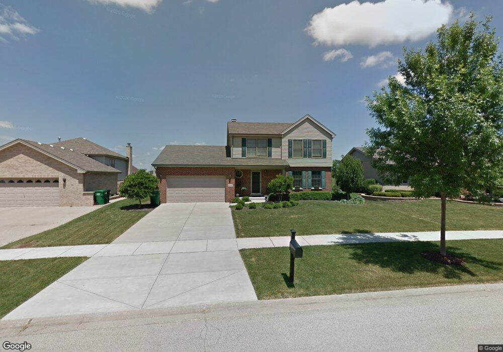
12536 Cedar Ridge Dr Homer Glen, IL 60491
Estimated Value: $429,608 - $638,000
--
Bed
--
Bath
1,959
Sq Ft
$255/Sq Ft
Est. Value
About This Home
This home is located at 12536 Cedar Ridge Dr, Homer Glen, IL 60491 and is currently estimated at $500,152, approximately $255 per square foot. 12536 Cedar Ridge Dr is a home located in Will County with nearby schools including Hadley Middle School, Luther J Schilling School, and Homer Jr High School.
Ownership History
Date
Name
Owned For
Owner Type
Purchase Details
Closed on
Feb 3, 2003
Sold by
Standard Bank & Trust Co
Bought by
Tomanich Michael P and Tomanich Jill E
Current Estimated Value
Home Financials for this Owner
Home Financials are based on the most recent Mortgage that was taken out on this home.
Original Mortgage
$219,000
Interest Rate
5.94%
Mortgage Type
Purchase Money Mortgage
Create a Home Valuation Report for This Property
The Home Valuation Report is an in-depth analysis detailing your home's value as well as a comparison with similar homes in the area
Home Values in the Area
Average Home Value in this Area
Purchase History
| Date | Buyer | Sale Price | Title Company |
|---|---|---|---|
| Tomanich Michael P | $239,500 | Chicago Title Insurance Co |
Source: Public Records
Mortgage History
| Date | Status | Borrower | Loan Amount |
|---|---|---|---|
| Previous Owner | Tomanich Michael P | $219,000 |
Source: Public Records
Tax History Compared to Growth
Tax History
| Year | Tax Paid | Tax Assessment Tax Assessment Total Assessment is a certain percentage of the fair market value that is determined by local assessors to be the total taxable value of land and additions on the property. | Land | Improvement |
|---|---|---|---|---|
| 2024 | $8,836 | $129,711 | $28,086 | $101,625 |
| 2023 | $8,836 | $117,577 | $25,459 | $92,118 |
| 2022 | $8,479 | $109,782 | $23,771 | $86,011 |
| 2021 | $7,696 | $104,009 | $22,521 | $81,488 |
| 2020 | $7,718 | $100,182 | $21,692 | $78,490 |
| 2019 | $7,352 | $96,375 | $20,868 | $75,507 |
| 2018 | $6,910 | $89,947 | $20,629 | $69,318 |
| 2017 | $6,781 | $87,430 | $20,052 | $67,378 |
| 2016 | $6,612 | $84,514 | $19,383 | $65,131 |
| 2015 | $7,087 | $81,341 | $18,655 | $62,686 |
| 2014 | $7,087 | $79,014 | $18,270 | $60,744 |
| 2013 | $7,087 | $88,422 | $18,270 | $70,152 |
Source: Public Records
Map
Nearby Homes
- 12459 Rosewood Dr Unit 1
- Fremont Plan at Kingston Hills
- Briarcliffe Plan at Kingston Hills
- Danbury Plan at Kingston Hills
- Calysta Plan at Kingston Hills
- Eden Plan at Kingston Hills
- Amberwood Plan at Kingston Hills
- 14748 S Carlton Ln
- 15022 S Woodcrest Ave Unit 3
- 14715 S Woodcrest Ave
- 14561 S Appaloosa Ln
- 12222 Rambling Rd
- 14542 S Mustang Dr
- 14541 S Bell Rd
- 14453 S Bell Rd
- 15328 Sharon Dr
- 14325 S Bell Rd
- 15507 Willow Ct
- 13116 Woodland Dr
- 14225 Mallard Dr
- 12540 Cedar Ridge Dr
- 12530 Cedar Ridge Dr
- 12548 Cedar Ridge Dr
- 14801 S Heathcliff Rd Unit 5
- 14824 Pheasant Ln
- 12509 W Manor Dr
- 14818 S Pheasant Ln
- 12535 Cedar Ridge Dr
- 12558 Cedar Ridge Dr
- 12541 Cedar Ridge Dr
- 12515 W Manor Dr
- 12527 Cedar Ridge Dr
- 14812 S Pheasant Ln
- 14765 S Heathcliff Rd Unit 5
- 12549 Cedar Ridge Dr
- 12519 Cedar Ridge Dr
- 14806 S Pheasant Ln
- 12521 W Manor Dr
- 12564 Cedar Ridge Dr
- 12559 Cedar Ridge Dr