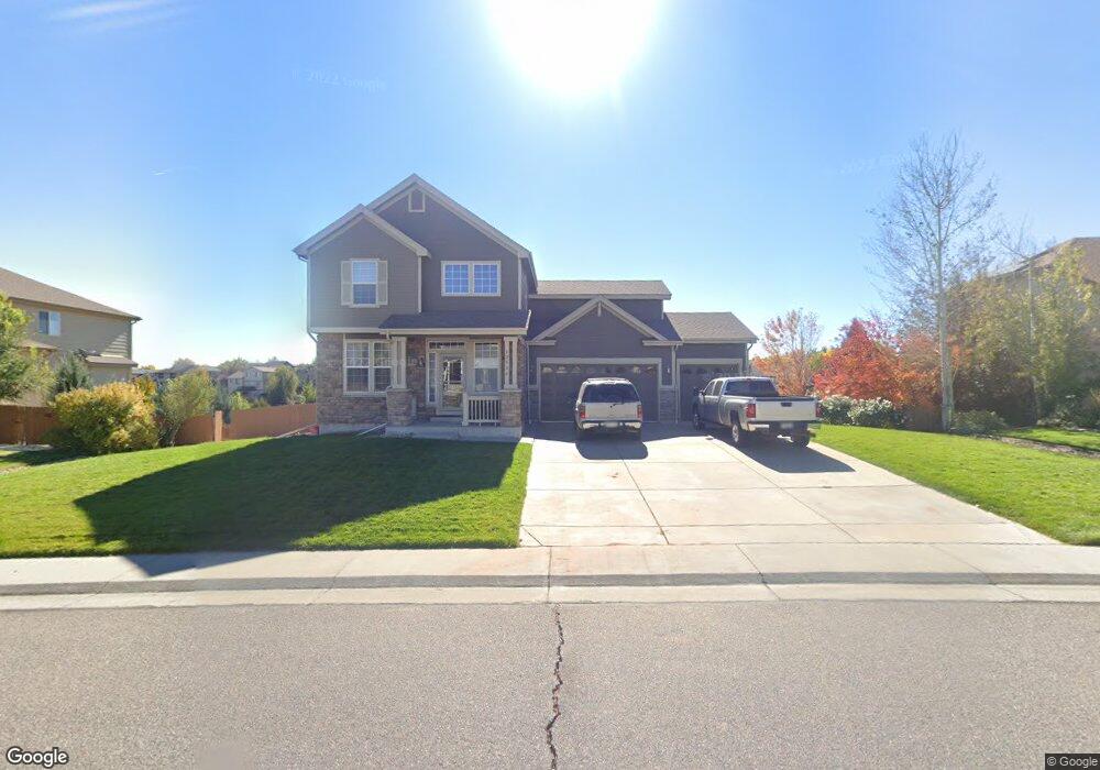
12536 Locust Way Thornton, CO 80602
Estimated Value: $628,565 - $687,000
3
Beds
3
Baths
4,076
Sq Ft
$164/Sq Ft
Est. Value
About This Home
This home is located at 12536 Locust Way, Thornton, CO 80602 and is currently estimated at $669,141, approximately $164 per square foot. 12536 Locust Way is a home located in Adams County with nearby schools including West Ridge Elementary School, Shore Acres Elementary School, and Elderberry Elementary.
Ownership History
Date
Name
Owned For
Owner Type
Purchase Details
Closed on
Oct 3, 2012
Sold by
Davidson John E and Davidson John
Bought by
Hawkins Jason L and Hawkins Stacey J
Current Estimated Value
Home Financials for this Owner
Home Financials are based on the most recent Mortgage that was taken out on this home.
Original Mortgage
$253,200
Outstanding Balance
$179,966
Interest Rate
3.7%
Mortgage Type
New Conventional
Estimated Equity
$489,175
Purchase Details
Closed on
Apr 29, 2009
Sold by
Gallegos Angela and Davidson Angela
Bought by
Davidson John
Purchase Details
Closed on
Jan 26, 2006
Sold by
Centex Homes
Bought by
Davidson John E and Davidson Angela
Home Financials for this Owner
Home Financials are based on the most recent Mortgage that was taken out on this home.
Original Mortgage
$63,652
Interest Rate
6.19%
Mortgage Type
Stand Alone Second
Create a Home Valuation Report for This Property
The Home Valuation Report is an in-depth analysis detailing your home's value as well as a comparison with similar homes in the area
Home Values in the Area
Average Home Value in this Area
Purchase History
| Date | Buyer | Sale Price | Title Company |
|---|---|---|---|
| Hawkins Jason L | $316,500 | Fidelity National Title Insu | |
| Davidson John | -- | None Available | |
| Davidson John E | $318,260 | Commerce Title |
Source: Public Records
Mortgage History
| Date | Status | Borrower | Loan Amount |
|---|---|---|---|
| Open | Hawkins Jason L | $13,970 | |
| Open | Hawkins Jason L | $40,000 | |
| Open | Hawkins Jason L | $253,200 | |
| Previous Owner | Davidson John | $257,508 | |
| Previous Owner | Davidson John E | $63,652 | |
| Previous Owner | Davidson John E | $254,608 |
Source: Public Records
Tax History Compared to Growth
Tax History
| Year | Tax Paid | Tax Assessment Tax Assessment Total Assessment is a certain percentage of the fair market value that is determined by local assessors to be the total taxable value of land and additions on the property. | Land | Improvement |
|---|---|---|---|---|
| 2024 | $4,197 | $41,190 | $7,940 | $33,250 |
| 2023 | $4,176 | $46,740 | $7,100 | $39,640 |
| 2022 | $3,340 | $34,050 | $7,300 | $26,750 |
| 2021 | $3,217 | $34,050 | $7,300 | $26,750 |
| 2020 | $3,126 | $34,530 | $7,510 | $27,020 |
| 2019 | $3,129 | $34,530 | $7,510 | $27,020 |
| 2018 | $2,868 | $31,640 | $6,840 | $24,800 |
| 2017 | $2,864 | $31,640 | $6,840 | $24,800 |
| 2016 | $2,389 | $26,290 | $4,620 | $21,670 |
| 2015 | $2,383 | $26,290 | $4,620 | $21,670 |
| 2014 | -- | $23,890 | $3,780 | $20,110 |
Source: Public Records
Map
Nearby Homes
- 12388 Jasmine St
- 12682 Kearney St
- 12450 Kearney Cir
- 12609 Jersey Cir W
- 12778 Jasmine St Unit E
- 6659 Monaco Way
- 6712 E 123rd Cir
- 6264 E 122nd Ave
- 12260 Magnolia Way
- 12733 Leyden St Unit C
- 12740 Jasmine St Unit F
- 5757 E 122nd Dr
- 12774 Leyden St Unit D
- 12754 Leyden St Unit E
- 12333 Newport Ct
- 6358 E 121st Place
- 5913 E 121st Place
- 12774 Jasmine Ct
- 12771 Jasmine Ct
- 12554 Hudson Ct
- 12542 Locust Way
- 12530 Locust Way
- 12543 Locust Way
- 12548 Locust Way
- 12533 Locust Way
- 12555 Locust Way
- 12410 Kearney Cir
- 12523 Locust Way
- 12563 Locust Way
- 6312 E 126th Place
- 12509 Locust Place
- 12513 Locust Way
- 6302 E 126th Place
- 6322 E 126th Place
- 12519 Locust Place
- 6229 E 123rd Dr
- 6219 E 123rd Dr
- 6239 E 123rd Dr
- 12583 Locust Way
- 6209 E 123rd Dr