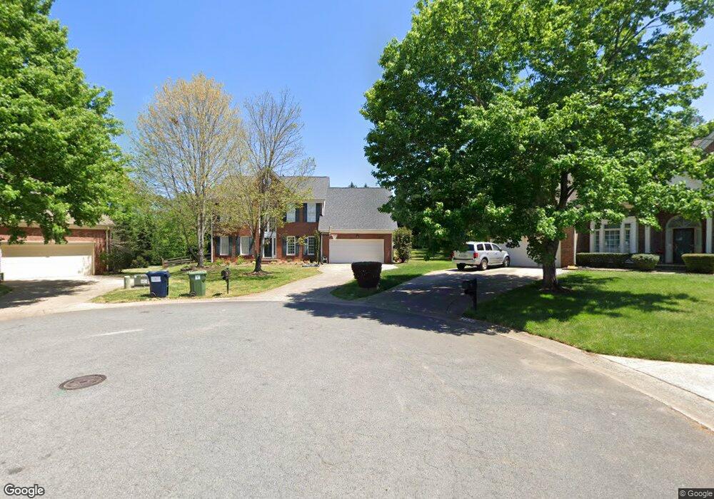
12537 Rolling Rock Ct Charlotte, NC 28215
Bradfield Farms NeighborhoodEstimated Value: $495,265 - $545,000
5
Beds
3
Baths
3,167
Sq Ft
$166/Sq Ft
Est. Value
About This Home
This home is located at 12537 Rolling Rock Ct, Charlotte, NC 28215 and is currently estimated at $526,566, approximately $166 per square foot. 12537 Rolling Rock Ct is a home located in Mecklenburg County with nearby schools including Clear Creek Elementary, Northeast Middle, and Rocky River High School.
Ownership History
Date
Name
Owned For
Owner Type
Purchase Details
Closed on
Jun 11, 2013
Sold by
Brown Joseph L and Brown Tami
Bought by
Stover Jeffrey C and Stover Brandi M
Current Estimated Value
Home Financials for this Owner
Home Financials are based on the most recent Mortgage that was taken out on this home.
Original Mortgage
$211,850
Outstanding Balance
$149,890
Interest Rate
3.37%
Mortgage Type
New Conventional
Estimated Equity
$376,676
Purchase Details
Closed on
Nov 18, 2002
Sold by
Bradwell Marvin V and Bradwell Audrey B
Bought by
Brown Joseph L and Brown Tami
Home Financials for this Owner
Home Financials are based on the most recent Mortgage that was taken out on this home.
Original Mortgage
$171,000
Interest Rate
5.98%
Mortgage Type
Purchase Money Mortgage
Create a Home Valuation Report for This Property
The Home Valuation Report is an in-depth analysis detailing your home's value as well as a comparison with similar homes in the area
Home Values in the Area
Average Home Value in this Area
Purchase History
| Date | Buyer | Sale Price | Title Company |
|---|---|---|---|
| Stover Jeffrey C | $223,000 | None Available | |
| Brown Joseph L | $216,000 | -- |
Source: Public Records
Mortgage History
| Date | Status | Borrower | Loan Amount |
|---|---|---|---|
| Open | Stover Jeffrey C | $211,850 | |
| Previous Owner | Brown Joseph L | $171,000 |
Source: Public Records
Tax History Compared to Growth
Tax History
| Year | Tax Paid | Tax Assessment Tax Assessment Total Assessment is a certain percentage of the fair market value that is determined by local assessors to be the total taxable value of land and additions on the property. | Land | Improvement |
|---|---|---|---|---|
| 2025 | $3,128 | $447,700 | $90,000 | $357,700 |
| 2024 | $3,128 | $447,700 | $90,000 | $357,700 |
| 2023 | $3,077 | $447,500 | $90,000 | $357,500 |
| 2022 | $2,257 | $247,400 | $50,000 | $197,400 |
| 2021 | $2,204 | $247,400 | $50,000 | $197,400 |
| 2020 | $2,192 | $247,400 | $50,000 | $197,400 |
| 2019 | $2,165 | $247,400 | $50,000 | $197,400 |
| 2018 | $2,550 | $225,700 | $37,800 | $187,900 |
| 2017 | $2,530 | $225,700 | $37,800 | $187,900 |
| 2016 | $2,497 | $225,700 | $37,800 | $187,900 |
| 2015 | $2,471 | $225,700 | $37,800 | $187,900 |
| 2014 | $2,429 | $225,700 | $37,800 | $187,900 |
Source: Public Records
Map
Nearby Homes
- 4713 Hanging Ivy Dr
- 3902 Larkhaven Village Dr
- 10648 Jardin Way
- 10631 Jardin Way
- 7109 Scuppernong Ct
- 6930 Reedy Creek Rd
- 10219 Windtree Ln
- 11136 Scrimshaw Ln
- 7024 Passeres Ct
- 10700 Harrisburg Rd
- 5134 Tracewood Ct
- 11004 Pale Hickory Ln
- 11106 Pale Hickory Ln
- 12015 Chantress Ln
- 5066 Summer Surprise Ln
- 7633 Nicolette Ct
- 13206 Cozy Ct
- 13214 Cozy Ct
- 0 Cambridge Commons Dr Unit 3770354
- 13222 Cozy Ct
- 12533 Rolling Rock Ct
- 5740 Coulee Ln
- 12532 Rolling Rock Ct
- 12529 Rolling Rock Ct
- 12543 Cedar Post Ln
- 12601 Cedar Post Ln
- 4510 Bellhook Dr
- 12521 Rolling Rock Ct
- 12522 Rolling Rock Ct
- 12535 Cedar Post Ln
- 12803 Bald Eagle Dr
- 12517 Marblerock Ct
- 12514 Rolling Rock Ct
- 12514 Rolling Rock Ct Unit 33
- 12527 Cedar Post Ln
- 12800 Bald Eagle Dr
- 12605 Cedar Post Ln
- 4800 Oak Bend Ct
- 4808 Oak Bend Ct
- 12513 Marblerock Ct