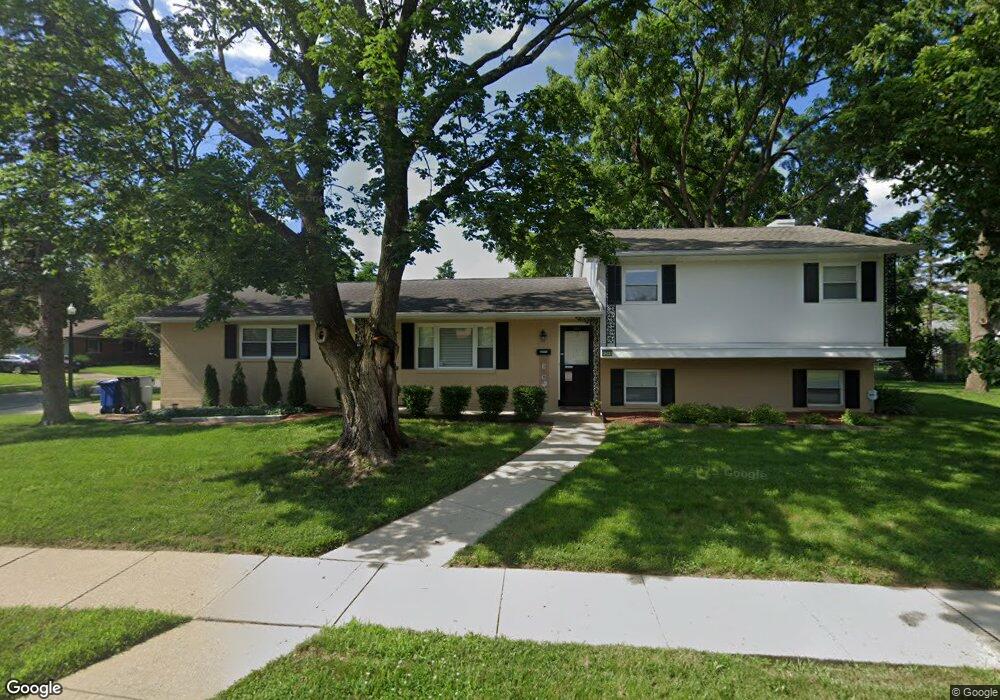
1254 Maize Ct Columbus, OH 43229
Woodward Park NeighborhoodEstimated Value: $277,000 - $307,000
3
Beds
2
Baths
1,640
Sq Ft
$180/Sq Ft
Est. Value
About This Home
This home is located at 1254 Maize Ct, Columbus, OH 43229 and is currently estimated at $295,732, approximately $180 per square foot. 1254 Maize Ct is a home located in Franklin County with nearby schools including Valley Forge Elementary School, Woodward Park Middle School, and Northland High School.
Ownership History
Date
Name
Owned For
Owner Type
Purchase Details
Closed on
Mar 29, 2002
Sold by
Ueltschy Judith D
Bought by
Neff Stephen J
Current Estimated Value
Home Financials for this Owner
Home Financials are based on the most recent Mortgage that was taken out on this home.
Original Mortgage
$105,000
Outstanding Balance
$41,790
Interest Rate
6.82%
Mortgage Type
Purchase Money Mortgage
Estimated Equity
$253,942
Purchase Details
Closed on
Nov 6, 1964
Bought by
Ueltschy Richard F
Create a Home Valuation Report for This Property
The Home Valuation Report is an in-depth analysis detailing your home's value as well as a comparison with similar homes in the area
Home Values in the Area
Average Home Value in this Area
Purchase History
We collect this data history from publicly available records. To have your information removed, we recommend requesting removal directly through your county’s website.
| Date | Buyer | Sale Price | Title Company |
|---|---|---|---|
| Neff Stephen J | $132,000 | -- | |
| Ueltschy Richard F | -- | -- |
Source: Public Records
Mortgage History
We collect this data history from publicly available records. To have your information removed, we recommend requesting removal directly through your county’s website.
| Date | Status | Borrower | Loan Amount |
|---|---|---|---|
| Open | Neff Stephen J | $105,000 |
Source: Public Records
Tax History
| Year | Tax Paid | Tax Assessment Tax Assessment Total Assessment is a certain percentage of the fair market value that is determined by local assessors to be the total taxable value of land and additions on the property. | Land | Improvement |
|---|---|---|---|---|
| 2025 | $3,769 | $83,970 | $21,630 | $62,340 |
| 2024 | $3,769 | $83,970 | $21,630 | $62,340 |
| 2023 | $3,720 | $83,965 | $21,630 | $62,335 |
| 2022 | $2,893 | $55,760 | $13,410 | $42,350 |
| 2021 | $2,897 | $55,760 | $13,410 | $42,350 |
| 2020 | $2,901 | $55,760 | $13,410 | $42,350 |
| 2019 | $2,726 | $44,940 | $10,710 | $34,230 |
| 2018 | $2,534 | $44,940 | $10,710 | $34,230 |
| 2017 | $2,725 | $44,940 | $10,710 | $34,230 |
| 2016 | $2,585 | $39,030 | $9,940 | $29,090 |
| 2015 | $2,347 | $39,030 | $9,940 | $29,090 |
| 2014 | $2,353 | $39,030 | $9,940 | $29,090 |
| 2013 | $1,222 | $41,090 | $10,465 | $30,625 |
Source: Public Records
Map
Nearby Homes
- 1294 Maize Ct
- 4875 Ridgerun Dr
- 4795 Colonel Perry Dr
- 1167 Reed Circle Dr
- 4459 Hartwell Rd
- 4818 Colonel Perry Dr
- 1116 Marland Dr N
- 1485 Norma Rd
- 1004 Marland Dr N
- 4460 Wanda Lane Rd
- 1398 Matthias Dr
- 4339 Blythe Rd
- 1451 Shanley Dr
- 4281 Blythe Rd
- 1510 Matthias Dr
- 4141 Karl Rd Unit 310
- 4143 Karl Rd Unit 215
- 4143 Karl Rd Unit 314
- 1288 Carbone Dr
- 4852 Snowbird Cir Unit 13B
- 1291 Maize Ct
- 1297 Maize Ct
- 1279 Maize Ct
- 1264 Fenceway Dr Unit 266
- 1264-1266 Fenceway Dr
- 1265 Maize Ct
- 1258 Fenceway Dr
- 1270 Fenceway Dr Unit 272
- 1299 Maize Ct
- 1298 Maize Ct
- 1288 Maize Ct
- 1304 Maize Ct
- 1282 Fenceway Dr Unit 284
- 1282-1284 Fenceway Dr
- 4732 Maize Rd
- 1282 Maize Ct
- 1250 Fenceway Dr
- 1253 Maize Ct
- 1308 Maize Ct
- 1292 Fenceway Dr Unit 294
Your Personal Tour Guide
Ask me questions while you tour the home.