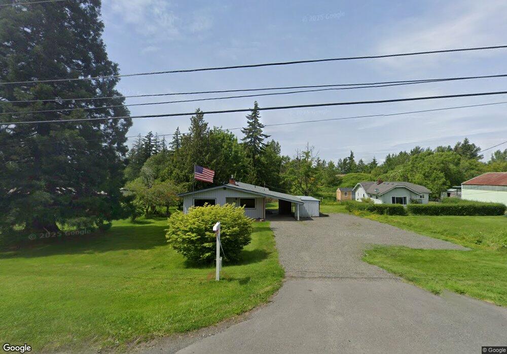
1254 Mt Baker Hwy Bellingham, WA 98226
Barkley NeighborhoodEstimated Value: $503,000 - $549,909
3
Beds
1
Bath
1,220
Sq Ft
$437/Sq Ft
Est. Value
About This Home
This home is located at 1254 Mt Baker Hwy, Bellingham, WA 98226 and is currently estimated at $533,227, approximately $437 per square foot. 1254 Mt Baker Hwy is a home located in Whatcom County with nearby schools including Northern Heights Elementary School, Shuksan Middle School, and Squalicum High School.
Ownership History
Date
Name
Owned For
Owner Type
Purchase Details
Closed on
Nov 6, 2025
Sold by
Lindner Coe R and Lindner Eileen B
Bought by
Coe R And Eileen B Lindner Trust and Lindner
Current Estimated Value
Purchase Details
Closed on
Jun 12, 2025
Sold by
Oddie And Patricia Bowen Living Trust and Bowen Michael F
Bought by
Lindner Coe R and Lindner Eileen B
Purchase Details
Closed on
Sep 20, 2017
Sold by
Bowen Oddie C and Bowen Patricia
Bought by
Bowen Oddie C and Bowen Patricia A
Create a Home Valuation Report for This Property
The Home Valuation Report is an in-depth analysis detailing your home's value as well as a comparison with similar homes in the area
Home Values in the Area
Average Home Value in this Area
Purchase History
| Date | Buyer | Sale Price | Title Company |
|---|---|---|---|
| Coe R And Eileen B Lindner Trust | $313 | None Listed On Document | |
| Lindner Coe R | $545,000 | Chicago Title | |
| Bowen Oddie C | -- | None Available |
Source: Public Records
Tax History Compared to Growth
Tax History
| Year | Tax Paid | Tax Assessment Tax Assessment Total Assessment is a certain percentage of the fair market value that is determined by local assessors to be the total taxable value of land and additions on the property. | Land | Improvement |
|---|---|---|---|---|
| 2024 | $3,625 | $443,678 | $244,771 | $198,907 |
| 2023 | $3,625 | $463,187 | $255,534 | $207,653 |
| 2022 | $3,138 | $406,305 | $224,153 | $182,152 |
| 2021 | $2,309 | $335,789 | $185,250 | $150,539 |
| 2020 | $2,256 | $232,725 | $109,039 | $123,686 |
| 2019 | $2,025 | $217,470 | $101,955 | $115,515 |
| 2018 | $2,095 | $195,060 | $91,455 | $103,605 |
| 2017 | $1,828 | $172,591 | $80,920 | $91,671 |
| 2016 | $1,800 | $156,894 | $73,640 | $83,254 |
| 2015 | $1,720 | $149,403 | $70,000 | $79,403 |
| 2014 | -- | $0 | $0 | $0 |
| 2013 | -- | $0 | $0 | $0 |
Source: Public Records
Map
Nearby Homes
- 3817 E Sunset Dr
- 3715 E Sunset Dr
- 3606 Tree Farm Ct
- 3827 Keystone Way
- 0 E Bakerview Rd Unit NWM2398341
- 1368 Roma Rd
- 3713 Bristol St
- 3709 Bristol St
- 1314 Welling Rd
- 3001 E Sunset Dr
- 3010 E Sunset Dr
- 2870 E Bakerview Rd
- 1430 Welling Rd
- 4269 Dewey Rd
- 1379 Northwood Ct
- 1430 Mt Baker Hwy
- 3527 Sussex Dr
- 1445 Mt Baker Hwy
- 2809 E Sunset Dr
- 4121 Malachite Dr
- 3703 Tree Farm Ln
- 252 5 Mount Baker Hwy
- 252 9 Mount Baker Hwy
- 3820 E Sunset Dr
- 4020 Dewey Rd
- 3707 Tree Farm Ln
- 4000 Dewey Rd
- 4000 Dewey Rd
- 1230 Mt Baker Hwy
- 3711 Tree Farm Ln
- 3704 Tree Farm Ln
- 3708 Tree Farm Ln
- 3715 Tree Farm Ln
- 1286 Mt Baker Hwy
- 3702 Tree Farm Ln
- 3712 Tree Farm Ln
- 3719 Tree Farm Ln
- 3701 Tree Farm Ln
- 0 L18 Tree Farm Ln
- 0 L1 Tree Farm Ln