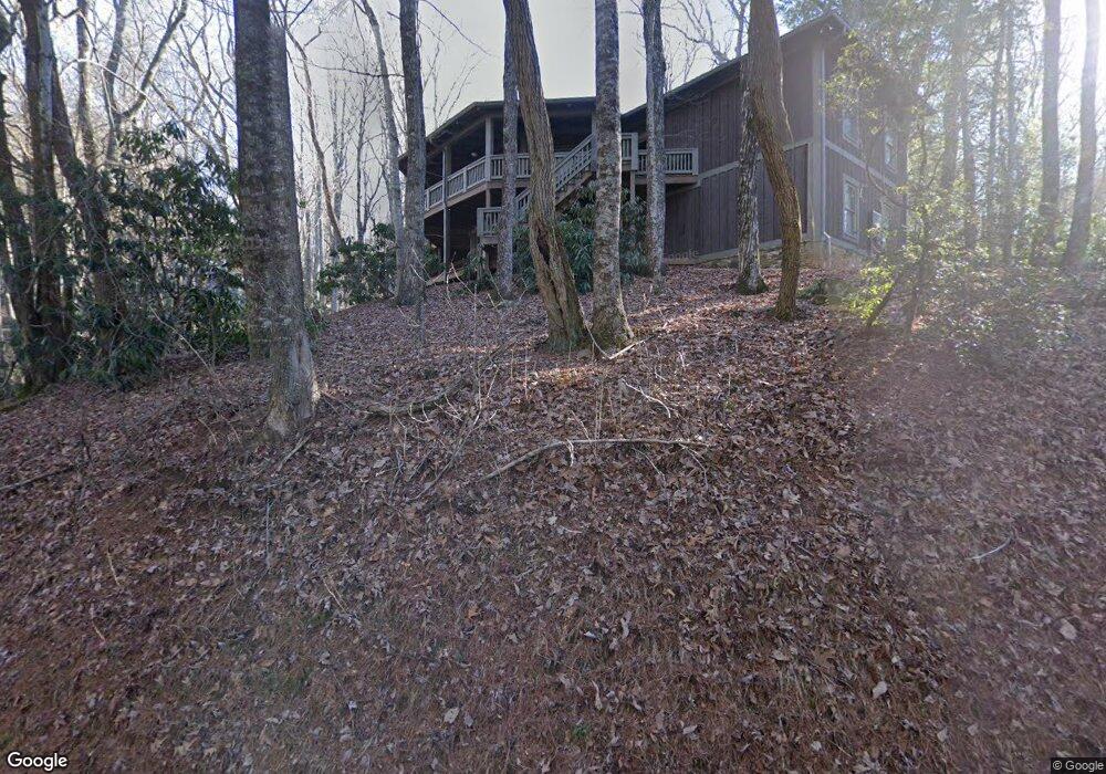
1254 Sky High Dr Dillard, GA 30537
Estimated Value: $505,000 - $801,000
3
Beds
4
Baths
3,571
Sq Ft
$182/Sq Ft
Est. Value
About This Home
This home is located at 1254 Sky High Dr, Dillard, GA 30537 and is currently estimated at $651,097, approximately $182 per square foot. 1254 Sky High Dr is a home located in Rabun County with nearby schools including Rabun County Primary School and Rabun County High School.
Ownership History
Date
Name
Owned For
Owner Type
Purchase Details
Closed on
Dec 27, 2021
Sold by
Shepard Betty J
Bought by
Shepard William Steve
Current Estimated Value
Purchase Details
Closed on
Dec 16, 2011
Sold by
Rolader Laverne D
Bought by
Shepard W Steve
Purchase Details
Closed on
Nov 1, 2006
Sold by
Not Provided
Bought by
Rolader Laverne D
Purchase Details
Closed on
Jun 1, 2006
Sold by
Not Provided
Bought by
Rolader Laverne D
Purchase Details
Closed on
Oct 1, 2000
Purchase Details
Closed on
May 1, 1998
Purchase Details
Closed on
Aug 1, 1993
Create a Home Valuation Report for This Property
The Home Valuation Report is an in-depth analysis detailing your home's value as well as a comparison with similar homes in the area
Home Values in the Area
Average Home Value in this Area
Purchase History
| Date | Buyer | Sale Price | Title Company |
|---|---|---|---|
| Shepard William Steve | -- | -- | |
| Shepard William Steve | -- | -- | |
| Shepard W Steve | $335,000 | -- | |
| Shepard W Steve | $335,000 | -- | |
| Rolader Laverne D | $125,000 | -- | |
| Rolader Laverne D | $125,000 | -- | |
| Rolader Laverne D | $90,000 | -- | |
| Rolader Laverne D | $90,000 | -- | |
| -- | $77,000 | -- | |
| -- | $77,000 | -- | |
| -- | $55,000 | -- | |
| -- | $55,000 | -- | |
| -- | $56,300 | -- | |
| -- | $56,300 | -- |
Source: Public Records
Tax History
| Year | Tax Paid | Tax Assessment Tax Assessment Total Assessment is a certain percentage of the fair market value that is determined by local assessors to be the total taxable value of land and additions on the property. | Land | Improvement |
|---|---|---|---|---|
| 2025 | $5,784 | $209,387 | $24,000 | $185,387 |
| 2024 | $5,452 | $197,375 | $24,000 | $173,375 |
| 2023 | $5,196 | $166,050 | $19,200 | $146,850 |
| 2022 | $2,772 | $151,476 | $16,800 | $134,676 |
| 2021 | $2,408 | $128,419 | $9,600 | $118,819 |
| 2020 | $2,284 | $117,776 | $9,600 | $108,176 |
| 2019 | $2,301 | $117,776 | $9,600 | $108,176 |
| 2018 | $2,309 | $117,776 | $9,600 | $108,176 |
| 2017 | $2,214 | $117,776 | $9,600 | $108,176 |
| 2016 | $2,220 | $117,776 | $9,600 | $108,176 |
| 2015 | $2,294 | $119,114 | $9,600 | $109,514 |
| 2014 | $2,306 | $119,114 | $9,600 | $109,514 |
Source: Public Records
Map
Nearby Homes
- 42 Lost Valley Dr
- 41 Peek and Peak Dr
- 480 Sky High Dr
- 226 Moon Ridge Dr
- 0 LOT 41 Rebel Cir
- 522 Rebel Cir
- 594 Sky High Dr
- 119 Buttermilk Cir
- 137 Pleasant Mountain Dr
- 0 Saddleback Cir Unit 10538862
- LOT 35 Thomas Knob Estates Rd
- 374 W Sugarbush Dr
- 0 LOT 41 Pipetrack Gap Rd
- LOT 1 Pleasant Mountain Dr
- 452 E Sugarbush Dr
- 156 Tahoe Ln
- 340 Eagle Cir
- 767 Driver Ln
- 70 Fairway Ln
- 36 Mountain Breeze Ridge
- 1227 Sky High Dr
- 178 Sky High Dr
- 37 Breckenridge Ln
- 146 Sky High Dr Unit 27
- 146 Sky High Dr
- 204 Sky High Dr
- TBD Sky High Dr
- 395 Bald Mountain Rd
- 1193 Sky High Dr
- 1193 Sky High Dr Unit 78,98,99
- 0 Breckenridge Ln Unit 51 9057932
- 1191 Sky High Dr
- 215 Peek and Peak Dr
- 35 Moon Ridge Dr
- 230 Sky High Dr
- 230 Sky High Dr Unit 24 NW 2
- 55 Sky High Dr
- 1179 Sky High Dr
- 21 Moon Ridge Dr
- 95 Breckenridge Ln
Your Personal Tour Guide
Ask me questions while you tour the home.