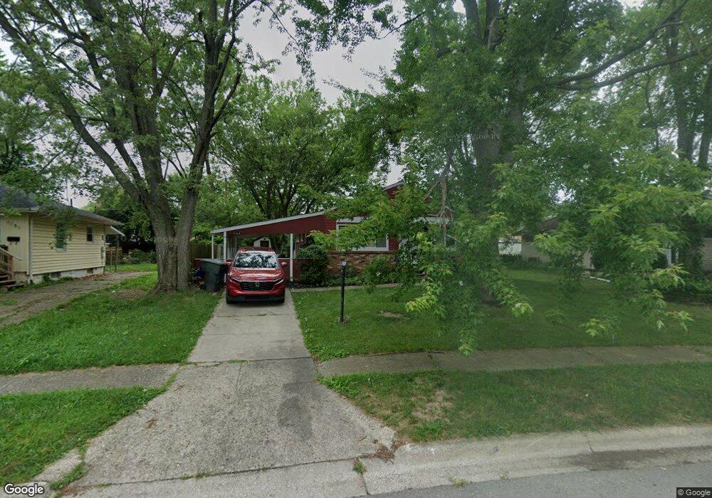
1254 Thurston Dr Columbus, OH 43227
Shady Lane NeighborhoodEstimated Value: $189,000 - $266,000
3
Beds
1
Bath
1,056
Sq Ft
$201/Sq Ft
Est. Value
About This Home
This home is located at 1254 Thurston Dr, Columbus, OH 43227 and is currently estimated at $211,846, approximately $200 per square foot. 1254 Thurston Dr is a home located in Franklin County with nearby schools including Shady Lane Elementary School, Sherwood Middle School, and Walnut Ridge High School.
Ownership History
Date
Name
Owned For
Owner Type
Purchase Details
Closed on
Mar 17, 2017
Sold by
Miller Natalie
Bought by
Sandstorm Properties Llc
Current Estimated Value
Purchase Details
Closed on
Jan 9, 2017
Sold by
Sutherin Rae Ann and Miller Natalie
Bought by
Miller Natalie
Purchase Details
Closed on
Dec 3, 1993
Bought by
Sutherin Rae A
Purchase Details
Closed on
Dec 27, 1988
Purchase Details
Closed on
May 1, 1986
Create a Home Valuation Report for This Property
The Home Valuation Report is an in-depth analysis detailing your home's value as well as a comparison with similar homes in the area
Home Values in the Area
Average Home Value in this Area
Purchase History
| Date | Buyer | Sale Price | Title Company |
|---|---|---|---|
| Sandstorm Properties Llc | $65,000 | First Ohio Title Ins | |
| Miller Natalie | -- | None Available | |
| Sutherin Rae A | $66,000 | -- | |
| -- | $51,000 | -- | |
| -- | $46,600 | -- |
Source: Public Records
Tax History Compared to Growth
Tax History
| Year | Tax Paid | Tax Assessment Tax Assessment Total Assessment is a certain percentage of the fair market value that is determined by local assessors to be the total taxable value of land and additions on the property. | Land | Improvement |
|---|---|---|---|---|
| 2024 | $2,849 | $62,170 | $19,570 | $42,600 |
| 2023 | $2,814 | $62,160 | $19,565 | $42,595 |
| 2022 | $1,548 | $29,120 | $7,420 | $21,700 |
| 2021 | $1,731 | $29,120 | $7,420 | $21,700 |
| 2020 | $1,724 | $29,120 | $7,420 | $21,700 |
| 2019 | $1,432 | $23,030 | $5,950 | $17,080 |
| 2018 | $1,389 | $23,030 | $5,950 | $17,080 |
| 2017 | $1,432 | $23,030 | $5,950 | $17,080 |
| 2016 | $1,485 | $22,410 | $5,850 | $16,560 |
| 2015 | $1,348 | $22,410 | $5,850 | $16,560 |
| 2014 | $1,351 | $22,410 | $5,850 | $16,560 |
| 2013 | $784 | $26,355 | $6,860 | $19,495 |
Source: Public Records
Map
Nearby Homes
- 1281 Maetzel Dr
- 4530 Amesbury Rd
- 4501 Amesbury Rd
- 4484 Grimsby Rd
- 4467 Grimsby Rd
- 1068 Ross Rd
- 1085 S Hamilton Rd
- 1130 Little Plum Ln
- 1291 Westphal Ave
- 4571 Aragon Ave
- 1563 Genoa Place
- 1571 Baxter Dr
- 1543 S Hamilton Rd
- 4677 E Livingston Ave
- 1607 Simpson Dr
- 1607 Shady Lane Rd
- 4181 Colby Ave
- 1618 S Hamilton Rd
- 963 Erickson Ave
- 4701 Janis Dr
- 1258 Thurston Dr
- 1250 Thurston Dr
- 1234 Maetzel Dr
- 1226 Maetzel Dr
- 1262 Thurston Dr
- 1233 Huntly Dr
- 1239 Huntly Dr
- 1225 Huntly Dr
- 1247 Huntly Dr
- 1218 Maetzel Dr
- 1217 Huntly Dr
- 1262 Maetzel Dr
- 1270 Thurston Dr
- 1265 Thurston Dr
- 1255 Huntly Dr
- 1209 Huntly Dr
- 1210 Maetzel Dr
- 1275 Thurston Dr
- 1276 Thurston Dr
- 1263 Huntly Dr