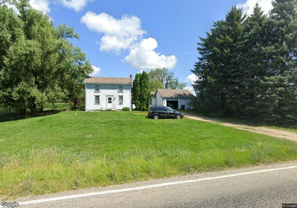
12540 N Adams Rd North Adams, MI 49262
Estimated Value: $223,551 - $369,000
3
Beds
3
Baths
2,223
Sq Ft
$127/Sq Ft
Est. Value
About This Home
This home is located at 12540 N Adams Rd, North Adams, MI 49262 and is currently estimated at $281,638, approximately $126 per square foot. 12540 N Adams Rd is a home located in Hillsdale County with nearby schools including North Adams-Jerome Elementary School and North Adams-Jerome Middle/High School.
Ownership History
Date
Name
Owned For
Owner Type
Purchase Details
Closed on
Apr 25, 2005
Sold by
Riley Linda J
Bought by
Riley Dale E and Riley Linda J
Current Estimated Value
Home Financials for this Owner
Home Financials are based on the most recent Mortgage that was taken out on this home.
Original Mortgage
$105,000
Outstanding Balance
$55,519
Interest Rate
6.06%
Mortgage Type
New Conventional
Estimated Equity
$226,119
Purchase Details
Closed on
Sep 15, 1995
Sold by
Smith Nicholas and Smith B
Bought by
Riley Dale E and Riley Linda J
Create a Home Valuation Report for This Property
The Home Valuation Report is an in-depth analysis detailing your home's value as well as a comparison with similar homes in the area
Home Values in the Area
Average Home Value in this Area
Purchase History
| Date | Buyer | Sale Price | Title Company |
|---|---|---|---|
| Riley Dale E | -- | -- | |
| Riley Dale E | $36,000 | -- |
Source: Public Records
Mortgage History
| Date | Status | Borrower | Loan Amount |
|---|---|---|---|
| Open | Riley Dale E | $105,000 |
Source: Public Records
Tax History Compared to Growth
Tax History
| Year | Tax Paid | Tax Assessment Tax Assessment Total Assessment is a certain percentage of the fair market value that is determined by local assessors to be the total taxable value of land and additions on the property. | Land | Improvement |
|---|---|---|---|---|
| 2025 | $1,113 | $95,300 | $0 | $0 |
| 2024 | $568 | $89,800 | $0 | $0 |
| 2023 | $541 | $85,100 | $0 | $0 |
| 2022 | $1,002 | $83,800 | $0 | $0 |
| 2021 | $973 | $73,400 | $0 | $0 |
| 2020 | $967 | $59,100 | $0 | $0 |
| 2019 | $968 | $58,500 | $0 | $0 |
| 2018 | $918 | $48,600 | $0 | $0 |
| 2017 | $908 | $45,900 | $0 | $0 |
| 2016 | $903 | $44,720 | $0 | $0 |
| 2015 | $456 | $44,720 | $0 | $0 |
| 2013 | $442 | $43,930 | $0 | $0 |
| 2012 | $431 | $39,370 | $0 | $0 |
Source: Public Records
Map
Nearby Homes
- 11480 N Adams Rd
- 13820 N Adams Rd
- 3000 N Waldron Blk Rd
- 2251 N Waldron Rd
- 5875 U S 127
- 236 S Steer St
- 2951 N Meridian Rd
- 10191 Wood Rd
- 135 S Steer St
- 6482 Sorby Hwy
- 305 N Steer St
- 7100 S Waldron Rd
- 2041 N Meridian Rd
- 10421 E Greenlawn Dr
- 9010 U S 127
- 10720 E Bacon Rd
- 18000 blk Forrister Rd
- 18000 blk #3 Forrister Rd
- 18000 blk #2 Forrister Rd
- 18000 blk #1 Forrister Rd
- 12860 N Adams Rd
- 12860 N Adams Rd Unit ADAMS
- 12375 N Adams Rd
- 12900 N Adams Rd
- 12880 N Adams Rd
- 12951 N Adams Rd
- 12980 N Adams Rd
- 12980 N Adams Rd Unit 12960 North Adams Ro
- 12960 N Adams Rd
- 12940 N Adams Rd
- 12960 N Adams Rd
- 12170 N Adams Rd
- 5100 Wheatland Rd
- 5010 Wheatland Rd
- 4911 Wheatland Rd
- 4871 Wheatland Rd
- 13067 N Adams Rd
- 13080 N Adams Rd
- 4797 Wheatland Rd
- 13191 N Adams Rd