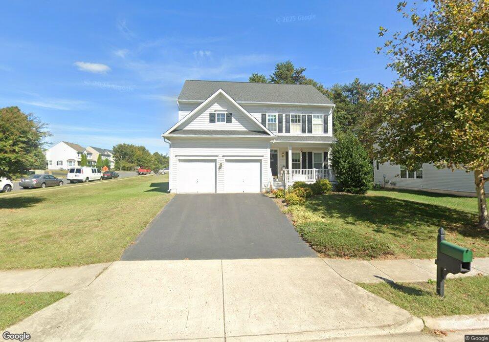
12546 Rickwood Ct Bristow, VA 20136
Estimated Value: $787,447 - $817,000
4
Beds
3
Baths
2,543
Sq Ft
$314/Sq Ft
Est. Value
About This Home
This home is located at 12546 Rickwood Ct, Bristow, VA 20136 and is currently estimated at $798,362, approximately $313 per square foot. 12546 Rickwood Ct is a home located in Prince William County with nearby schools including Bristow Run Elementary School, Patriot High School, and E.H. Marsteller Middle School.
Ownership History
Date
Name
Owned For
Owner Type
Purchase Details
Closed on
Oct 30, 2007
Sold by
Brookfield Braemar Iii Ll
Bought by
Andrew Todd C
Current Estimated Value
Home Financials for this Owner
Home Financials are based on the most recent Mortgage that was taken out on this home.
Original Mortgage
$396,750
Outstanding Balance
$251,674
Interest Rate
6.43%
Mortgage Type
New Conventional
Estimated Equity
$546,688
Create a Home Valuation Report for This Property
The Home Valuation Report is an in-depth analysis detailing your home's value as well as a comparison with similar homes in the area
Home Values in the Area
Average Home Value in this Area
Purchase History
| Date | Buyer | Sale Price | Title Company |
|---|---|---|---|
| Andrew Todd C | $497,190 | -- |
Source: Public Records
Mortgage History
| Date | Status | Borrower | Loan Amount |
|---|---|---|---|
| Open | Andrew Todd C | $396,750 |
Source: Public Records
Tax History Compared to Growth
Tax History
| Year | Tax Paid | Tax Assessment Tax Assessment Total Assessment is a certain percentage of the fair market value that is determined by local assessors to be the total taxable value of land and additions on the property. | Land | Improvement |
|---|---|---|---|---|
| 2025 | $6,652 | $732,900 | $194,300 | $538,600 |
| 2024 | $6,652 | $668,900 | $185,100 | $483,800 |
| 2023 | $6,602 | $634,500 | $175,500 | $459,000 |
| 2022 | $6,696 | $594,300 | $151,000 | $443,300 |
| 2021 | $6,317 | $518,400 | $133,000 | $385,400 |
| 2020 | $7,252 | $467,900 | $121,100 | $346,800 |
| 2019 | $7,135 | $460,300 | $121,100 | $339,200 |
| 2018 | $5,318 | $440,400 | $115,300 | $325,100 |
| 2017 | $5,251 | $426,100 | $115,300 | $310,800 |
| 2016 | $5,066 | $414,800 | $109,700 | $305,100 |
| 2015 | $4,971 | $416,300 | $109,700 | $306,600 |
| 2014 | $4,971 | $398,200 | $104,600 | $293,600 |
Source: Public Records
Map
Nearby Homes
- 9475 Sarah Mill Terrace
- 9293 Crestview Ridge Dr
- 9318 Crestview Ridge Dr
- 9244 Crestview Ridge Dr
- 9381 Crestview Ridge Dr
- 9478 Merrimont Trace Cir
- Hampton II Plan at Parkgate Estates
- 9256 Crestview Ridge Dr
- 9656 Bedder Stone Place
- 10045 Pentland Hills Way
- 9579 Scales Place
- 12048 Elliots Oak Place
- 10028 Boreland Ct
- 12673 Crabtree Falls Dr
- 12151 Hayfield Ct
- 12441 Great Falls Dr
- 12100 Brevard Park Ct
- 12127 & 12131 Vint Hill Rd
- 9218 Dawkins Crest Cir
- 9061 Slate Stone Loop