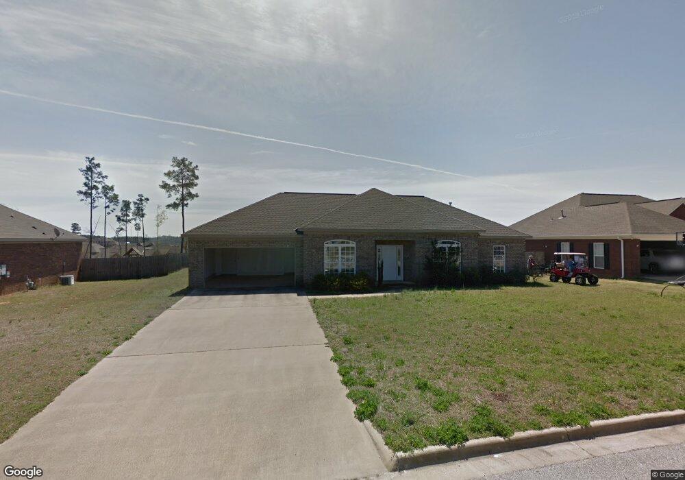
12546 Rock Pointe Way Northport, AL 35475
Estimated Value: $304,000 - $400,000
3
Beds
1
Bath
2,092
Sq Ft
$176/Sq Ft
Est. Value
About This Home
This home is located at 12546 Rock Pointe Way, Northport, AL 35475 and is currently estimated at $368,703, approximately $176 per square foot. 12546 Rock Pointe Way is a home located in Tuscaloosa County with nearby schools including Huntington Place Elementary School, Echols Middle School, and Tuscaloosa County High School.
Ownership History
Date
Name
Owned For
Owner Type
Purchase Details
Closed on
Apr 20, 2016
Sold by
Mclemore Darrell
Bought by
Mclemore Robin W
Current Estimated Value
Home Financials for this Owner
Home Financials are based on the most recent Mortgage that was taken out on this home.
Original Mortgage
$120,000
Outstanding Balance
$95,333
Interest Rate
3.68%
Mortgage Type
New Conventional
Estimated Equity
$273,370
Purchase Details
Closed on
Jan 27, 2015
Sold by
J & B Construction Llc
Bought by
Mclemore Darrell
Purchase Details
Closed on
Aug 5, 2005
Sold by
Bbl
Bought by
J & B Construction Llc
Create a Home Valuation Report for This Property
The Home Valuation Report is an in-depth analysis detailing your home's value as well as a comparison with similar homes in the area
Home Values in the Area
Average Home Value in this Area
Purchase History
| Date | Buyer | Sale Price | Title Company |
|---|---|---|---|
| Mclemore Robin W | $160,000 | -- | |
| Mclemore Darrell | -- | -- | |
| J & B Construction Llc | $40,501 | -- |
Source: Public Records
Mortgage History
| Date | Status | Borrower | Loan Amount |
|---|---|---|---|
| Open | Mclemore Robin W | $120,000 |
Source: Public Records
Tax History Compared to Growth
Tax History
| Year | Tax Paid | Tax Assessment Tax Assessment Total Assessment is a certain percentage of the fair market value that is determined by local assessors to be the total taxable value of land and additions on the property. | Land | Improvement |
|---|---|---|---|---|
| 2024 | $1,321 | $71,060 | $9,000 | $62,060 |
| 2023 | $1,321 | $65,880 | $9,000 | $56,880 |
| 2022 | $1,122 | $60,700 | $9,000 | $51,700 |
| 2021 | $1,033 | $56,120 | $9,000 | $47,120 |
| 2020 | $997 | $27,110 | $4,500 | $22,610 |
| 2019 | $932 | $25,440 | $4,500 | $20,940 |
| 2018 | $932 | $25,440 | $4,500 | $20,940 |
| 2017 | $834 | $0 | $0 | $0 |
| 2016 | $1,687 | $0 | $0 | $0 |
| 2015 | $1,716 | $0 | $0 | $0 |
| 2014 | $1,704 | $44,260 | $9,000 | $35,260 |
Source: Public Records
Map
Nearby Homes
- 12539 Willow View Cir
- 12692 Windword Pointe Dr
- 12674 Windword Pointe Dr
- 13883 Sullivan Blvd
- 13871 Sullivan Blvd
- 13767 Blackoak Dr
- 13743 Blackoak Dr
- 13761 Blackoak Dr
- 13754 Blackoak Dr
- 12596 Cottage Cir
- 13908 Highland Pointe Dr
- 13712 Blackoak Dr
- 13812 Providence Place
- 12602 Cottage Ln
- 13742 Highland Pointe Dr
- 13986 Knoll Pointe Dr
- 12370 Huntington Village Dr
- 5419 Easton Ln
- 12599 Oak Ridge Rd
- 13600 Date St
- 12550 Rock Pointe Way
- 12535 Willow View Cir
- 12531 Willow View Cir
- 12554 Rock Pointe Way
- 12542 Rock Pointe Way
- 12538 Rock Pointe Way
- 12543 Willow View Cir
- 13911 Chase Pointe Ln
- 12558 Rock Pointe Way
- 12527 Willow View Cir
- 12547 Willow View Cir
- 12534 Rock Pointe Way
- 13911 Willow View Ln
- 13912 Chase Pointe Ln
- 12536 Willow View Cir Unit 599
- 12536 Willow View Cir
- 12540 Willow View Cir
- 13892 Darden Ave
- 12544 Willow View Cir
- 13906 Darden Ave