Estimated Value: $917,000 - $1,052,962
3
Beds
2
Baths
2,003
Sq Ft
$482/Sq Ft
Est. Value
About This Home
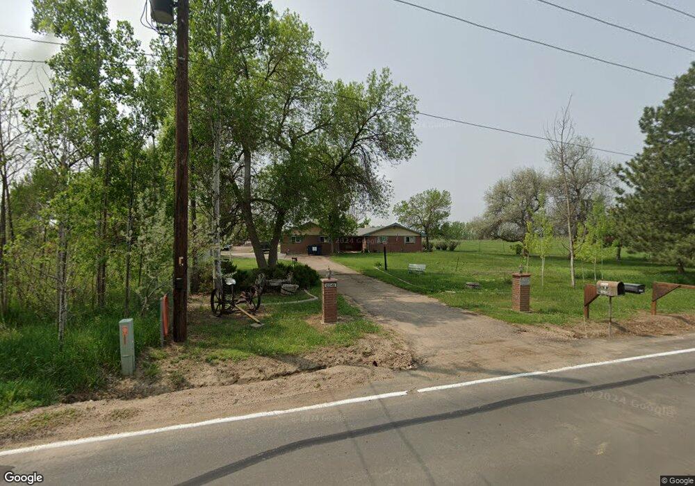
This home is located at 12548 Jay Rd, Erie, CO 80516 and is currently estimated at $965,991, approximately $482 per square foot. 12548 Jay Rd is a home located in Boulder County with nearby schools including Erie Elementary School, Erie Middle School, and Erie High School.
Ownership History
Date
Name
Owned For
Owner Type
Purchase Details
Closed on
Mar 16, 2023
Sold by
Emerson Suzanne E
Bought by
Emerson-Hines Suzanne E and Hines Orville Lee
Current Estimated Value
Purchase Details
Closed on
Jul 12, 1994
Sold by
Moore Robert Wayne and Moore Johanna Levina
Bought by
Emerson Suzanne E
Home Financials for this Owner
Home Financials are based on the most recent Mortgage that was taken out on this home.
Original Mortgage
$150,000
Interest Rate
5.25%
Purchase Details
Closed on
May 15, 1989
Bought by
Emerson Suzanne E
Purchase Details
Closed on
Jul 26, 1970
Bought by
Emerson Suzanne E
Create a Home Valuation Report for This Property
The Home Valuation Report is an in-depth analysis detailing your home's value as well as a comparison with similar homes in the area
Home Values in the Area
Average Home Value in this Area
Purchase History
| Date | Buyer | Sale Price | Title Company |
|---|---|---|---|
| Emerson-Hines Suzanne E | -- | -- | |
| Emerson Suzanne E | $188,500 | Commonwealth Land Title Ins | |
| Emerson Suzanne E | $106,500 | -- | |
| Emerson Suzanne E | $24,100 | -- |
Source: Public Records
Mortgage History
| Date | Status | Borrower | Loan Amount |
|---|---|---|---|
| Previous Owner | Hines Suzanne E Emerson | $180,000 | |
| Previous Owner | Emerson Suzanne E | $160,000 | |
| Previous Owner | Emerson Suzanne E | $25,047 | |
| Previous Owner | Emerson Suzanne E | $150,000 |
Source: Public Records
Tax History Compared to Growth
Tax History
| Year | Tax Paid | Tax Assessment Tax Assessment Total Assessment is a certain percentage of the fair market value that is determined by local assessors to be the total taxable value of land and additions on the property. | Land | Improvement |
|---|---|---|---|---|
| 2025 | $5,743 | $63,338 | $29,619 | $33,719 |
| 2024 | $5,743 | $63,338 | $29,619 | $33,719 |
| 2023 | $5,667 | $64,977 | $16,542 | $52,119 |
| 2022 | $4,244 | $48,532 | $14,685 | $33,847 |
| 2021 | $4,300 | $49,929 | $15,108 | $34,821 |
| 2020 | $4,355 | $50,601 | $22,880 | $27,721 |
| 2019 | $4,339 | $50,601 | $22,880 | $27,721 |
| 2018 | $3,592 | $43,402 | $19,008 | $24,394 |
| 2017 | $3,374 | $47,982 | $21,014 | $26,968 |
| 2016 | $2,906 | $38,438 | $17,432 | $21,006 |
| 2015 | $2,768 | $32,182 | $15,522 | $16,660 |
| 2014 | $2,262 | $32,182 | $15,522 | $16,660 |
Source: Public Records
Map
Nearby Homes
- 12640 Jay Rd
- 747 Cheesman St
- 740 Meadowlark Dr
- 745 Turner St
- 769 Turner St
- 781 Turner St
- 722 Green St
- 787 Turner St
- 785 Delechant Dr
- 800 Meadowlark Dr
- 448 Biscuit St
- 448 Biscuit St Unit 1-23
- 370 Lawley Dr
- 304 Nighthawk St
- 310 Nighthawk St
- 890 Meadowlark Dr
- 885 Delechant Dr
- 881 Meadowlark Dr
- 122 Jackson Dr
- 0 High St Unit REC9712912
- 12572 Jay Rd
- 12590 Jay Rd
- 12589 Jay Rd
- 0 2 St Unit 791931
- 12591 Jay Rd
- 4075 NE County Line Rd
- 602 Delechant Dr
- 12657 Jay Rd
- 622 Delechant Dr
- 651 Meadowlark Dr
- 642 Delechant Dr
- 661 Meadowlark Dr
- 662 Delechant Dr
- 645 Delechant Dr
- 12692 Jay Rd
- 700 Meadowlark Dr
- 671 Meadowlark Dr
- 682 Delechant Dr
- 665 Delechant Dr
- 710 Meadowlark Dr