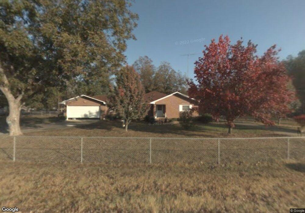
1255 Allen Rd E Macon, GA 31216
Estimated Value: $197,000 - $256,000
3
Beds
1
Bath
1,854
Sq Ft
$117/Sq Ft
Est. Value
About This Home
This home is located at 1255 Allen Rd E, Macon, GA 31216 and is currently estimated at $217,761, approximately $117 per square foot. 1255 Allen Rd E is a home located in Bibb County with nearby schools including Porter Elementary School, Rutland Middle School, and Rutland High School.
Ownership History
Date
Name
Owned For
Owner Type
Purchase Details
Closed on
Apr 8, 2005
Sold by
Bass Jack O
Bought by
Hamlin Matthew S and Hamlin Heather A
Current Estimated Value
Home Financials for this Owner
Home Financials are based on the most recent Mortgage that was taken out on this home.
Original Mortgage
$93,932
Outstanding Balance
$47,713
Interest Rate
5.74%
Mortgage Type
FHA
Estimated Equity
$170,048
Purchase Details
Closed on
Sep 17, 2003
Create a Home Valuation Report for This Property
The Home Valuation Report is an in-depth analysis detailing your home's value as well as a comparison with similar homes in the area
Home Values in the Area
Average Home Value in this Area
Purchase History
| Date | Buyer | Sale Price | Title Company |
|---|---|---|---|
| Hamlin Matthew S | $100,000 | None Available | |
| -- | $100 | -- |
Source: Public Records
Mortgage History
| Date | Status | Borrower | Loan Amount |
|---|---|---|---|
| Open | Hamlin Matthew S | $93,932 |
Source: Public Records
Tax History Compared to Growth
Tax History
| Year | Tax Paid | Tax Assessment Tax Assessment Total Assessment is a certain percentage of the fair market value that is determined by local assessors to be the total taxable value of land and additions on the property. | Land | Improvement |
|---|---|---|---|---|
| 2025 | $1,197 | $55,703 | $4,790 | $50,913 |
| 2024 | $1,237 | $55,703 | $4,790 | $50,913 |
| 2023 | $1,387 | $53,816 | $2,903 | $50,913 |
| 2022 | $1,475 | $49,600 | $10,000 | $39,600 |
| 2021 | $1,619 | $49,600 | $10,000 | $39,600 |
| 2020 | $1,654 | $49,600 | $10,000 | $39,600 |
| 2019 | $1,668 | $49,600 | $10,000 | $39,600 |
| 2018 | $2,734 | $49,600 | $10,000 | $39,600 |
| 2017 | $1,596 | $49,600 | $10,000 | $39,600 |
| 2016 | $1,474 | $49,600 | $10,000 | $39,600 |
| 2015 | $2,087 | $49,600 | $10,000 | $39,600 |
| 2014 | $2,090 | $49,600 | $10,000 | $39,600 |
Source: Public Records
Map
Nearby Homes
- 337 Stockton Cir
- 301 Stockton Cir
- 341 Stockton Cir
- 326 Stockton Cir
- Plan 2700 at The Abberley
- 137 Abberley Ln
- 120 Abberley Ln
- 1660 Allen Rd
- 1850 Barnes Ferry Rd
- 2154 Allen Rd
- 7070 Sofkee Place
- 116 Allentown Ct
- 344 Browning Pointe Rd
- 321 Browning Pointe Rd
- 2960 Regina Dr
- 2165 Griffin Rd
- 106 Maries Garden Trail
- 149 Lew Dr
- 116 Fred Ct
- 2728 Nowell Dr
- 1271 Allen Rd E
- 1281 Allen Rd N
- 1291 Allen Rd N
- 1250 Allen Rd
- 1321 N Allen Rd
- 1321 Allen Rd
- 1190 Allen Rd E
- 1181 Allen Rd E
- 901 Allen Rd N
- 1150 Allen Rd E
- 1130 Allen Rd
- 1487 Allen Rd
- 1103 Allen Rd
- 1100 Allen Rd E
- 1495 Allen Rd
- 1055 Allen Rd E
- 1525 Allen Rd
- 1504 Allen Rd
- 6040 Champion Rd
- 1524 Allen Rd