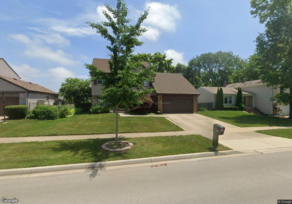
1255 Brandywyn Ln Buffalo Grove, IL 60089
Estimated Value: $550,509 - $577,000
--
Bed
3
Baths
2,080
Sq Ft
$270/Sq Ft
Est. Value
About This Home
This home is located at 1255 Brandywyn Ln, Buffalo Grove, IL 60089 and is currently estimated at $561,877, approximately $270 per square foot. 1255 Brandywyn Ln is a home located in Lake County with nearby schools including Prairie Elementary School, Twin Groves Middle School, and Adlai E Stevenson High School.
Ownership History
Date
Name
Owned For
Owner Type
Purchase Details
Closed on
Jul 28, 2005
Sold by
Pandya Jatin V and Pandya Jyoti J
Bought by
Preetha Parthasarathy Amar and Preetha Amaraprabhu
Current Estimated Value
Home Financials for this Owner
Home Financials are based on the most recent Mortgage that was taken out on this home.
Original Mortgage
$332,000
Outstanding Balance
$165,471
Interest Rate
4.87%
Mortgage Type
Purchase Money Mortgage
Estimated Equity
$396,406
Create a Home Valuation Report for This Property
The Home Valuation Report is an in-depth analysis detailing your home's value as well as a comparison with similar homes in the area
Home Values in the Area
Average Home Value in this Area
Purchase History
| Date | Buyer | Sale Price | Title Company |
|---|---|---|---|
| Preetha Parthasarathy Amar | $415,000 | -- |
Source: Public Records
Mortgage History
| Date | Status | Borrower | Loan Amount |
|---|---|---|---|
| Open | Preetha Parthasarathy Amar | $332,000 |
Source: Public Records
Tax History Compared to Growth
Tax History
| Year | Tax Paid | Tax Assessment Tax Assessment Total Assessment is a certain percentage of the fair market value that is determined by local assessors to be the total taxable value of land and additions on the property. | Land | Improvement |
|---|---|---|---|---|
| 2024 | $13,910 | $159,803 | $33,789 | $126,014 |
| 2023 | $12,812 | $143,606 | $30,364 | $113,242 |
| 2022 | $12,812 | $128,872 | $27,249 | $101,623 |
| 2021 | $12,326 | $127,482 | $26,955 | $100,527 |
| 2020 | $12,036 | $127,917 | $27,047 | $100,870 |
| 2019 | $11,871 | $127,445 | $26,947 | $100,498 |
| 2018 | $11,328 | $125,592 | $26,632 | $98,960 |
| 2017 | $11,113 | $122,660 | $26,010 | $96,650 |
| 2016 | $10,822 | $117,457 | $24,907 | $92,550 |
| 2015 | $10,534 | $109,845 | $23,293 | $86,552 |
| 2014 | $9,938 | $102,567 | $25,016 | $77,551 |
| 2012 | $9,869 | $102,772 | $25,066 | $77,706 |
Source: Public Records
Map
Nearby Homes
- 1265 Devonshire Rd
- 1141 Devonshire Rd
- 327 Lasalle Ln
- 890 Knollwood Dr
- 931 Shady Grove Ln
- 1118 Larraway Dr
- 950 Belmar Ln
- 1546 Brandywyn Ln
- 1152 Courtland Dr Unit 406
- 1032 Courtland Dr Unit 9
- 437 Caren Dr
- 614 Lyon Ct
- 1113 Lockwood Dr
- 538 Lasalle Ct
- 12 Cloverdale Ct
- 711 Woodhollow Ln
- 5107 N Arlington Heights Rd
- 938 Hidden Lake Dr
- 800 Clohesey Dr
- 610 Checker Dr
- 1243 Brandywyn Ln
- 1271 Brandywyn Ln
- 1254 Gail Dr
- 1229 Brandywyn Ln Unit 2
- 1246 Gail Dr
- 1270 Gail Dr
- 1285 Brandywyn Ln
- 1256 Brandywyn Ln Unit 2
- 1270 Brandywyn Ln
- 1238 Gail Dr
- 1242 Brandywyn Ln
- 1284 Brandywyn Ln
- 1215 Brandywyn Ln
- 1299 Brandywyn Ln
- 1278 Gail Dr
- 1230 Gail Dr Unit 4
- 1298 Brandywyn Ln
- 1245 Devonshire Rd
- 1251 Devonshire Rd
- 1214 Brandywyn Ln