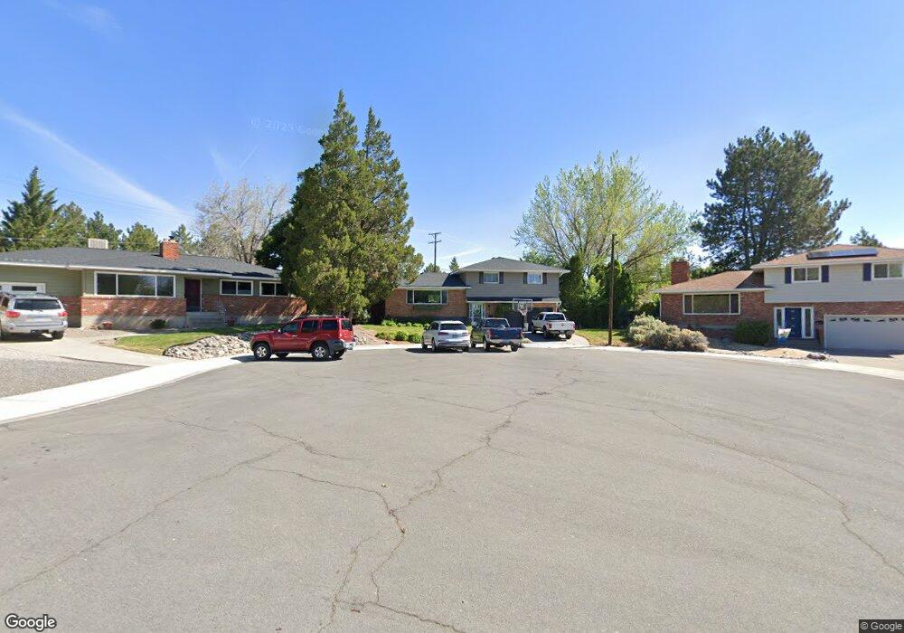
1255 Brookfield Dr Reno, NV 89503
West University NeighborhoodEstimated Value: $606,000 - $686,000
5
Beds
4
Baths
2,148
Sq Ft
$300/Sq Ft
Est. Value
About This Home
This home is located at 1255 Brookfield Dr, Reno, NV 89503 and is currently estimated at $644,203, approximately $299 per square foot. 1255 Brookfield Dr is a home located in Washoe County with nearby schools including Peavine Elementary School, Archie Clayton Pre-AP Academy, and Reno High School.
Ownership History
Date
Name
Owned For
Owner Type
Purchase Details
Closed on
Jan 14, 2020
Sold by
Mccarthy Thomas E and Mccarthy Hillory H
Bought by
Mccarthy Thomas E and Mccarthy Hillory H
Current Estimated Value
Purchase Details
Closed on
Jul 25, 2001
Sold by
Mccarthy James P and Mccarthy Anita M
Bought by
Mccarthy Thomas E and Mccarthy Hillory H
Home Financials for this Owner
Home Financials are based on the most recent Mortgage that was taken out on this home.
Original Mortgage
$155,000
Interest Rate
7.1%
Create a Home Valuation Report for This Property
The Home Valuation Report is an in-depth analysis detailing your home's value as well as a comparison with similar homes in the area
Home Values in the Area
Average Home Value in this Area
Purchase History
| Date | Buyer | Sale Price | Title Company |
|---|---|---|---|
| Mccarthy Thomas E | -- | None Available | |
| Mccarthy Thomas E | $205,000 | Stewart Title Northern Nevad |
Source: Public Records
Mortgage History
| Date | Status | Borrower | Loan Amount |
|---|---|---|---|
| Closed | Mccarthy Thomas E | $155,000 |
Source: Public Records
Tax History Compared to Growth
Tax History
| Year | Tax Paid | Tax Assessment Tax Assessment Total Assessment is a certain percentage of the fair market value that is determined by local assessors to be the total taxable value of land and additions on the property. | Land | Improvement |
|---|---|---|---|---|
| 2025 | $1,429 | $84,710 | $47,670 | $37,040 |
| 2024 | $1,388 | $80,530 | $44,065 | $36,465 |
| 2023 | $1,388 | $76,654 | $42,945 | $33,709 |
| 2022 | $1,346 | $62,147 | $34,650 | $27,497 |
| 2021 | $1,309 | $52,054 | $25,235 | $26,819 |
| 2020 | $1,266 | $49,886 | $23,520 | $26,366 |
| 2019 | $1,858 | $46,948 | $21,875 | $25,073 |
| 2018 | $1,195 | $41,176 | $17,115 | $24,061 |
| 2017 | $1,643 | $39,958 | $16,345 | $23,613 |
| 2016 | $1,130 | $36,807 | $13,265 | $23,542 |
| 2015 | $1,640 | $34,924 | $11,638 | $23,286 |
| 2014 | $1,098 | $31,853 | $9,875 | $21,978 |
| 2013 | -- | $28,794 | $7,648 | $21,146 |
Source: Public Records
Map
Nearby Homes
- 1275 Washington St
- 840 Brookfield Dr
- 1130 Bon Rea Way
- 850 W 11th St
- 535 Citadel Rd
- 960 Ralston St
- 1480 Grandview Ave
- 595 College Dr
- 1217 Keystone Ave
- 250 College Dr
- 1496 Highland Pines Dr
- 1702 Grandview Ave
- 1415 Kings Row
- 1375 Wesley Dr
- 1035 N Sierra St
- 1449 Hillside Dr
- 1516 Coleman Dr
- 1341 N Virginia St
- 1510 Majestic Dr Unit one
- 1600 Majestic Dr
- 1245 Brookfield Dr
- 1265 Brookfield Dr
- 1265 Washington St
- 1245 Washington St
- 1235 Brookfield Dr
- 1275 Brookfield Dr
- 1235 Washington St
- 1225 Brookfield Dr
- 1250 Brookfield Dr
- 835 Grandview Ave
- 1225 Washington St
- 840 Grandview Ave
- 735 W 12th St
- 1330 Washington St
- 765 W 12th St
- 1311 Ridgeway Ct
- 709 Cleveland Ave
- 1279 Ridgeway Ct
- 865 Grandview Ave
- 715 W 12th St