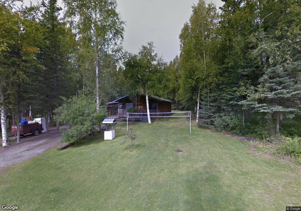
1255 E Brant Cir Wasilla, AK 99654
Estimated Value: $204,000 - $400,839
--
Bed
--
Bath
1,324
Sq Ft
$234/Sq Ft
Est. Value
About This Home
This home is located at 1255 E Brant Cir, Wasilla, AK 99654 and is currently estimated at $309,460, approximately $233 per square foot. 1255 E Brant Cir is a home located in Matanuska-Susitna Borough with nearby schools including Larson Elementary School, Teeland Middle School, and Colony High School.
Ownership History
Date
Name
Owned For
Owner Type
Purchase Details
Closed on
Nov 23, 2021
Sold by
Ramos Nathan M
Bought by
Ramos Nathan M and Tanner Olga C
Current Estimated Value
Home Financials for this Owner
Home Financials are based on the most recent Mortgage that was taken out on this home.
Original Mortgage
$190,500
Outstanding Balance
$149,763
Interest Rate
3.05%
Mortgage Type
New Conventional
Estimated Equity
$159,697
Purchase Details
Closed on
May 22, 2012
Sold by
Platinum Builders Llc
Bought by
Ramos Nathan M
Home Financials for this Owner
Home Financials are based on the most recent Mortgage that was taken out on this home.
Original Mortgage
$209,061
Interest Rate
3.5%
Mortgage Type
FHA
Purchase Details
Closed on
Dec 28, 2011
Sold by
On The Level Construction Llc
Bought by
Platinum Builders Llc
Purchase Details
Closed on
May 12, 2004
Sold by
Milne Joseph
Bought by
Shary Paul Stephen
Create a Home Valuation Report for This Property
The Home Valuation Report is an in-depth analysis detailing your home's value as well as a comparison with similar homes in the area
Home Values in the Area
Average Home Value in this Area
Purchase History
| Date | Buyer | Sale Price | Title Company |
|---|---|---|---|
| Ramos Nathan M | -- | None Available | |
| Ramos Nathan M | -- | Mat Su Title Ins Agency Inc | |
| Platinum Builders Llc | -- | Mat Su Title Ins Agency Inc | |
| Shary Paul Stephen | -- | None Available |
Source: Public Records
Mortgage History
| Date | Status | Borrower | Loan Amount |
|---|---|---|---|
| Open | Ramos Nathan M | $190,500 | |
| Closed | Ramos Nathan M | $209,061 |
Source: Public Records
Tax History Compared to Growth
Tax History
| Year | Tax Paid | Tax Assessment Tax Assessment Total Assessment is a certain percentage of the fair market value that is determined by local assessors to be the total taxable value of land and additions on the property. | Land | Improvement |
|---|---|---|---|---|
| 2025 | $4,132 | $341,400 | $23,000 | $318,400 |
| 2024 | $4,132 | $326,000 | $23,000 | $303,000 |
| 2023 | $3,819 | $310,900 | $23,000 | $287,900 |
| 2022 | $3,701 | $282,200 | $23,000 | $259,200 |
| 2021 | $3,618 | $249,300 | $23,000 | $226,300 |
| 2020 | $3,543 | $236,600 | $23,000 | $213,600 |
| 2019 | $3,470 | $229,800 | $23,000 | $206,800 |
| 2018 | $3,367 | $224,200 | $23,000 | $201,200 |
| 2017 | $3,271 | $217,800 | $23,000 | $194,800 |
| 2016 | $3,174 | $216,700 | $20,000 | $196,700 |
| 2015 | $2,887 | $208,900 | $20,000 | $188,900 |
| 2014 | $2,887 | $205,400 | $19,000 | $186,400 |
Source: Public Records
Map
Nearby Homes
- 1151 E Dunedin St
- 1550 E Raven Dr
- 3410 N Tattler Ct
- 1775 E Raven Cir
- 1000 E Loch Ness Ct
- 1280 E Brent Pointe Dr
- 1300 E Brent Pointe Dr
- 3524 N Bald Eagle Dr
- 630 E Mcadoo Way
- 1975 E Caribou Loop
- 2755 N Holly Way
- 1055 E Onyx Cir
- 1906 E Ridgeview Dr
- 2721 N Brennas Way
- 900 E Burlwood Dr
- 480 E Agate Ln
- 231 E Luther Ave
- 380 E New Field Dr
- 2004 N Saddle Horse Dr
- 4228 E Serendipity Loop
- 1255 E Brant Cir
- 3655 N Snow Goose Dr
- 1275 E Brant Cir
- 1260 E Brant Cir
- 1301 E Brant Cir
- 3601 N Snow Goose Dr
- 1601 Gosling Dr
- 3610 N Snow Goose Dr
- 1340 E Brant Cir
- 1345 E Brant Cir
- 1345 Brant Cir
- 3575 N Snow Goose Dr
- 1230 E Scotwood Dr
- 1375 E Brant Cir
- 1200 E Scotwood Dr
- 1260 E Scotwood Dr
- 3585 N Plover Cir
- 3595 N Plover
- 3555 N Snow Goose Dr
- 3701 N Snow Goose Dr