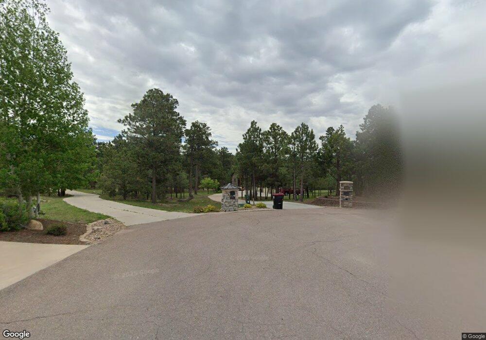
1255 Scarsbrook Ct Monument, CO 80132
Kings Deer NeighborhoodEstimated Value: $1,285,642 - $1,437,000
4
Beds
4
Baths
4,540
Sq Ft
$298/Sq Ft
Est. Value
About This Home
This home is located at 1255 Scarsbrook Ct, Monument, CO 80132 and is currently estimated at $1,352,911, approximately $297 per square foot. 1255 Scarsbrook Ct is a home located in El Paso County with nearby schools including Prairie Winds Elementary School, Lewis-Palmer Middle School, and Lewis-Palmer High School.
Ownership History
Date
Name
Owned For
Owner Type
Purchase Details
Closed on
May 28, 2021
Sold by
Pletcher John H and Pletcher Phyllis G
Bought by
Larned Russ H and Larned Vaune E
Current Estimated Value
Home Financials for this Owner
Home Financials are based on the most recent Mortgage that was taken out on this home.
Original Mortgage
$459,000
Outstanding Balance
$416,213
Interest Rate
3%
Mortgage Type
VA
Estimated Equity
$936,698
Purchase Details
Closed on
Feb 26, 2009
Sold by
White Randall K and White Joni A
Bought by
Pletcher John H and Pletcher Phyllis G
Purchase Details
Closed on
Apr 29, 2002
Sold by
Green Hilda E
Bought by
White Randall K and White Joni A
Purchase Details
Closed on
Feb 8, 1994
Sold by
Arrowwood Development Corp
Bought by
Green Hilda E
Purchase Details
Closed on
Sep 15, 1993
Bought by
Pletcher Phyllis G
Create a Home Valuation Report for This Property
The Home Valuation Report is an in-depth analysis detailing your home's value as well as a comparison with similar homes in the area
Home Values in the Area
Average Home Value in this Area
Purchase History
| Date | Buyer | Sale Price | Title Company |
|---|---|---|---|
| Larned Russ H | $1,084,000 | Unified Title Co | |
| Pletcher John H | $750,000 | Fahtco | |
| White Randall K | $130,000 | Security Title | |
| Green Hilda E | -- | Unified Title Co Inc | |
| Pletcher Phyllis G | -- | -- |
Source: Public Records
Mortgage History
| Date | Status | Borrower | Loan Amount |
|---|---|---|---|
| Open | Larned Russ H | $459,000 |
Source: Public Records
Tax History Compared to Growth
Tax History
| Year | Tax Paid | Tax Assessment Tax Assessment Total Assessment is a certain percentage of the fair market value that is determined by local assessors to be the total taxable value of land and additions on the property. | Land | Improvement |
|---|---|---|---|---|
| 2025 | $4,916 | $73,380 | -- | -- |
| 2024 | $4,802 | $78,320 | $25,910 | $52,410 |
| 2023 | $4,802 | $78,320 | $25,910 | $52,410 |
| 2022 | $3,825 | $56,540 | $19,300 | $37,240 |
| 2021 | $3,471 | $58,160 | $19,850 | $38,310 |
| 2020 | $3,141 | $51,420 | $16,640 | $34,780 |
| 2019 | $3,630 | $51,420 | $16,640 | $34,780 |
| 2018 | $3,401 | $45,630 | $14,030 | $31,600 |
| 2017 | $3,401 | $45,630 | $14,030 | $31,600 |
| 2016 | $3,347 | $47,960 | $16,330 | $31,630 |
| 2015 | $3,344 | $47,960 | $16,330 | $31,630 |
| 2014 | $3,301 | $45,240 | $15,300 | $29,940 |
Source: Public Records
Map
Nearby Homes
- Boulder Plan at The Preserve at Walden - Ranch
- Palisade 1923 Plan at The Preserve at Walden - Ranch
- Arvada Grand Plan at The Preserve at Walden - Ranch
- Legacy Plan at The Preserve at Walden - Ranch
- Arvada Plan at The Preserve at Walden - Ranch
- Glenwood Plan at The Preserve at Walden - Two Story
- Steamboat Plan at The Preserve at Walden - Two Story
- Buena Vista I Plan at The Preserve at Walden - Ranch
- Magnolia Plan at The Preserve at Walden - Ranch
- Buena Vista II Plan at The Preserve at Walden - Ranch
- 1250 Dolan Dr
- 17075 Viscount Ct
- 1120 Brenthaven Ct
- 17270 Colonial Park Dr
- 17715 Radbourne Ct
- 17552 Colonial Park Dr
- 1070 Panoramic Dr
- 331 Grandwood Dr
- 16445 Mountain Glory Dr
- 16477 Corkbark Terrace
- 1245 Scarsbrook Ct
- 1260 Scarsbrook Ct
- 17010 Viscount Ct
- 1250 Scarsbrook Ct
- 17020 Viscount Ct
- 1235 Scarsbrook Ct
- 17460 Colonial Park Dr
- 1130 Dolan Dr
- 17030 Viscount Ct
- 1225 Scarsbrook Ct
- 17190 Colonial Park Dr
- 17210 Colonial Park Dr
- 1170 Dolan Dr
- 1090 Dolan Dr
- 17180 Colonial Park Dr
- 17450 Colonial Park Dr
- 17015 Viscount Ct
- 17220 Colonial Park Dr
- 17440 Colonial Park Dr
- 1210 Dolan Dr
