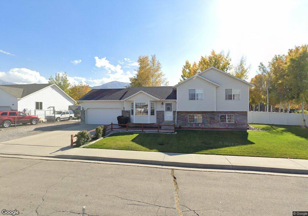
1255 W 1000 S Payson, UT 84651
Estimated Value: $462,000 - $476,938
3
Beds
2
Baths
1,762
Sq Ft
$266/Sq Ft
Est. Value
About This Home
This home is located at 1255 W 1000 S, Payson, UT 84651 and is currently estimated at $468,646, approximately $265 per square foot. 1255 W 1000 S is a home located in Utah County with nearby schools including Wilson Elementary School, Mt. Nebo Middle, and Payson Junior High School.
Ownership History
Date
Name
Owned For
Owner Type
Purchase Details
Closed on
Apr 1, 2020
Sold by
Stites David L and Stites Glenda L
Bought by
Stites David and Stites Glenda
Current Estimated Value
Home Financials for this Owner
Home Financials are based on the most recent Mortgage that was taken out on this home.
Original Mortgage
$168,500
Outstanding Balance
$133,499
Interest Rate
3.4%
Mortgage Type
New Conventional
Estimated Equity
$335,147
Purchase Details
Closed on
Sep 26, 2011
Sold by
Fannie Mae
Bought by
Stites David L and Stites Glenda L
Home Financials for this Owner
Home Financials are based on the most recent Mortgage that was taken out on this home.
Original Mortgage
$133,421
Interest Rate
3.75%
Mortgage Type
FHA
Purchase Details
Closed on
Apr 13, 2011
Sold by
Haskell Laura B and Haskell Wade C
Bought by
Federal National Mortgage Association
Purchase Details
Closed on
Jul 25, 2007
Sold by
Coburn Kurt M and Coburn Marli Jo
Bought by
Haskell Wade C and Haskell Laura B
Home Financials for this Owner
Home Financials are based on the most recent Mortgage that was taken out on this home.
Original Mortgage
$202,000
Interest Rate
6.73%
Mortgage Type
Purchase Money Mortgage
Purchase Details
Closed on
Nov 20, 2003
Sold by
Coburn Kurt M
Bought by
Coburn Kurt M and Coburn Marli Jo
Home Financials for this Owner
Home Financials are based on the most recent Mortgage that was taken out on this home.
Original Mortgage
$143,000
Interest Rate
5%
Mortgage Type
Purchase Money Mortgage
Purchase Details
Closed on
Aug 8, 2002
Sold by
Coburn Kurt M
Bought by
Coburn Kurt M and Coburn Marli Jo
Home Financials for this Owner
Home Financials are based on the most recent Mortgage that was taken out on this home.
Original Mortgage
$140,600
Interest Rate
6.51%
Purchase Details
Closed on
Apr 27, 2000
Sold by
Woods Carrie L
Bought by
Hiatt Noel Ray
Purchase Details
Closed on
Mar 31, 1999
Sold by
Hiatt Noel Ray
Bought by
Coburn Kurt M and Coburn Marli Jo
Purchase Details
Closed on
Oct 30, 1997
Sold by
Hiatt Ray and Woods Carrie
Bought by
Hiatt Ray
Home Financials for this Owner
Home Financials are based on the most recent Mortgage that was taken out on this home.
Original Mortgage
$92,250
Interest Rate
7.36%
Mortgage Type
Construction
Create a Home Valuation Report for This Property
The Home Valuation Report is an in-depth analysis detailing your home's value as well as a comparison with similar homes in the area
Home Values in the Area
Average Home Value in this Area
Purchase History
| Date | Buyer | Sale Price | Title Company |
|---|---|---|---|
| Stites David | -- | Inwest Title | |
| Stites David L | -- | Empire Land Title Inc | |
| Federal National Mortgage Association | $170,943 | Etitle Insurance Agency | |
| Haskell Wade C | -- | Wasatch Land & Title | |
| Coburn Kurt M | -- | First American Title Agency | |
| Coburn Kurt M | -- | First American Title Agency | |
| Coburn Kurt M | -- | Wasatch Land & Title Payson | |
| Hiatt Noel Ray | -- | Title West Title Co | |
| Coburn Kurt M | -- | Title West Title Co | |
| Hiatt Ray | -- | Title West |
Source: Public Records
Mortgage History
| Date | Status | Borrower | Loan Amount |
|---|---|---|---|
| Open | Stites David | $168,500 | |
| Closed | Stites David L | $133,421 | |
| Previous Owner | Haskell Wade C | $202,000 | |
| Previous Owner | Coburn Kurt M | $143,000 | |
| Previous Owner | Coburn Kurt M | $140,600 | |
| Previous Owner | Hiatt Ray | $92,250 | |
| Closed | Hiatt Ray | $89,250 |
Source: Public Records
Tax History
| Year | Tax Paid | Tax Assessment Tax Assessment Total Assessment is a certain percentage of the fair market value that is determined by local assessors to be the total taxable value of land and additions on the property. | Land | Improvement |
|---|---|---|---|---|
| 2025 | $2,213 | $232,815 | -- | -- |
| 2024 | $2,213 | $225,170 | $0 | $0 |
| 2023 | $2,274 | $232,100 | $0 | $0 |
| 2022 | $2,218 | $222,585 | $0 | $0 |
| 2021 | $1,863 | $299,900 | $111,100 | $188,800 |
| 2020 | $1,736 | $273,400 | $96,600 | $176,800 |
| 2019 | $1,550 | $250,300 | $96,600 | $153,700 |
| 2018 | $1,373 | $213,700 | $75,000 | $138,700 |
| 2017 | $1,250 | $104,610 | $0 | $0 |
| 2016 | $1,143 | $95,040 | $0 | $0 |
| 2015 | $1,094 | $90,365 | $0 | $0 |
| 2014 | $1,012 | $84,205 | $0 | $0 |
Source: Public Records
Map
Nearby Homes
- 1245 W 1000 S
- 1024 S 1170 W
- 1183 W 1050 S Unit 212
- 1068 S 1150 W
- 1192 W 1130 St S Unit 202
- 1152 W 1000 S
- 1128 W 1150 S Unit 9
- 1216 S 1150 W Unit 19
- 1146 W 1260 S
- 1116 W 1290 S
- 991 S 930 W
- 2003 S 1150 W Unit 1040
- 1333 S 1050 W
- 1338 S 1050 W
- 1172 S 880 W
- 846 S 880 W
- 1320 S 950 W
- 2200 W 1130 St S
- 1546 W 800 S
- 1045 S 1700 W Unit 1232
- 1256 W 1050 S
- 1236 W 1050 S
- 1289 W 1050 S
- 1277 W 1050 S
- 1299 W 1050 S
- 1252 W 1000 S
- 1244 W 1000 S
- 1235 W 1000 S
- 1216 W 1050 S
- 1297 S 1050 W
- 1236 W 1000 S
- 1230 W 1000 S
- 1257 W 1050 S
- 1247 W 1050 S
- 1060 Turf Farm Rd Unit 3
- 1060 Turf Farm Rd Unit 2
- 1060 Turf Farm Rd Unit 1
- 1225 W 1050 S
- 1248 W 1130 S Unit 101
- 1234 W 1130 S Unit 102
Your Personal Tour Guide
Ask me questions while you tour the home.