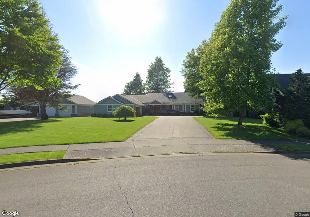
1255 W Park St Lynden, WA 98264
Estimated Value: $835,000 - $1,058,000
3
Beds
3
Baths
2,983
Sq Ft
$316/Sq Ft
Est. Value
About This Home
This home is located at 1255 W Park St, Lynden, WA 98264 and is currently estimated at $943,637, approximately $316 per square foot. 1255 W Park St is a home located in Whatcom County with nearby schools including Lynden High School, Lynden Christian School, and Lynden Christian Schools: Administration.
Ownership History
Date
Name
Owned For
Owner Type
Purchase Details
Closed on
Jul 15, 2021
Sold by
Bargen Theodore and Bargen Sandra
Bought by
Slagle John R and Slagle Heidi
Current Estimated Value
Home Financials for this Owner
Home Financials are based on the most recent Mortgage that was taken out on this home.
Original Mortgage
$615,000
Outstanding Balance
$558,528
Interest Rate
2.96%
Mortgage Type
Purchase Money Mortgage
Estimated Equity
$385,109
Purchase Details
Closed on
Mar 9, 2020
Sold by
Bongard Christopher M and Bongard Aurelia B
Bought by
Gagnon Michael and Gagnon Charlyn
Create a Home Valuation Report for This Property
The Home Valuation Report is an in-depth analysis detailing your home's value as well as a comparison with similar homes in the area
Home Values in the Area
Average Home Value in this Area
Purchase History
| Date | Buyer | Sale Price | Title Company |
|---|---|---|---|
| Slagle John R | -- | None Available | |
| Gagnon Michael | $4,325,000 | Chicago Title |
Source: Public Records
Mortgage History
| Date | Status | Borrower | Loan Amount |
|---|---|---|---|
| Open | Slagle John R | $615,000 |
Source: Public Records
Tax History Compared to Growth
Tax History
| Year | Tax Paid | Tax Assessment Tax Assessment Total Assessment is a certain percentage of the fair market value that is determined by local assessors to be the total taxable value of land and additions on the property. | Land | Improvement |
|---|---|---|---|---|
| 2024 | $6,320 | $895,891 | $272,813 | $623,078 |
| 2023 | $6,320 | $880,363 | $281,250 | $599,113 |
| 2022 | $6,639 | $872,038 | $216,612 | $655,426 |
| 2021 | $6,512 | $720,684 | $179,016 | $541,668 |
| 2020 | $5,703 | $643,485 | $159,840 | $483,645 |
| 2019 | $5,074 | $590,101 | $146,760 | $443,341 |
| 2018 | $5,546 | $538,218 | $133,692 | $404,526 |
| 2017 | $5,153 | $483,097 | $120,000 | $363,097 |
| 2016 | $4,855 | $477,441 | $121,000 | $356,441 |
| 2015 | $4,303 | $447,395 | $116,380 | $331,015 |
| 2014 | -- | $432,241 | $112,420 | $319,821 |
| 2013 | -- | $429,821 | $110,000 | $319,821 |
Source: Public Records
Map
Nearby Homes
- 761 Sunrise Dr
- 902 Captain Bay Ct
- 872 Sunrise Dr
- 0 Benson Rd Unit NWM2378945
- 1739 Emerald Way
- 1725 Harrison Place Unit 104
- 307 Kwanzan Dr
- 1877 Emerald Way
- 8780 Depot Rd Unit 309
- 8780 Depot Rd Unit 308
- 8780 Depot Rd Unit 207
- 500 Fieldstone Loop Unit 13
- 211 E Sunrise Dr
- 107 Springview Dr
- 518 Edson St
- 908 Glenning St
- 1584 Main St
- 114 Twin Sister Loop
- 325 Island Green Way
- 8872 Depot Rd Unit 203