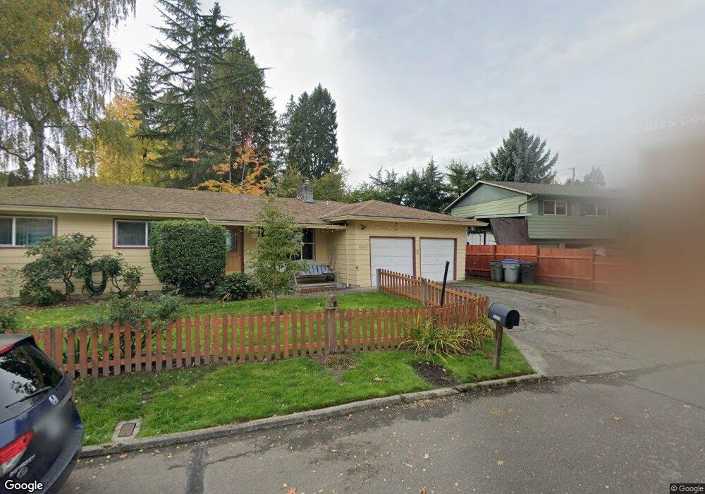
12555 SW Brookside Ct Tigard, OR 97223
Greenburg Road NeighborhoodEstimated Value: $561,000 - $598,000
3
Beds
6
Baths
1,618
Sq Ft
$359/Sq Ft
Est. Value
About This Home
This home is located at 12555 SW Brookside Ct, Tigard, OR 97223 and is currently estimated at $581,244, approximately $359 per square foot. 12555 SW Brookside Ct is a home located in Washington County with nearby schools including Charles F. Tigard Elementary School, Thomas R. Fowler Middle School, and Tigard High School.
Ownership History
Date
Name
Owned For
Owner Type
Purchase Details
Closed on
Oct 18, 2024
Sold by
Carter Leslie E and Carter Bennett S
Bought by
Carter Family Trust and Carter
Current Estimated Value
Purchase Details
Closed on
Feb 18, 1999
Sold by
Smurthwaite Larry D and Smurthwaite Debbie Ann
Bought by
Carter Leslie E and Carter Bennett S
Home Financials for this Owner
Home Financials are based on the most recent Mortgage that was taken out on this home.
Original Mortgage
$136,650
Interest Rate
6.77%
Purchase Details
Closed on
Nov 17, 1995
Sold by
Cate Jack N
Bought by
Smurthwaite Larry D and Smurthwaite Debbie Ann
Home Financials for this Owner
Home Financials are based on the most recent Mortgage that was taken out on this home.
Original Mortgage
$110,700
Interest Rate
7.48%
Create a Home Valuation Report for This Property
The Home Valuation Report is an in-depth analysis detailing your home's value as well as a comparison with similar homes in the area
Home Values in the Area
Average Home Value in this Area
Purchase History
| Date | Buyer | Sale Price | Title Company |
|---|---|---|---|
| Carter Family Trust | -- | None Listed On Document | |
| Carter Leslie E | $151,880 | Oregon Title Insurance Co | |
| Smurthwaite Larry D | $123,000 | Ticor Title Insurance |
Source: Public Records
Mortgage History
| Date | Status | Borrower | Loan Amount |
|---|---|---|---|
| Previous Owner | Carter Leslie E | $136,650 | |
| Previous Owner | Smurthwaite Larry D | $110,700 |
Source: Public Records
Tax History Compared to Growth
Tax History
| Year | Tax Paid | Tax Assessment Tax Assessment Total Assessment is a certain percentage of the fair market value that is determined by local assessors to be the total taxable value of land and additions on the property. | Land | Improvement |
|---|---|---|---|---|
| 2025 | $4,964 | $291,180 | -- | -- |
| 2024 | $4,831 | $282,700 | -- | -- |
| 2023 | $4,831 | $274,470 | $0 | $0 |
| 2022 | $4,692 | $274,470 | $0 | $0 |
| 2021 | $4,575 | $258,720 | $0 | $0 |
| 2020 | $4,437 | $251,190 | $0 | $0 |
| 2019 | $4,245 | $243,880 | $0 | $0 |
| 2018 | $4,073 | $236,780 | $0 | $0 |
| 2017 | $3,926 | $229,890 | $0 | $0 |
| 2016 | $3,749 | $223,200 | $0 | $0 |
| 2015 | $3,603 | $216,700 | $0 | $0 |
| 2014 | $3,497 | $210,390 | $0 | $0 |
Source: Public Records
Map
Nearby Homes
- 10097 SW Woodard Ln
- 10060 SW Molly Ct
- 12065 SW Karol Ct
- 12230 SW 106th Dr
- 10635 SW Watkins Place
- 10455 SW Meadow St
- 11010 SW Fonner St
- 13235 SW Ash Dr
- 10200 SW Tigard St
- 10985 SW Mira Ct
- 13465 SW 107th Ave
- 12393 SW 114th Terrace
- 11220 SW Buffalo Place
- 11355 SW 97th Ct
- 12557 SW 115th Ave
- 11464 SW 96th Ave
- 11790 SW 90th Ave
- 11044 SW Greenburg Rd Unit 321
- 11287 SW 112th Ave
- 9270 SW Edgewood St
- 12555 SW Brookside Ave
- 10260 SW Brookside Ct
- 12575 SW Brookside Ave
- 12525 SW Brookside Ave
- 10290 SW Brookside Ct
- 10265 SW Brookside Ct
- 12595 SW Brookside Ave
- 12550 SW Brookside Ave
- 12505 SW Brookside Ave
- 12570 SW Brookside Ave
- 10295 SW Brookside Ct
- 10265 SW Walnut St
- 10210 SW Brookside Place
- 10240 SW Brookside Place
- 10130 SW Brookside Place
- 12535 SW Watkins Ave
- 10270 SW Brookside Place
- 12485 SW Brookside Ave
- 10330 SW Walnut St
- 10300 SW Brookside Place