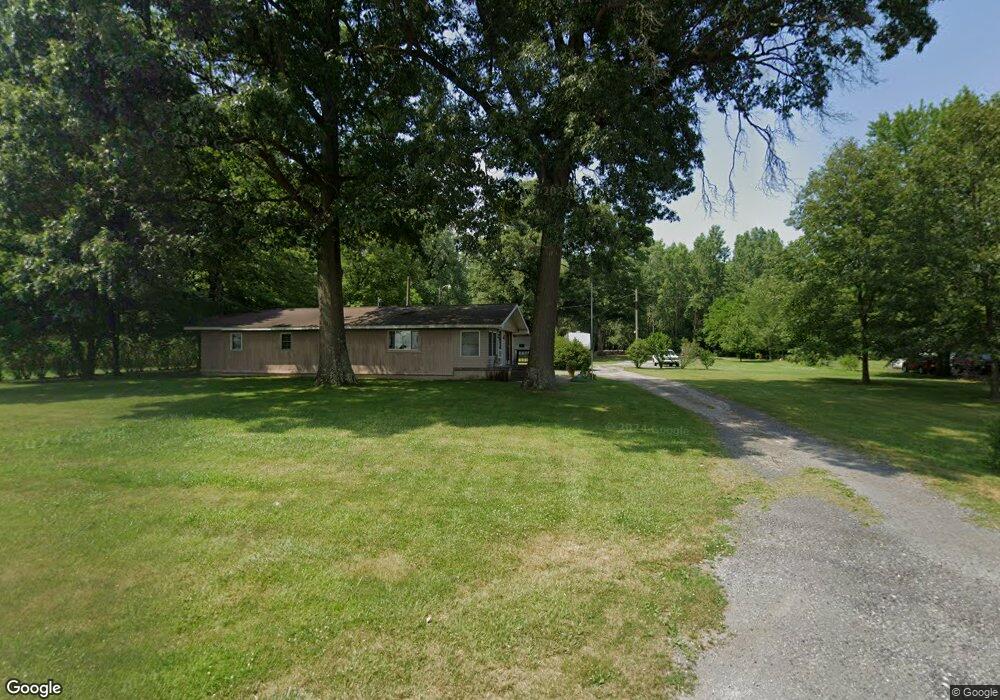
12556 County Road L Wauseon, OH 43567
Estimated Value: $173,000 - $250,000
3
Beds
2
Baths
1,426
Sq Ft
$158/Sq Ft
Est. Value
About This Home
This home is located at 12556 County Road L, Wauseon, OH 43567 and is currently estimated at $224,702, approximately $157 per square foot. 12556 County Road L is a home located in Fulton County with nearby schools including Delta Elementary School, Pike-Delta-York Middle School, and Pike-Delta-York High School.
Ownership History
Date
Name
Owned For
Owner Type
Purchase Details
Closed on
Sep 1, 2011
Sold by
Us Bank Na
Bought by
Federal Field Services Llc
Current Estimated Value
Purchase Details
Closed on
Jun 21, 2010
Sold by
Johnson Linda D and Johnson Linda Diane
Bought by
U S Bank N A
Purchase Details
Closed on
Dec 26, 1995
Sold by
Fosnight Aaron D
Bought by
Johnson Linda D
Home Financials for this Owner
Home Financials are based on the most recent Mortgage that was taken out on this home.
Original Mortgage
$52,700
Interest Rate
7.43%
Mortgage Type
New Conventional
Purchase Details
Closed on
Jan 1, 1990
Bought by
Fosnight Aaron D
Create a Home Valuation Report for This Property
The Home Valuation Report is an in-depth analysis detailing your home's value as well as a comparison with similar homes in the area
Home Values in the Area
Average Home Value in this Area
Purchase History
| Date | Buyer | Sale Price | Title Company |
|---|---|---|---|
| Federal Field Services Llc | $38,199 | None Available | |
| U S Bank N A | $60,000 | Attorney | |
| Johnson Linda D | $32,000 | -- | |
| Fosnight Aaron D | -- | -- |
Source: Public Records
Mortgage History
| Date | Status | Borrower | Loan Amount |
|---|---|---|---|
| Previous Owner | Johnson Linda D | $52,700 |
Source: Public Records
Tax History Compared to Growth
Tax History
| Year | Tax Paid | Tax Assessment Tax Assessment Total Assessment is a certain percentage of the fair market value that is determined by local assessors to be the total taxable value of land and additions on the property. | Land | Improvement |
|---|---|---|---|---|
| 2024 | $2,032 | $51,530 | $11,800 | $39,730 |
| 2023 | $2,036 | $51,530 | $11,800 | $39,730 |
| 2022 | $1,945 | $38,230 | $9,840 | $28,390 |
| 2021 | $2,021 | $38,230 | $9,840 | $28,390 |
| 2020 | $2,009 | $38,230 | $9,840 | $28,390 |
| 2019 | $1,832 | $36,470 | $9,170 | $27,300 |
| 2018 | $1,699 | $36,470 | $9,170 | $27,300 |
| 2017 | $1,653 | $34,370 | $9,170 | $25,200 |
| 2016 | $1,586 | $30,520 | $9,800 | $20,720 |
| 2015 | $1,510 | $30,520 | $9,800 | $20,720 |
| 2014 | $1,503 | $30,520 | $9,800 | $20,720 |
| 2013 | $1,638 | $32,800 | $9,450 | $23,350 |
Source: Public Records
Map
Nearby Homes
- 11715 County Road L
- 11517 County Road 11
- 11396 County Road N
- 11670 County Road L
- 8453 County Road 13
- 0 County Road H
- 7620 County Road 12
- 7373 County Road 12
- 14640 County Road K
- 14900 W Co Rd H
- 14900 County Road H
- 13354 U S 20a
- 13242 Us Highway 20a
- 16099 Us Highway 20
- 460 Airport Hwy
- 14578 Us Highway 20a
- 117 Fairview St
- 1209 Apache Dr
- 110 Hinkle St
- Integrity 1830 Plan at Arrowhead Trails
- 12520 County Road L
- 12545 County Road L
- 12606 County Road L
- 12484 County Road L
- 12511 County Road L
- 12575 County Road L
- 12660 County Road L
- 12400 County Road L
- 12500 County Road L
- 12709 County Road L
- 12720 County Road L
- 12730 County Road L
- 12735 County Road L
- 12325 County Road L
- 12827 County Road L
- 12244 County Road L
- 12233 County Road L
- 12487 County Road M
- 11350 County Road 13
- 12631 County Road M