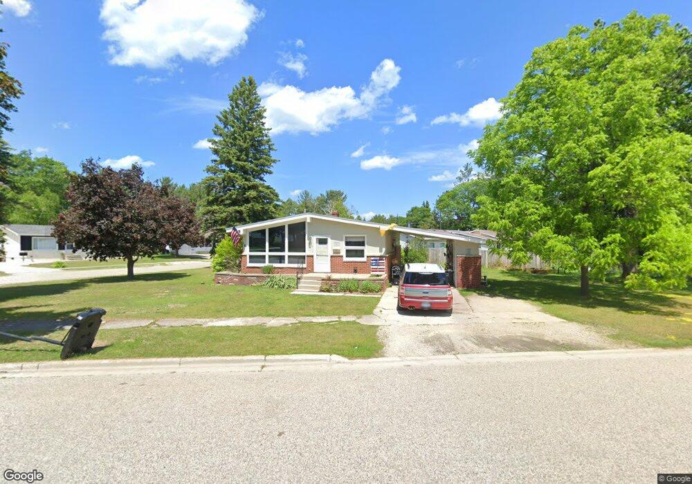
1256 Birchwood Ave Rogers City, MI 49779
Estimated Value: $137,000 - $186,000
3
Beds
1
Bath
1,300
Sq Ft
$116/Sq Ft
Est. Value
About This Home
This home is located at 1256 Birchwood Ave, Rogers City, MI 49779 and is currently estimated at $150,545, approximately $115 per square foot. 1256 Birchwood Ave is a home located in Presque Isle County with nearby schools including Rogers City Elementary School, Rogers City High School, and Rogers City Montessori School.
Ownership History
Date
Name
Owned For
Owner Type
Purchase Details
Closed on
Jul 10, 2015
Sold by
Vogelheim Joseph T
Bought by
Tackitt Melissa M and Tackitt Michael D
Current Estimated Value
Home Financials for this Owner
Home Financials are based on the most recent Mortgage that was taken out on this home.
Original Mortgage
$45,000
Outstanding Balance
$35,320
Interest Rate
4.05%
Mortgage Type
Future Advance Clause Open End Mortgage
Estimated Equity
$115,225
Create a Home Valuation Report for This Property
The Home Valuation Report is an in-depth analysis detailing your home's value as well as a comparison with similar homes in the area
Home Values in the Area
Average Home Value in this Area
Purchase History
| Date | Buyer | Sale Price | Title Company |
|---|---|---|---|
| Tackitt Melissa M | -- | Barron Title Agency |
Source: Public Records
Mortgage History
| Date | Status | Borrower | Loan Amount |
|---|---|---|---|
| Open | Tackitt Melissa M | $45,000 |
Source: Public Records
Tax History Compared to Growth
Tax History
| Year | Tax Paid | Tax Assessment Tax Assessment Total Assessment is a certain percentage of the fair market value that is determined by local assessors to be the total taxable value of land and additions on the property. | Land | Improvement |
|---|---|---|---|---|
| 2025 | $1,428 | $65,300 | $0 | $0 |
| 2024 | $1,140 | $55,800 | $0 | $0 |
| 2023 | $1,088 | $48,000 | $0 | $0 |
| 2022 | $1,316 | $44,700 | $0 | $0 |
| 2021 | $1,275 | $38,000 | $0 | $0 |
| 2020 | $1,235 | $35,400 | $0 | $0 |
| 2019 | $1,212 | $34,600 | $0 | $0 |
| 2018 | $1,184 | $32,500 | $0 | $0 |
| 2016 | -- | $29,700 | $0 | $0 |
| 2014 | -- | $30,000 | $0 | $0 |
Source: Public Records
Map
Nearby Homes
- 1053 St Paul St
- 1194 Larke Ave
- 1089 Dettloff St
- 440 Hemlock St
- 354 N 6th St
- 1334 N Cedar St
- 360 E Huron Ave
- 0 M-68 Unit 201836886
- 0 M-68 Unit 28 Acres 201828504
- 312 E Orchard St
- 0 451 Hwy Unit 201834784
- 0 Airport Hwy & County Road 451 Unit 201836885
- 0 M-68 Hwy and Airport Rd Unit 201836887
- V/L W Airport Hwy
- 0 W Airport Hwy Unit 201835935
- 0 Airport Hwy Unit 201836889
- 0 Airport Hwy Unit 201836891
- 1367 Wenzel Hwy
- 1473 W Heythaler Hwy
- 3997 Vermeersch Rd
- 765 Susie Ln
- 722 Susie Ln
- 736 Susie Ln
- 736 Susie Ln
- 736 Susie Ln
- 1236 Birchwood Ave
- 1251 Birchwood Ave
- 1275 Birchwood Ave
- 1290 Birchwood Ave
- 1235 Birchwood Ave
- 775 Susie Ln
- 1235 Birchwood Ave
- 750 Susie Ln
- 750 Susie Ln
- 0 Birchwood St Unit 299877
- 0 Birchwood St Unit 299876
- 0 Birchwood St Unit 299875
- 0 Birchwood St Unit 299874
- 0 Birchwood St Unit 299873
- 0 Birchwood St Unit 299868