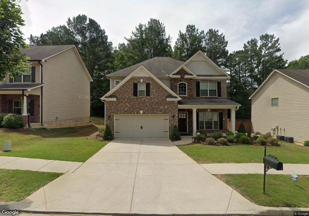
1256 Clear Stream Ridge Unit 41A Auburn, GA 30011
Estimated Value: $474,153 - $575,000
4
Beds
3
Baths
3,390
Sq Ft
$152/Sq Ft
Est. Value
About This Home
This home is located at 1256 Clear Stream Ridge Unit 41A, Auburn, GA 30011 and is currently estimated at $514,788, approximately $151 per square foot. 1256 Clear Stream Ridge Unit 41A is a home located in Gwinnett County with nearby schools including Mulberry Elementary School, Dacula Middle School, and Dacula High School.
Ownership History
Date
Name
Owned For
Owner Type
Purchase Details
Closed on
Apr 29, 2015
Sold by
The Ryland Grp Inc
Bought by
Patrick Leonard Hendrick and Champion Lolita
Current Estimated Value
Home Financials for this Owner
Home Financials are based on the most recent Mortgage that was taken out on this home.
Original Mortgage
$243,009
Outstanding Balance
$184,876
Interest Rate
3.5%
Mortgage Type
FHA
Estimated Equity
$329,912
Purchase Details
Closed on
Dec 27, 2006
Sold by
Maple Leaf Dev Llc
Bought by
Grp Ryland
Create a Home Valuation Report for This Property
The Home Valuation Report is an in-depth analysis detailing your home's value as well as a comparison with similar homes in the area
Home Values in the Area
Average Home Value in this Area
Purchase History
| Date | Buyer | Sale Price | Title Company |
|---|---|---|---|
| Patrick Leonard Hendrick | $247,493 | -- | |
| Grp Ryland | $195,300 | -- |
Source: Public Records
Mortgage History
| Date | Status | Borrower | Loan Amount |
|---|---|---|---|
| Open | Patrick Leonard Hendrick | $243,009 |
Source: Public Records
Tax History Compared to Growth
Tax History
| Year | Tax Paid | Tax Assessment Tax Assessment Total Assessment is a certain percentage of the fair market value that is determined by local assessors to be the total taxable value of land and additions on the property. | Land | Improvement |
|---|---|---|---|---|
| 2025 | $6,026 | $220,480 | $30,000 | $190,480 |
| 2024 | $5,668 | $193,600 | $32,800 | $160,800 |
| 2023 | $5,668 | $191,920 | $32,800 | $159,120 |
| 2022 | $5,068 | $166,040 | $28,000 | $138,040 |
| 2021 | $4,231 | $122,520 | $22,400 | $100,120 |
| 2020 | $4,216 | $120,560 | $18,400 | $102,160 |
| 2019 | $3,890 | $102,000 | $14,560 | $87,440 |
| 2018 | $3,894 | $102,000 | $14,560 | $87,440 |
| 2016 | $3,805 | $99,000 | $12,800 | $86,200 |
| 2015 | $3,391 | $88,120 | $12,800 | $75,320 |
| 2014 | $292 | $7,200 | $7,200 | $0 |
Source: Public Records
Map
Nearby Homes
- 1267 Clear Stream Ridge
- 3569 Tupelo Trail
- 3439 Tupelo Trail
- 3590 Tupelo Trail
- 1100 Rock Elm Dr Unit 1
- 3630 Tupelo Trail Unit 1
- 3536 Bridle Brook Dr
- 310 Meacham Ct
- 3613 Walking Stick Way
- 735 Galloping Bend Ct
- 3266 Bridle Brook Dr
- 619 Catesby Terrace
- 3463 Hillyard Dr
- 300 Meacham Ct
- 3449 Mulberry Cove Way
- 1256 Clear Stream Ridge
- 1246 Clear Stream
- 1246 Clear Stream Ridge
- 1246 Clear Stream Ridge Unit 42
- 1266 Clear Stream Ridge Unit 40
- 1266 Clear Stream Ridge
- 1226 Clear Stream Ridge
- 1276 Clear Stream
- 1276 Clear Stream Ridge Unit 39A
- 1276 Clear Stream Ridge
- 1257 Clear Stream Ridge
- 1247 Clear Stream Ridge Unit 30A
- 1247 Clear Stream Ridge
- 1267 Clear Stream Ridge Unit 32A
- 1267 Clear Stream Ridge Unit 32
- 1145 Sparkleberry Ct
- 1216 Clear Stream Ridge
- 1216 Clear Stream Ridge Unit 44
- 1155 Sparkleberry Ct Unit 51A
- 1155 Sparkleberry Ct