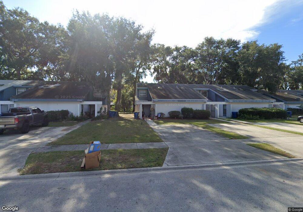
1256 Mayport Landing Dr Atlantic Beach, FL 32233
North Beach NeighborhoodEstimated Value: $184,738 - $216,000
2
Beds
2
Baths
1,100
Sq Ft
$183/Sq Ft
Est. Value
About This Home
This home is located at 1256 Mayport Landing Dr, Atlantic Beach, FL 32233 and is currently estimated at $201,435, approximately $183 per square foot. 1256 Mayport Landing Dr is a home located in Duval County with nearby schools including Anchor Academy, Mayport Middle School, and Duncan U. Fletcher High School.
Ownership History
Date
Name
Owned For
Owner Type
Purchase Details
Closed on
Mar 1, 2017
Bought by
Hcmc Properties Inc
Current Estimated Value
Purchase Details
Closed on
Jun 28, 2002
Sold by
Rea Richard W and Fortini Ronald D
Bought by
Hcmc Properties Inc
Purchase Details
Closed on
May 1, 2000
Sold by
Murphy Paula L and Wood Paula L
Bought by
Wood Barry J
Home Financials for this Owner
Home Financials are based on the most recent Mortgage that was taken out on this home.
Original Mortgage
$28,750
Interest Rate
8.14%
Mortgage Type
Stand Alone First
Create a Home Valuation Report for This Property
The Home Valuation Report is an in-depth analysis detailing your home's value as well as a comparison with similar homes in the area
Home Values in the Area
Average Home Value in this Area
Purchase History
| Date | Buyer | Sale Price | Title Company |
|---|---|---|---|
| Hcmc Properties Inc | $100 | -- | |
| Hcmc Properties Inc | $45,000 | Watson & Osborne Title Svcs | |
| Wood Barry J | -- | -- | |
| Fortini Ronald D | $23,000 | -- |
Source: Public Records
Mortgage History
| Date | Status | Borrower | Loan Amount |
|---|---|---|---|
| Previous Owner | Wood Barry J | $28,750 |
Source: Public Records
Tax History Compared to Growth
Tax History
| Year | Tax Paid | Tax Assessment Tax Assessment Total Assessment is a certain percentage of the fair market value that is determined by local assessors to be the total taxable value of land and additions on the property. | Land | Improvement |
|---|---|---|---|---|
| 2025 | $2,222 | $94,851 | -- | -- |
| 2024 | $1,976 | $166,518 | $72,500 | $94,018 |
| 2023 | $1,976 | $139,910 | $45,000 | $94,910 |
| 2022 | $1,645 | $118,555 | $40,000 | $78,555 |
| 2021 | $1,450 | $89,566 | $20,000 | $69,566 |
| 2020 | $1,338 | $80,678 | $20,000 | $60,678 |
| 2019 | $1,229 | $69,886 | $12,500 | $57,386 |
| 2018 | $1,176 | $68,722 | $12,500 | $56,222 |
| 2017 | $1,032 | $52,346 | $8,500 | $43,846 |
| 2016 | $939 | $43,158 | $0 | $0 |
| 2015 | $906 | $42,549 | $0 | $0 |
| 2014 | $807 | $33,248 | $0 | $0 |
Source: Public Records
Map
Nearby Homes
- 1227 Mayport Landing Dr
- 1142 Nantucket Ave
- 1124 Nantucket Ave
- 1137 Cape Charles Ave
- 2984 Songbird Dr
- 1104 Cape Charles Ave
- 2638 W West End St
- 1087 Spokane Ave
- 2627 Sandy Dune Dr
- 2455 Seaway St
- 2604 Sandy Dune Dr
- 2595 Sandy Dune Dr
- 1105 Beach Dune Dr
- 909 Gavagan Rd
- 905 Gavagan Rd
- 942 Wonderwood Dr
- 1209 Beach Dune Dr
- 1232 Beach Dune Dr
- 1253 Beach Dune Dr
- 2548 Haywood Estates Ln
- 1254 Mayport Landing Dr
- 1260 Mayport Landing Dr
- 1248 Mayport Landing Dr
- 1264 Mayport Landing Dr
- 1240 Mayport Landing Dr
- 1268 Mayport Landing Dr
- 1241 Mayport Landing Cir
- 1236 Mayport Landing Dr
- 1272 Mayport Landing Dr
- 1276 Mayport Landing Dr
- 1232 Mayport Landing Dr
- 1225 Nantucket Ave
- 1235 Nantucket Ave
- 1225 Mayport Landing Cir Unit 1
- 1230 Mayport Landing Cir
- 1228 Mayport Landing Dr
- 1226 Mayport Landing Dr
- 1217 Mayport Landing Cir Unit 1
- 1215 Nantucket Ave
- 1243 Nantucket Ave