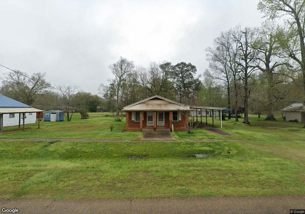
12562 Tangipahoa Ave Roseland, LA 70456
Estimated Value: $139,228 - $158,000
3
Beds
2
Baths
1,612
Sq Ft
$94/Sq Ft
Est. Value
About This Home
This home is located at 12562 Tangipahoa Ave, Roseland, LA 70456 and is currently estimated at $152,057, approximately $94 per square foot. 12562 Tangipahoa Ave is a home located in Tangipahoa Parish with nearby schools including Amite Elementary Magnet School, Amite Westside Middle Magnet, and Amite High Magnet.
Ownership History
Date
Name
Owned For
Owner Type
Purchase Details
Closed on
Aug 6, 2008
Sold by
Sullivan Michale E and Sullivan Shirley F
Bought by
Bruins Jaime Loatrecia
Current Estimated Value
Home Financials for this Owner
Home Financials are based on the most recent Mortgage that was taken out on this home.
Original Mortgage
$96,900
Outstanding Balance
$64,034
Interest Rate
6.47%
Mortgage Type
New Conventional
Estimated Equity
$88,023
Create a Home Valuation Report for This Property
The Home Valuation Report is an in-depth analysis detailing your home's value as well as a comparison with similar homes in the area
Home Values in the Area
Average Home Value in this Area
Purchase History
| Date | Buyer | Sale Price | Title Company |
|---|---|---|---|
| Bruins Jaime Loatrecia | $91,322 | Hammond Title Company Inc |
Source: Public Records
Mortgage History
| Date | Status | Borrower | Loan Amount |
|---|---|---|---|
| Open | Bruins Jaime Loatrecia | $96,900 |
Source: Public Records
Tax History Compared to Growth
Tax History
| Year | Tax Paid | Tax Assessment Tax Assessment Total Assessment is a certain percentage of the fair market value that is determined by local assessors to be the total taxable value of land and additions on the property. | Land | Improvement |
|---|---|---|---|---|
| 2024 | $375 | $5,664 | $233 | $5,431 |
| 2023 | $379 | $5,647 | $216 | $5,431 |
| 2022 | $379 | $5,647 | $216 | $5,431 |
| 2021 | $379 | $5,647 | $216 | $5,431 |
| 2020 | $411 | $5,647 | $216 | $5,431 |
| 2019 | $468 | $5,647 | $216 | $5,431 |
| 2018 | $470 | $5,647 | $216 | $5,431 |
| 2017 | $469 | $5,647 | $216 | $5,431 |
| 2016 | $469 | $5,647 | $216 | $5,431 |
| 2015 | -- | $6,004 | $216 | $5,788 |
| 2014 | -- | $6,004 | $216 | $5,788 |
Source: Public Records
Map
Nearby Homes
- 62445 Commercial St
- 0 Tangipahoa Ave
- 64161 U S Highway 51
- 64161 U S 51
- 0 Commercial St
- 63070 Oak St
- 63036 Church St
- 12519 North Ave
- 12558 Central Ave
- 0 S Roseland Ave Unit 2501645
- 12084 Highway 1048
- 12663 Arcola Rd
- 14181 E Russell Town Rd
- 310 N Duncan Ave
- 62636 Russell Town Rd
- 704 N 1st St
- 15182 Sterling Smith Rd
- 01 Old Highway 51
- 02 Old Highway 51
- 0 Camille St
- 12578 Tangipahoa Ave
- 12546 Tangipahoa Ave
- 12594 Tangipahoa Ave
- 12571 Tangipahoa Ave
- 62453 Church St
- 12581 Tangipahoa Ave
- 12591 Tangipahoa Ave
- 62437 Church St
- 12612 Tangipahoa Ave
- 12520 Louisiana Ave
- 62523 Church St
- 12626 Tangipahoa Ave
- 62442 Church St
- 60395 Oak St
- 62426 Church St
- 62516 Church St
- 12627 Tangipahoa Ave
- 12634 Tangipahoa Ave
- 63018 Hill St