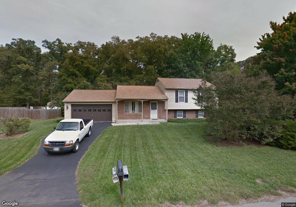
12569 Council Oak Dr Waldorf, MD 20601
Estimated Value: $373,030 - $442,000
--
Bed
2
Baths
1,728
Sq Ft
$243/Sq Ft
Est. Value
About This Home
This home is located at 12569 Council Oak Dr, Waldorf, MD 20601 and is currently estimated at $419,258, approximately $242 per square foot. 12569 Council Oak Dr is a home located in Charles County with nearby schools including J.P. Ryon Elementary School, John Hanson Middle School, and Thomas Stone High School.
Ownership History
Date
Name
Owned For
Owner Type
Purchase Details
Closed on
Oct 25, 1999
Sold by
Roman William R
Bought by
Roman William R Trust
Current Estimated Value
Purchase Details
Closed on
Apr 1, 1986
Sold by
Curtis Homes Inc
Bought by
Roman William R
Home Financials for this Owner
Home Financials are based on the most recent Mortgage that was taken out on this home.
Original Mortgage
$68,550
Interest Rate
10.1%
Purchase Details
Closed on
Jan 3, 1986
Sold by
Curtis Properties, Inc
Bought by
Curtis Homes Inc
Home Financials for this Owner
Home Financials are based on the most recent Mortgage that was taken out on this home.
Original Mortgage
$767,050
Interest Rate
10.81%
Create a Home Valuation Report for This Property
The Home Valuation Report is an in-depth analysis detailing your home's value as well as a comparison with similar homes in the area
Home Values in the Area
Average Home Value in this Area
Purchase History
| Date | Buyer | Sale Price | Title Company |
|---|---|---|---|
| Roman William R Trust | -- | -- | |
| Roman William R | $106,100 | -- | |
| Curtis Homes Inc | $200,000 | -- |
Source: Public Records
Mortgage History
| Date | Status | Borrower | Loan Amount |
|---|---|---|---|
| Previous Owner | Roman William R | $68,550 | |
| Previous Owner | Curtis Homes Inc | $767,050 |
Source: Public Records
Tax History Compared to Growth
Tax History
| Year | Tax Paid | Tax Assessment Tax Assessment Total Assessment is a certain percentage of the fair market value that is determined by local assessors to be the total taxable value of land and additions on the property. | Land | Improvement |
|---|---|---|---|---|
| 2025 | $10,115 | $330,100 | -- | -- |
| 2024 | $4,515 | $318,400 | $125,200 | $193,200 |
| 2023 | $4,162 | $291,267 | $0 | $0 |
| 2022 | $3,746 | $264,133 | $0 | $0 |
| 2021 | $3,254 | $237,000 | $95,200 | $141,800 |
| 2020 | $3,254 | $230,133 | $0 | $0 |
| 2019 | $3,147 | $223,267 | $0 | $0 |
| 2018 | $3,017 | $216,400 | $90,200 | $126,200 |
| 2017 | $2,944 | $211,467 | $0 | $0 |
| 2016 | -- | $206,533 | $0 | $0 |
| 2015 | $2,935 | $201,600 | $0 | $0 |
| 2014 | $2,935 | $201,600 | $0 | $0 |
Source: Public Records
Map
Nearby Homes
- 2552 Fernwood Ct
- 12720 Bar Oak Dr
- 12820 Twin Oak Dr
- 1525 Pin Oak Dr
- 2549 Mattawoman Beantown Rd
- 1610 Pin Oak Dr
- 2204 Holly Oak Ct
- 2002 English Oak Ct
- 12606 Sub Station Rd
- 4208 Sandwich Cir
- 2650 Pinewood Dr
- 2290 Mattawoman Beantown Rd
- 2914 Sandwich Dr
- 3502 Lisa Ln
- 4302 Sandwich Ct
- 3907 Brewster Ct
- 12113 Farrar Place
- 2217 Pinefield Way
- 12361 Echo Hill Place
- 12329 Cheerio Place
- 12567 Council Oak Dr
- 12571 Council Oak Dr
- 12568 Council Oak Dr
- 12570 Council Oak Dr
- 12565 Council Oak Dr
- 12573 Council Oak Dr
- 12566 Council Oak Dr
- 12572 Council Oak Dr
- 12564 Council Oak Dr
- 12563 Council Oak Dr
- 12575 Council Oak Dr
- 12574 Council Oak Dr
- 2556 Fernwood Ct
- 12562 Council Oak Dr
- 2560 Fernwood Ct
- 2548 Fernwood Ct
- 2544 Fernwood Ct
- 2540 Fernwood Ct
- 2565 Fernwood Ct
- 2561 Fernwood Ct