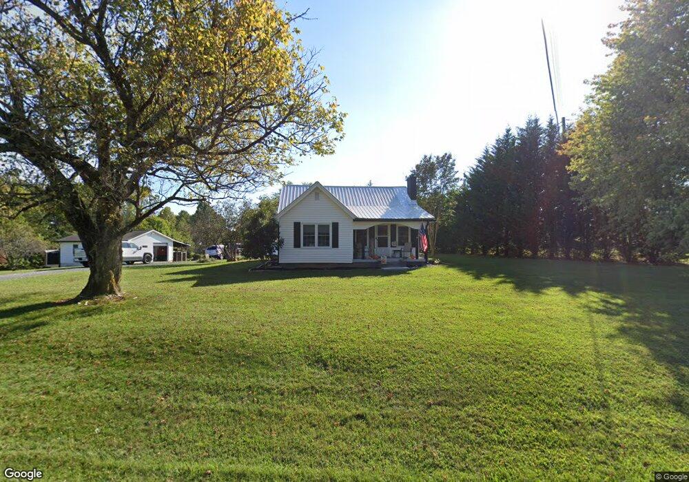
1257 Slate Mountain Rd Mount Airy, NC 27030
Estimated Value: $145,000 - $203,000
3
Beds
1
Bath
1,254
Sq Ft
$143/Sq Ft
Est. Value
About This Home
This home is located at 1257 Slate Mountain Rd, Mount Airy, NC 27030 and is currently estimated at $179,232, approximately $142 per square foot. 1257 Slate Mountain Rd is a home located in Surry County with nearby schools including Westfield Elementary School, Pilot Mountain Middle School, and East Surry High School.
Ownership History
Date
Name
Owned For
Owner Type
Purchase Details
Closed on
Oct 13, 2021
Sold by
Boles Richard M and Collins-Boles Lori
Bought by
Stoddard Todd M and Stoddard Heather K
Current Estimated Value
Home Financials for this Owner
Home Financials are based on the most recent Mortgage that was taken out on this home.
Original Mortgage
$138,446
Outstanding Balance
$125,976
Interest Rate
2.8%
Mortgage Type
FHA
Estimated Equity
$53,256
Purchase Details
Closed on
Jan 20, 2021
Sold by
Mcmillian Hersie and Mcmillian Judy
Bought by
Boles Richard M and Boles Lori C
Purchase Details
Closed on
Jan 1, 2000
Purchase Details
Closed on
Aug 1, 1997
Purchase Details
Closed on
Oct 1, 1991
Create a Home Valuation Report for This Property
The Home Valuation Report is an in-depth analysis detailing your home's value as well as a comparison with similar homes in the area
Home Values in the Area
Average Home Value in this Area
Purchase History
| Date | Buyer | Sale Price | Title Company |
|---|---|---|---|
| Stoddard Todd M | $141,000 | None Available | |
| Boles Richard M | $95,000 | None Available | |
| -- | $86,000 | -- | |
| -- | $69,000 | -- | |
| -- | $51,000 | -- |
Source: Public Records
Mortgage History
| Date | Status | Borrower | Loan Amount |
|---|---|---|---|
| Open | Stoddard Todd M | $138,446 |
Source: Public Records
Tax History Compared to Growth
Tax History
| Year | Tax Paid | Tax Assessment Tax Assessment Total Assessment is a certain percentage of the fair market value that is determined by local assessors to be the total taxable value of land and additions on the property. | Land | Improvement |
|---|---|---|---|---|
| 2025 | $888 | $141,830 | $11,700 | $130,130 |
| 2024 | $761 | $109,420 | $10,800 | $98,620 |
| 2023 | $604 | $109,420 | $10,800 | $98,620 |
| 2022 | $749 | $109,420 | $10,800 | $98,620 |
| 2021 | $648 | $92,070 | $10,800 | $81,270 |
| 2020 | $602 | $82,620 | $10,800 | $71,820 |
| 2019 | $599 | $82,620 | $0 | $0 |
| 2018 | $577 | $82,620 | $0 | $0 |
| 2017 | $567 | $82,620 | $0 | $0 |
| 2016 | $567 | $82,620 | $0 | $0 |
| 2013 | -- | $81,200 | $0 | $0 |
Source: Public Records
Map
Nearby Homes
- 107 Cory Trail
- 00 Blue Hollow Rd Unit 5
- 733 Slate Mountain Rd
- 0 Norman Rd
- 583 Snody Rd
- 0 Blue Hollow Rd Unit 33 1176021
- 0 Blue Hollow Rd Unit 23105199
- 000 Blue Hollow Rd Unit 27
- 7.8ac Norman Rd
- 759 Cameron Ln
- 140 Daniels Dell Ln
- 109 Dorothy Ln
- 1970 Mcbride Rd
- 0 NE Pine St
- Lot 4,5,6 Sideview Ln
- 203 Brannock Ln
- 731 Indian Grove Church Rd
- xx 44.93 Acres Stardust Trail
- 00 Paynetown Rd
- 335 Badgett Ave
- 1231 Slate Mountain Rd
- 1225 Slate Mountain Rd
- 1288 Slate Mountain Rd
- 781 Athey Simmons Rd
- 1300 Slate Mountain Rd
- 145 Cory Trail
- 152 Mount Herman Church Rd
- 159 Mount Herman Church Rd
- 718 Athey Simmons Rd
- 1169 Slate Mountain Rd
- 149 Crosscut Trail
- 1174 Slate Mountain Rd
- 00 Slate Mountain Rd
- 1331 Slate Mountain Rd
- 173 Crosscut Trail
- 209 Mount Herman Church Rd
- 1119 Slate Mountain Rd
- 210 Cory Trail
- 233 Mount Herman Church Rd
- 1089 Slate Mountain Rd