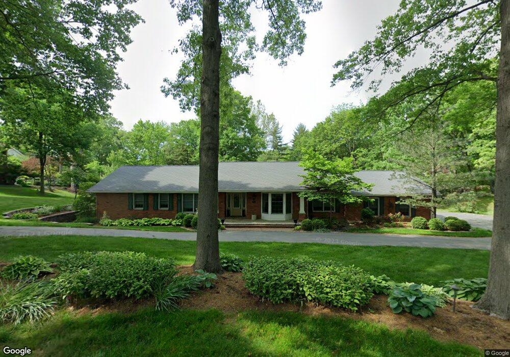
12574 Bickford Dr Saint Louis, MO 63141
Estimated Value: $909,989 - $941,000
3
Beds
4
Baths
3,216
Sq Ft
$289/Sq Ft
Est. Value
About This Home
This home is located at 12574 Bickford Dr, Saint Louis, MO 63141 and is currently estimated at $927,997, approximately $288 per square foot. 12574 Bickford Dr is a home located in St. Louis County with nearby schools including Mason Ridge Elementary School, Parkway West Middle School, and Parkway West High School.
Ownership History
Date
Name
Owned For
Owner Type
Purchase Details
Closed on
Jun 6, 2012
Sold by
Fritsche John L and Fritsche Joan M
Bought by
Fritsche John L and Fritsche Joan M
Current Estimated Value
Purchase Details
Closed on
Jul 30, 2003
Sold by
Rolwes Kenneth H
Bought by
Fritsche John L and Fritsche Joan M
Home Financials for this Owner
Home Financials are based on the most recent Mortgage that was taken out on this home.
Original Mortgage
$225,000
Outstanding Balance
$95,154
Interest Rate
5.19%
Mortgage Type
Purchase Money Mortgage
Estimated Equity
$832,843
Purchase Details
Closed on
Dec 10, 2002
Sold by
Rolwes Kenneth H
Bought by
Rolwes Kenneth H and The Kenneth H Rolwes Revocable Trust
Create a Home Valuation Report for This Property
The Home Valuation Report is an in-depth analysis detailing your home's value as well as a comparison with similar homes in the area
Home Values in the Area
Average Home Value in this Area
Purchase History
| Date | Buyer | Sale Price | Title Company |
|---|---|---|---|
| Fritsche John L | -- | None Available | |
| Fritsche John L | $445,000 | -- | |
| Rolwes Kenneth H | -- | -- |
Source: Public Records
Mortgage History
| Date | Status | Borrower | Loan Amount |
|---|---|---|---|
| Open | Fritsche John L | $225,000 | |
| Closed | Fritsche John L | $175,500 |
Source: Public Records
Tax History Compared to Growth
Tax History
| Year | Tax Paid | Tax Assessment Tax Assessment Total Assessment is a certain percentage of the fair market value that is determined by local assessors to be the total taxable value of land and additions on the property. | Land | Improvement |
|---|---|---|---|---|
| 2025 | $8,013 | $137,750 | $87,340 | $50,410 |
| 2024 | $8,013 | $137,750 | $77,630 | $60,120 |
| 2023 | $7,584 | $137,750 | $77,630 | $60,120 |
| 2022 | $7,219 | $119,160 | $67,940 | $51,220 |
| 2021 | $7,159 | $119,160 | $67,940 | $51,220 |
| 2020 | $5,994 | $95,400 | $49,950 | $45,450 |
| 2019 | $5,910 | $95,400 | $49,950 | $45,450 |
| 2018 | $6,412 | $95,680 | $49,950 | $45,730 |
| 2017 | $6,325 | $95,680 | $49,950 | $45,730 |
| 2016 | $6,681 | $96,070 | $38,440 | $57,630 |
| 2015 | $7,042 | $96,070 | $38,440 | $57,630 |
| 2014 | $7,005 | $103,820 | $36,900 | $66,920 |
Source: Public Records
Map
Nearby Homes
- 12549 Bickford Dr
- Pearson Plan at Deer Hollow - Masterpiece Collection
- Clay Plan at Deer Hollow - Masterpiece Collection
- Rhodes Plan at Deer Hollow - Masterpiece Collection
- Huxley Plan at Deer Hollow - Masterpiece Collection
- Teagan Plan at Deer Hollow - Masterpiece Collection
- Finley Plan at Deer Hollow - Masterpiece Collection
- Margot Plan at Deer Hollow - Masterpiece Collection
- Everett Plan at Deer Hollow - Masterpiece Collection
- Mitchell Plan at Deer Hollow - Masterpiece Collection
- Grayson Plan at Deer Hollow - Masterpiece Collection
- 9 Kirken Knoll Dr
- 11 Roclare Ln
- 13 Balcon Estates Ct
- 8 Balcon Estates
- 2409 N Ballas Rd
- 12040 Conway Rd
- 5 W Point Ln
- 29a Chapel Hill Estates Dr
- 0 Unknown Unit 22071090
- 880 Delvin Dr
- 891 Amersham Dr
- 12575 Bickford Dr
- 872 Durbin Ct
- 12563 Bickford Dr
- 906 Delvin Dr
- 881 Delvin Dr
- 875 Amersham Dr
- 12565 Durbin Dr
- 860 Durbin Ct
- 898 Amersham Dr
- 901 Delvin Dr
- 914 Delvin Dr
- 890 Amersham Dr
- 882 Amersham Dr
- 12574 Durbin Dr
- 909 Delvin Dr
- 855 Durbin Ct
- 874 Amersham Dr
- 863 Amersham Dr