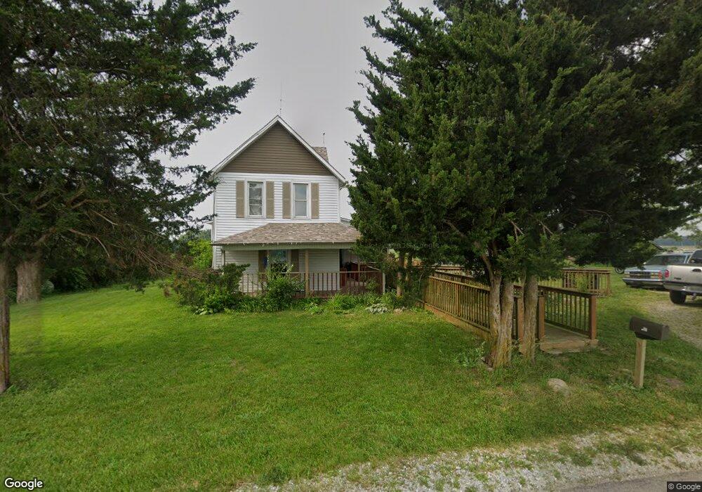
12574 W 800 S Losantville, IN 47354
Estimated Value: $133,000 - $202,000
3
Beds
1
Bath
1,950
Sq Ft
$90/Sq Ft
Est. Value
About This Home
This home is located at 12574 W 800 S, Losantville, IN 47354 and is currently estimated at $176,203, approximately $90 per square foot. 12574 W 800 S is a home located in Randolph County with nearby schools including Union Elementary School, Union Junior/Senior High School, and Indiana Digital Learning School - Jr. & High School.
Ownership History
Date
Name
Owned For
Owner Type
Purchase Details
Closed on
Jun 18, 2008
Sold by
Love Robin L
Bought by
Shook Jeffrey R and Shook Lisa C
Current Estimated Value
Home Financials for this Owner
Home Financials are based on the most recent Mortgage that was taken out on this home.
Original Mortgage
$90,600
Outstanding Balance
$57,870
Interest Rate
5.96%
Mortgage Type
New Conventional
Estimated Equity
$118,333
Create a Home Valuation Report for This Property
The Home Valuation Report is an in-depth analysis detailing your home's value as well as a comparison with similar homes in the area
Home Values in the Area
Average Home Value in this Area
Purchase History
| Date | Buyer | Sale Price | Title Company |
|---|---|---|---|
| Shook Jeffrey R | -- | None Available |
Source: Public Records
Mortgage History
| Date | Status | Borrower | Loan Amount |
|---|---|---|---|
| Open | Shook Jeffrey R | $90,600 |
Source: Public Records
Tax History Compared to Growth
Tax History
| Year | Tax Paid | Tax Assessment Tax Assessment Total Assessment is a certain percentage of the fair market value that is determined by local assessors to be the total taxable value of land and additions on the property. | Land | Improvement |
|---|---|---|---|---|
| 2024 | $592 | $117,700 | $15,200 | $102,500 |
| 2023 | $591 | $120,200 | $15,200 | $105,000 |
| 2022 | $718 | $119,900 | $15,200 | $104,700 |
| 2021 | $646 | $107,700 | $16,100 | $91,600 |
| 2020 | $517 | $98,300 | $14,000 | $84,300 |
| 2019 | $453 | $93,100 | $14,000 | $79,100 |
| 2018 | $430 | $94,500 | $16,200 | $78,300 |
| 2017 | $274 | $80,500 | $16,200 | $64,300 |
| 2016 | $192 | $77,600 | $15,100 | $62,500 |
| 2014 | $173 | $78,300 | $15,100 | $63,200 |
| 2013 | $173 | $73,900 | $14,700 | $59,200 |
Source: Public Records
Map
Nearby Homes
- 6810 E US Highway 35
- 700 W Mournest S
- 425 S 1200 W
- 9169 U S 36
- 6352 E County Road 600 N
- 8733 N County Road 575 E
- 000 E Us Highway 36
- 9921 S County Road 700 E
- 219 S Main St
- 400 S 1200 W
- 9*** County Road 800 W
- 9*** S 800 W
- 5694 E State Road 36
- 0000 N Buck Creek Pike
- 000 N County Road 550 E
- 4797 N County Road 550 E
- 9434 W 200 S
- 9601 E County Road 400 S
- 6504 S 560 Rd E
- 9100 S Us Highway 35
- 8983 E County Road 800 N
- 8880 E County Road 800 N
- 8869 E County Road 800 N
- 9000 S 1200 W
- 0 E Us 35 Unit 201704402
- 7854 N County Road 875 E
- 8754 E County Road 800 N
- 7817 N County Road 875 E
- 12037 W 800 S
- 8325 N County Road 875 E
- 8325 N Cr-875 E
- 9000 S 1200w
- 8639 E Us Highway 35
- 00 Maudlin Rd
- 11287 Us Hwy 36 Rd
- 000 N County Road-875 E
- 8549 E Us Highway 35
- 7498 N County Road 875 E
- 8494 S 1200 W
- 7450 N County Road 875 E