Estimated Value: $514,000 - $538,000
4
Beds
3
Baths
1,992
Sq Ft
$263/Sq Ft
Est. Value
About This Home
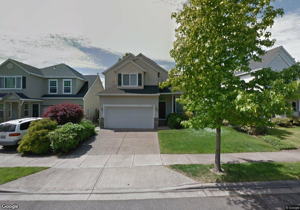
This home is located at 12577 NW Maplecrest Way, Banks, OR 97106 and is currently estimated at $523,293, approximately $262 per square foot. 12577 NW Maplecrest Way is a home located in Washington County with nearby schools including Banks Elementary School, Banks Middle School, and Banks High School.
Ownership History
Date
Name
Owned For
Owner Type
Purchase Details
Closed on
Oct 15, 2001
Sold by
West Hills Development Company
Bought by
Tillia James J and Martini Melinda K
Current Estimated Value
Home Financials for this Owner
Home Financials are based on the most recent Mortgage that was taken out on this home.
Original Mortgage
$156,000
Outstanding Balance
$60,975
Interest Rate
6.87%
Estimated Equity
$462,318
Create a Home Valuation Report for This Property
The Home Valuation Report is an in-depth analysis detailing your home's value as well as a comparison with similar homes in the area
Home Values in the Area
Average Home Value in this Area
Purchase History
| Date | Buyer | Sale Price | Title Company |
|---|---|---|---|
| Tillia James J | $195,000 | Chicago Title Insurance Co |
Source: Public Records
Mortgage History
| Date | Status | Borrower | Loan Amount |
|---|---|---|---|
| Open | Tillia James J | $156,000 |
Source: Public Records
Tax History Compared to Growth
Tax History
| Year | Tax Paid | Tax Assessment Tax Assessment Total Assessment is a certain percentage of the fair market value that is determined by local assessors to be the total taxable value of land and additions on the property. | Land | Improvement |
|---|---|---|---|---|
| 2025 | $5,042 | $274,450 | -- | -- |
| 2024 | $4,583 | $266,460 | -- | -- |
| 2023 | $4,583 | $258,700 | $0 | $0 |
| 2022 | $4,462 | $258,700 | $0 | $0 |
| 2021 | $4,304 | $243,860 | $0 | $0 |
| 2020 | $4,177 | $236,760 | $0 | $0 |
| 2019 | $4,009 | $229,870 | $0 | $0 |
| 2018 | $3,902 | $223,180 | $0 | $0 |
| 2017 | $3,737 | $216,680 | $0 | $0 |
| 2016 | $3,678 | $210,370 | $0 | $0 |
| 2015 | $3,535 | $204,250 | $0 | $0 |
| 2014 | $3,484 | $198,310 | $0 | $0 |
Source: Public Records
Map
Nearby Homes
- 41753 NW Buckshire St
- 41710 NW Oak Way
- 42015 NW Buckshire St
- 41637 NW Buckshire St
- 12734 NW Hammond Place
- 42002 NW Elmhurst Ct
- 42098 NW Broadshire Ln
- 42371 NW Banks Rd
- 0 NW Lodge Rd
- 48025 NW Strohmayer Rd
- 46345 NW Strohmayer Rd
- 45868 NW Hillside Rd
- 0 NW Green Mountain Rd Unit 1 23320324
- 0 NW Green Mountain Rd Unit 24253646
- 18282 NW Hilltop Place
- 11911 NW Seavey Rd
- 21076 NW Green Mountain Rd
- 40748 NW Verboort Rd
- 8648 NW Redtail Dr
- 20270 NW Pihl Rd
- 12585 NW Maplecrest Way
- 12569 NW Maplecrest Way
- 41812 NW Roseshire Ct
- 12561 NW Maplecrest Way
- 12603 NW Maplecrest Way
- 12568 NW Groveshire Ave
- 41834 NW Roseshire Ct
- 12553 NW Maplecrest Way
- 12621 NW Maplecrest Way
- 12584 NW Groveshire Ave
- 12580 NW Maplecrest Way
- 12566 NW Maplecrest Way
- 12787 NW Ashton Dr
- 41856 NW Roseshire Ct
- 12596 NW Groveshire Ave
- 12635 NW Maplecrest Way
- 12798 NW Ashton Dr
- 41807 NW Roseshire Ct
- 41829 NW Roseshire Ct
- 12765 NW Ashton Dr