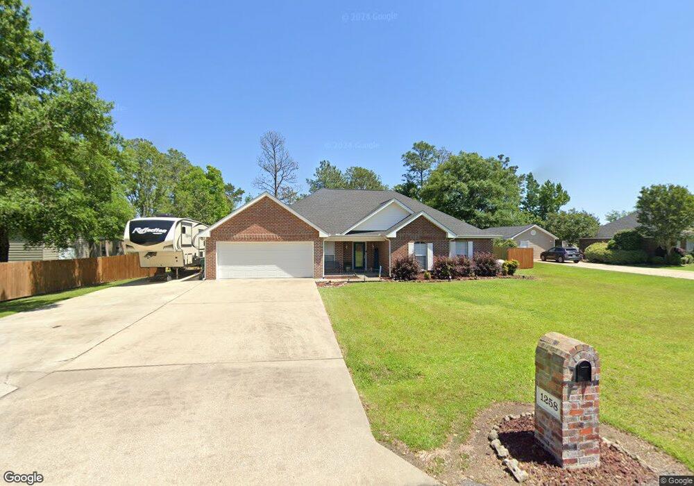
1258 Empress Rd Lake Charles, LA 70611
Moss Bluff NeighborhoodEstimated Value: $263,225 - $284,000
3
Beds
2
Baths
2,320
Sq Ft
$118/Sq Ft
Est. Value
About This Home
This home is located at 1258 Empress Rd, Lake Charles, LA 70611 and is currently estimated at $273,556, approximately $117 per square foot. 1258 Empress Rd is a home located in Calcasieu Parish with nearby schools including Graham & Parks Alternative Public School, Gillis Elementary School, and Putnam Avenue Upper School.
Ownership History
Date
Name
Owned For
Owner Type
Purchase Details
Closed on
Jun 8, 2007
Sold by
Mayo Craig Devron and Mayo Ericka Danielle
Bought by
Welch Charles Eric and Welch Stephanie Renee
Current Estimated Value
Home Financials for this Owner
Home Financials are based on the most recent Mortgage that was taken out on this home.
Original Mortgage
$167,200
Outstanding Balance
$102,142
Interest Rate
6.16%
Mortgage Type
New Conventional
Estimated Equity
$171,414
Purchase Details
Closed on
Feb 25, 2005
Sold by
Chaney Developent Inc
Bought by
Mayo Craig Devron and Mayo Ericka Danielle Fernandez
Home Financials for this Owner
Home Financials are based on the most recent Mortgage that was taken out on this home.
Original Mortgage
$139,685
Interest Rate
5.77%
Mortgage Type
Purchase Money Mortgage
Create a Home Valuation Report for This Property
The Home Valuation Report is an in-depth analysis detailing your home's value as well as a comparison with similar homes in the area
Home Values in the Area
Average Home Value in this Area
Purchase History
| Date | Buyer | Sale Price | Title Company |
|---|---|---|---|
| Welch Charles Eric | $176,000 | None Available | |
| Mayo Craig Devron | $30,000 | None Available |
Source: Public Records
Mortgage History
| Date | Status | Borrower | Loan Amount |
|---|---|---|---|
| Open | Welch Charles Eric | $167,200 | |
| Previous Owner | Mayo Craig Devron | $139,685 |
Source: Public Records
Tax History Compared to Growth
Tax History
| Year | Tax Paid | Tax Assessment Tax Assessment Total Assessment is a certain percentage of the fair market value that is determined by local assessors to be the total taxable value of land and additions on the property. | Land | Improvement |
|---|---|---|---|---|
| 2024 | $1,293 | $19,340 | $3,780 | $15,560 |
| 2023 | $1,273 | $19,340 | $3,780 | $15,560 |
| 2022 | $1,251 | $19,340 | $3,780 | $15,560 |
| 2021 | $1,313 | $19,340 | $3,780 | $15,560 |
| 2020 | $1,920 | $17,630 | $3,630 | $14,000 |
| 2019 | $2,083 | $19,060 | $3,500 | $15,560 |
| 2018 | $1,265 | $19,060 | $3,500 | $15,560 |
| 2017 | $2,115 | $19,060 | $3,500 | $15,560 |
| 2016 | $2,053 | $19,060 | $3,500 | $15,560 |
| 2015 | $2,053 | $18,380 | $2,200 | $16,180 |
Source: Public Records
Map
Nearby Homes
- 1003 New Castle Dr
- 1152 Park Rd
- 959 Southern Meadows Dr
- 1107 Idlebrook Dr
- 986 Hollyvale Dr
- 1425 Hollyvale Dr
- 1182 Waynewood Dr
- 0 Park Rd
- 0 Park Rd Unit SWL25002774
- 0 Ravenhurst Dr
- 0 Ravenhurst Dr Unit SWL23004014
- 751 N Perkins Ferry Rd
- 647 Morrow Rd
- 928 Crawford Dr
- 1706 Heard Rd
- 0 N Wallace Pointe Dr Unit SWL25000065
- 0 N Wallace Pointe Dr Unit SWL25000066
- 0 N Wallace Pointe Dr Unit SWL25000044
- 1649 S Woodland Forest Dr
- 462 Sharon Ln
- 1258 Empress Dr
- 1248 Empress Rd
- 1248 Empress Dr
- 1029 Stafford Rd
- 1259 Empress Rd
- 1236 Empress Dr
- 1236 Empress Rd
- 1247 Empress Rd
- 1026 E Bristol Dr
- 1235 Empress Dr
- 1235 Empress Rd
- 1015 Stafford Rd
- 1016 E Bristol Dr
- 1151 Stafford Rd
- 1126 W Bristol Dr
- 1218 Empress Dr
- 1218 Empress Rd
- 1006 E Bristol Dr
- 1015 E Bristol Dr
- 1025 E Bristol Dr