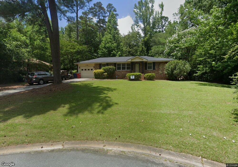
1258 Newport Rd Macon, GA 31210
Estimated Value: $168,000 - $201,000
3
Beds
2
Baths
1,200
Sq Ft
$150/Sq Ft
Est. Value
About This Home
This home is located at 1258 Newport Rd, Macon, GA 31210 and is currently estimated at $180,530, approximately $150 per square foot. 1258 Newport Rd is a home located in Bibb County with nearby schools including Lane Elementary School, Howard Middle School, and Howard High School.
Ownership History
Date
Name
Owned For
Owner Type
Purchase Details
Closed on
Feb 2, 2007
Sold by
Seabolt Dustin B
Bought by
Seabolt Dustin B and Lawrence Seabolt Melissa Sue
Current Estimated Value
Purchase Details
Closed on
Jul 1, 2005
Sold by
Deaver Elizabeth W and Wilson Elizabeth Wingate
Bought by
Seabolt Dustin B
Home Financials for this Owner
Home Financials are based on the most recent Mortgage that was taken out on this home.
Original Mortgage
$98,947
Outstanding Balance
$50,694
Interest Rate
5.57%
Mortgage Type
FHA
Estimated Equity
$129,836
Purchase Details
Closed on
Feb 23, 2001
Bought by
Seabolt Dustin B
Create a Home Valuation Report for This Property
The Home Valuation Report is an in-depth analysis detailing your home's value as well as a comparison with similar homes in the area
Home Values in the Area
Average Home Value in this Area
Purchase History
| Date | Buyer | Sale Price | Title Company |
|---|---|---|---|
| Seabolt Dustin B | -- | None Available | |
| Seabolt Dustin B | $100,500 | None Avileble | |
| Seabolt Dustin B | $88,000 | -- |
Source: Public Records
Mortgage History
| Date | Status | Borrower | Loan Amount |
|---|---|---|---|
| Open | Seabolt Dustin B | $98,947 |
Source: Public Records
Tax History Compared to Growth
Tax History
| Year | Tax Paid | Tax Assessment Tax Assessment Total Assessment is a certain percentage of the fair market value that is determined by local assessors to be the total taxable value of land and additions on the property. | Land | Improvement |
|---|---|---|---|---|
| 2025 | $1,083 | $51,056 | $11,250 | $39,806 |
| 2024 | $1,119 | $51,056 | $11,250 | $39,806 |
| 2023 | $344 | $38,546 | $9,000 | $29,546 |
| 2022 | $1,159 | $40,485 | $8,417 | $32,068 |
| 2021 | $1,303 | $41,283 | $8,417 | $32,866 |
| 2020 | $985 | $32,369 | $6,734 | $25,635 |
| 2019 | $993 | $32,369 | $6,734 | $25,635 |
| 2018 | $1,701 | $32,369 | $6,734 | $25,635 |
| 2017 | $921 | $31,594 | $6,397 | $25,197 |
| 2016 | $726 | $27,971 | $6,060 | $21,910 |
| 2015 | $941 | $26,202 | $5,387 | $20,815 |
| 2014 | $1,133 | $26,202 | $5,387 | $20,815 |
Source: Public Records
Map
Nearby Homes
- 1246 Newport Rd
- 1197 Matthews Place
- 161 Ten Knolls Dr
- 3500 Northside Dr
- 3602 Northside Dr
- 3622 Northside Dr
- 1161 Ousley Place
- 3640 Northside Dr
- 3678 Northside Dr
- 938 Lundy Terrace
- 957 Laurel Oak Ct
- 880 Winchester Cir
- 770 Windsor Rd
- 1051 Clairmont Place
- 753 Lokchapee Dr
- 4070 Carrie Ct
- 731 Lokchapee Dr
- 636 Lokchapee Ridge
- 627 Lokchapee Ridge
- 859 Forest Lake Dr S
- 1426 Newport Rd
- 1255 Newport Rd
- 1263 Newport Rd
- 1263 Newport Rd
- 1234 Newport Rd
- 1243 Newport Rd
- 1233 Newport Rd
- 1224 Newport Rd
- 1225 Newport Rd
- 1271 Newport Rd
- 1212 Newport Rd
- 1211 Newport Rd
- 1200 Newport Rd
- 1209 Newport Rd
- 190 Ten Knolls Dr
- 1154 Newport Rd
- 1191 Matthews Place
- 1151 Newport Rd
- 1144 Newport Rd
- 168 Ten Knolls Dr