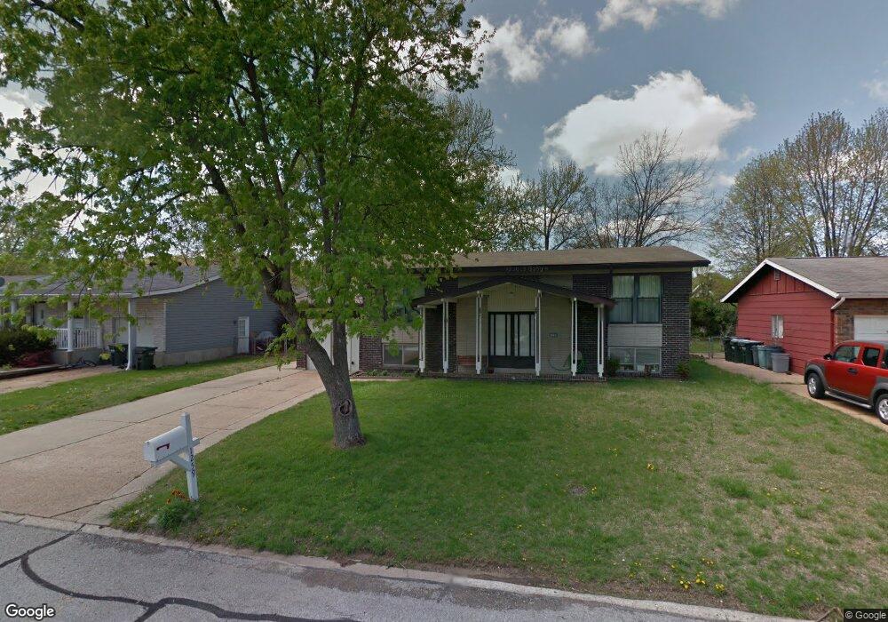
1259 Ballast Point Dr Arnold, MO 63010
Estimated Value: $224,000 - $251,000
--
Bed
--
Bath
960
Sq Ft
$248/Sq Ft
Est. Value
About This Home
This home is located at 1259 Ballast Point Dr, Arnold, MO 63010 and is currently estimated at $238,024, approximately $247 per square foot. 1259 Ballast Point Dr is a home located in Jefferson County with nearby schools including Rockport Heights Elementary School, Fox Middle School, and Fox Senior High School.
Ownership History
Date
Name
Owned For
Owner Type
Purchase Details
Closed on
Mar 31, 2022
Sold by
Andrews Properties Llc
Bought by
Loken Llc
Current Estimated Value
Purchase Details
Closed on
Mar 2, 2003
Sold by
Andrews Paul R and Gieselman Warren J
Bought by
A & G Properties Llc
Purchase Details
Closed on
May 28, 2002
Sold by
Stachowski Leonard and Stachowski Florence
Bought by
Andrews Paul R and Gieselman Warren
Home Financials for this Owner
Home Financials are based on the most recent Mortgage that was taken out on this home.
Original Mortgage
$89,200
Interest Rate
6.92%
Purchase Details
Closed on
Oct 8, 1998
Sold by
Neimeyer James C and Neimeyer Candy
Bought by
Stachowski Leonard and Stachowski Florence
Home Financials for this Owner
Home Financials are based on the most recent Mortgage that was taken out on this home.
Original Mortgage
$77,900
Interest Rate
6.73%
Purchase Details
Closed on
Oct 30, 1995
Sold by
Neimeyer Alaina K
Bought by
Niemeyer James C
Create a Home Valuation Report for This Property
The Home Valuation Report is an in-depth analysis detailing your home's value as well as a comparison with similar homes in the area
Home Values in the Area
Average Home Value in this Area
Purchase History
| Date | Buyer | Sale Price | Title Company |
|---|---|---|---|
| Loken Llc | -- | None Listed On Document | |
| A & G Properties Llc | -- | -- | |
| Andrews Paul R | -- | First American Title | |
| Stachowski Leonard | -- | Commonwealth Title | |
| Niemeyer James C | -- | Commonwealth Title |
Source: Public Records
Mortgage History
| Date | Status | Borrower | Loan Amount |
|---|---|---|---|
| Previous Owner | Andrews Paul R | $89,200 | |
| Previous Owner | Stachowski Leonard | $77,900 |
Source: Public Records
Tax History Compared to Growth
Tax History
| Year | Tax Paid | Tax Assessment Tax Assessment Total Assessment is a certain percentage of the fair market value that is determined by local assessors to be the total taxable value of land and additions on the property. | Land | Improvement |
|---|---|---|---|---|
| 2025 | $1,448 | $21,100 | $2,700 | $18,400 |
| 2024 | $1,448 | $20,700 | $2,700 | $18,000 |
| 2023 | $1,448 | $20,000 | $2,700 | $17,300 |
| 2022 | $1,426 | $20,000 | $2,700 | $17,300 |
| 2021 | $1,427 | $20,000 | $2,700 | $17,300 |
| 2020 | $1,353 | $18,000 | $2,300 | $15,700 |
| 2019 | $1,357 | $18,000 | $2,300 | $15,700 |
| 2018 | $1,349 | $18,000 | $2,300 | $15,700 |
| 2017 | $1,369 | $18,000 | $2,300 | $15,700 |
| 2016 | $1,149 | $16,200 | $2,300 | $13,900 |
| 2015 | -- | $16,200 | $2,300 | $13,900 |
Source: Public Records
Map
Nearby Homes
- 3270 Bayvue Blvd
- 1322 Rockwood Forest Dr
- 3444 Rockwood Forest Ct
- 3428 Rockwood Forest Ct
- Lot 2 Baeumners Second Subdivision
- Lot 1
- 164 Bogey Blvd
- 170 Bogey Blvd
- 4130 Brook Ridge Dr
- 7405 Shadow Point Dr
- 1310 Apollo Dr
- 7474 Shadow Point Dr
- 7495 Becker Rd
- 18 Pleasant Valley Terrace
- 3529 Swan Cir S
- 0 Unknown Unit 22071145
- 0 Unknown Unit 22071129
- 0 Unknown Unit 22071117
- 0 Unknown Unit 22001753
- 0 Unknown Unit 22001740
- 1255 Ballast Point Dr
- 1261 Ballast Point Dr
- 1265 Ballast Point Dr
- 1251 Ballast Point Dr
- 1260 Ballast Point Dr
- 1262 Bal Harbor Dr
- 1258 Ballast Point Dr
- 1264 Ballast Point Dr
- 1264 Bal Harbor Dr
- 1252 Bal Harbor Dr
- 1267 Ballast Point Dr
- 1266 Ballast Point Dr
- 1247 Ballast Point Dr
- 1266 Bal Harbor Dr
- 1256 Ballast Point Dr
- 1248 Bal Harbor Dr
- 1270 Ballast Point Dr
- 1243 Ballast Point Dr
- 1268 Bal Harbor Dr
- 1254 Ballast Point Dr