

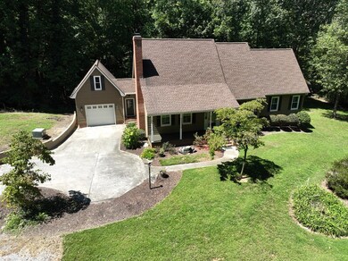
1259 Rollins Ketchum Rd Dalton, GA 30721
Estimated payment $2,889/month
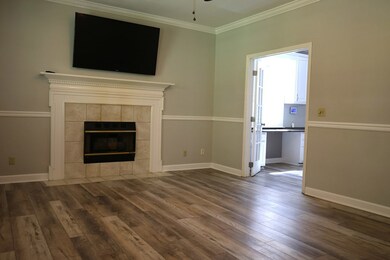
Highlights
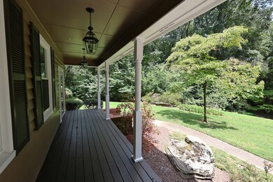
- Deck
- 2-Story Property
- Main Floor Primary Bedroom
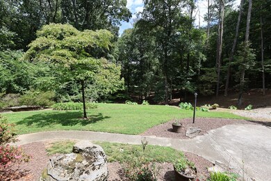
- Wooded Lot
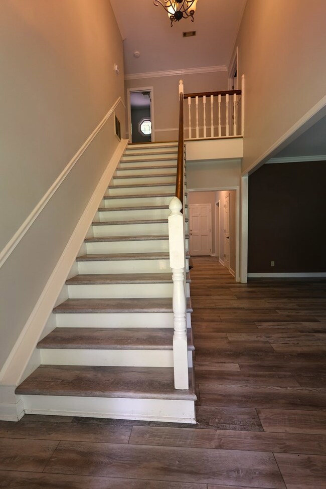
- Wood Flooring
- Covered Patio or Porch
About This Home
Here's a rare opportunity to own a private and serene home on 5 acres nestled in the countryside of Dalton, surrounded by mature trees and the quiet beauty of nature. This 3 bedroom, 2.5 bath home offers a perfect blend of seclusion and convenience, as it's just minutes from town. The floor plan features a large master suite on the main level, with his and hers walk-in closets, walk-in tiled shower and separate vanity area. The living room flows into a beautiful kitchen with amazing counter and cabinet space, plus an oversized island and extra sink. Enjoy nature by your outdoor fireplace off the partially covered back deck.
Listing Agent
Coldwell Banker Kinard Realty - Dalton Brokerage Email: 7062265182, brandy@kinardrealty.com License #259618 Listed on: 08/29/2025

Home Details
Home Type
- Single Family
Est. Annual Taxes
- $2,577
Year Built
- Built in 1998
Lot Details
- 5.07 Acre Lot
- Level Lot
- Cleared Lot
- Wooded Lot
Parking
- 3 Car Garage
- Garage Door Opener
- Open Parking
Home Design
- 2-Story Property
- Ridge Vents on the Roof
- Composition Roof
- Wood Siding
Interior Spaces
- Smooth Ceilings
- Ceiling Fan
- Gas Log Fireplace
- Thermal Windows
- Vinyl Clad Windows
- Plantation Shutters
- Living Room with Fireplace
- Dining Room with Fireplace
- Formal Dining Room
- Basement
- Crawl Space
- Laundry Room
Kitchen
- Breakfast Area or Nook
- Gas Range
- Range Hood
- Dishwasher
- Kitchen Island
- Disposal
Flooring
- Wood
- Carpet
- Ceramic Tile
Bedrooms and Bathrooms
- 3 Bedrooms
- Primary Bedroom on Main
- Walk-In Closet
- 3 Bathrooms
- Shower Only
- Separate Shower
Home Security
- Home Security System
- Fire and Smoke Detector
Outdoor Features
- Deck
- Covered Patio or Porch
Schools
- Cedar Ridge Elementary School
- Eastbrook Middle School
- Southeast High School
Utilities
- Multiple cooling system units
- Central Air
- Heating System Uses Propane
- Heat Pump System
- Propane
- Electric Water Heater
- Septic Tank
- Internet Available
- Cable TV Available
Listing and Financial Details
- Assessor Parcel Number 1217306000
Map
Home Values in the Area
Average Home Value in this Area
Tax History
| Year | Tax Paid | Tax Assessment Tax Assessment Total Assessment is a certain percentage of the fair market value that is determined by local assessors to be the total taxable value of land and additions on the property. | Land | Improvement |
|---|---|---|---|---|
| 2024 | $2,577 | $141,503 | $15,329 | $126,174 |
| 2023 | $2,577 | $92,907 | $15,300 | $77,607 |
| 2022 | $1,876 | $72,151 | $12,897 | $59,254 |
| 2021 | $1,876 | $72,151 | $12,897 | $59,254 |
| 2020 | $1,927 | $72,087 | $12,833 | $59,254 |
| 2019 | $1,953 | $72,087 | $12,833 | $59,254 |
| 2018 | $1,924 | $70,360 | $11,106 | $59,254 |
| 2017 | $1,925 | $70,360 | $11,106 | $59,254 |
| 2016 | $469 | $60,532 | $11,106 | $49,426 |
| 2014 | $1,406 | $59,621 | $10,195 | $49,426 |
| 2013 | -- | $59,620 | $10,195 | $49,425 |
Property History
| Date | Event | Price | List to Sale | Price per Sq Ft |
|---|---|---|---|---|
| 10/22/2025 10/22/25 | Price Changed | $509,900 | -2.9% | -- |
| 08/29/2025 08/29/25 | For Sale | $524,900 | -- | -- |
Purchase History
| Date | Type | Sale Price | Title Company |
|---|---|---|---|
| Warranty Deed | $263,000 | -- |
Mortgage History
| Date | Status | Loan Amount | Loan Type |
|---|---|---|---|
| Open | $258,236 | FHA |
Source: Carpet Capital Association of REALTORS®
MLS Number: 130837
APN: 12-173-06-000
- 0 Rollins Ketchum Rd
- Lot 63 Cherokee Dr NE
- 230 Indian Dr NE
- Lot 30-33 Indian Trail NE
- Lt 30-33 Indian Dr NE
- 111 Arthur St
- 0 Cheree Way Unit 129259
- 421 Coahulla Creek Dr
- 152 Washington St
- 147 Washington St
- 0 Monterey Drve Unit 127837
- 177 Bethel Church Rd NE
- 404 Lakeview Dr SE
- 359 Bethel Church Rd NE
- 4371 Bass McHan Dr NE
- 502 Richardson Rd NE
- 620 Lower Dawnville Rd NE
- 279 Satterfield Rd SE
- 4685 Mitchell Bridge Rd NE
- 210 Gordon Dr
- 1190 Township Place
- 1418 Burgess Dr
- 556 Horse Shoe Way
- 33 Heritage Cir
- 1135 Veterans Dr Unit A
- 1121 Dozier St
- 142 Andros Dr Unit 21A
- 1707 Willow Oak Ln Unit 49
- 896 E Summit Dr Unit 30
- 1821 Freeport Rd NW
- 809 Chattanooga Ave
- 609 S Thornton Ave
- 501 W Waugh St
- 100 Valley Dr
- 800 Thornton Place Unit B
- 1449 Highway 76
- 1161 Lofts Way
- 1411 Belton Ave
- 1104 Walston St
- 1309 Moice Dr Unit D